Kigilyakh Peninsula
Kigilyakh Peninsula (Russian: Полуостров Кигилях) is a peninsula in the New Siberian Islands, Sakha Republic, Russia.
| Полуостров Кигилях | |
|---|---|
 Bolshoy Lyakhovsky Landsat image with the Kigilyakh Peninsula extending southwestwards on the left. | |
 Kigilyakh Peninsula | |
| Geography | |
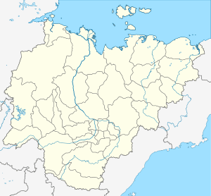
| Location | Bolshoy Lyakhovsky, New Siberian Islands |
| Coordinates | 73°24′N 140°7′E |
| Adjacent bodies of water | |
| Length | 25 km (15.5 mi) |
| Width | 10 km (6 mi) |
| Highest elevation | 164 m (538 ft) |
| Highest point | Gora Sannikov-Taga |
| Administration | |
Russia | |
| Federal subject | Sakha Republic |
History
This geographic feature was named after the Kigilyakh stone pillars.[1] In Soviet times on the Kigilyakh Peninsula, Vladimir Voronin, then in charge of the Polar station on the island, was shown a large standing rock which had been heavily eroded and which gave name to the peninsula.[2]
Geography
The Kigilyakh Peninsula is located in Bolshoy Lyakhovsky Island on the Laptev Sea. The peninsula is conspicuous from the air, projecting southwestwards from the western end with its isthmus in the east. Cape Vagin in the NW and Cape Kigilyakh in the SW shore of the peninsula are the westernmost points of Bolshoy Lyakhovsky. The Malakatyn River and the Gora Malakatyn-Chokur hill are some of the other geographic features of the peninsula.[3]
There is a scientific research base near Cape Kigilyakh.[4][5]
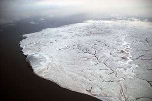 View of the Kigilyakh Peninsula. |
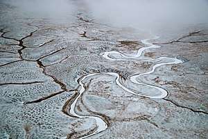 Section of the frozen Malakatyn river from the air. |
See also
References
- "Большой Ляховский". Brockhaus and Efron Encyclopedic Dictionary: In 86 Volumes (82 Volumes and 4 Additional Volumes). St. Petersburg. 1890–1907.
- Soviets gather geographic data in Arctic - CIA
- "Poluostrov Kigilyakh". Mapcarta. Retrieved 22 July 2019.
- "Kigilyakh". Mapcarta. Retrieved 22 July 2019.
- Kigilyakhi of the New Siberian Islands