Khajuwala
Khajuwala is a town in the Bikaner district of Rajasthan, India. It is located near the Indo-Pakistan border (23 km) and is situated around 113 km from the district headquarters Bikaner. It is an intermediate panchayat with several villages under its administration.[1] It produces a lot of raw cotton and wheat. Indira Gandhi Canal has brought about development of this area. It is a big agro products market in Bikaner district. Earlier its name was Beriyawali. It is also seat in Rajasthan legislative assembly. The current elected Member of Legislative assembly (MLA) from Khajuwala is Govind ram meghwal (INC). Khajuwala has recently been given a status of Panchayat samiti.
Khajuwala Beriawali | |
|---|---|
Town | |
 Smart village in khajuwala | |
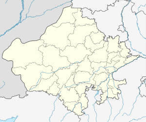 Khajuwala Location in Rajasthan, India  Khajuwala Khajuwala (India) | |
| Coordinates: 28.702°N 72.591°E | |
| Country | |
| State RAJASTHAN | Rajasthan |
| District | Bikaner |
| Tehsil | Khajuwala |
| Government | |
| • Body | Gram panchayat |
| • Sarpanch | Mrs. vipul jyani |
| Area | |
| • Total | 9 km2 (3 sq mi) |
| Population (2011) | |
| • Total | 15,784 |
| • Density | 1,418/km2 (3,670/sq mi) |
| Languages | |
| • Official | Hindi |
| • Other commonly used | Rajasthani, Punjabi, Sindhi, Sikh Bawri |
| Time zone | UTC+5:30 (IST) |
| PIN | 334023 |
| Telephone code | +91 01520 |
| ISO 3166 code | IN-RJ |
| Vehicle registration | RJ-07 |
| Nearest city | Bikaner |
| Sex ratio | 1000:903 ♂/♀ |
| Literacy | 65.92% |
| Climate | Average high (°C) 33.76 (Köppen) |
Khajuwala also have many industries such as mustard oil mills and cotton spinning mills. There are large number of brick kilns in the outskirts of the town also there are gypsum mines and plants.
It is the leading wheat, cotton, mustard and guar producing tehsil of Bikaner district. Agriculture is flourishing well here. With canal irrigation you can see vast lush green farmlands.
Marwari is the native language of Khajuwala.
Extent, geography and climate
Khajuwala is in the Thar Desert. Thorny shrubs and sandy dunes are the basic characteristics of this region. Kikar(Acacia), Aak (Calotropis procera), Khejari (Prosopis cineraria), Khimp (Leptadenia pyrotechnica), Lathiya, Laana and Booiin (Aerva tomentosa), Tumba(Citrullus colocynthis) make natural vegetation of this area. According to experts Khajuwala area is enriched with fertile soil for crops. Gypsum rocks are assets of this region. The waters of Ignp canal has brought changes to flora and fauna and agriculture of wheat, mustard, cotton, Guar, pulses and Jawar has given a composite form of sandy dunes and green fields. This region with Gharsana is called cotton-belt but now things are changing. Average annual rainfall has fallen dramatically in the last few years. Since key source of irrigation is canal-water, water supply is inadequate for agriculture.
Governance
Khajuwala is currently a gram panchayat local government. Khajuwala is divided into 23 wards. Khajuwala is a Tehsil and panchayat samiti also. Khajuwala was given municipality status in back years, But it was made back to the village panchayat due to the government's indifference. Main census town is known as Beriawali and Panchayat also Beriawali
Economy
People are mainly dependent on agriculture-based trades.
Industries
As far as industries is concerned gypsum grinding factories occupy the most important place. Raw gypsum material is supplied from villages. The government central processing unit is the perhaps largest unit in the Asian continent. After grinding, gypsum is transported to other northern Indian cities where gypsum based large scale industries use it as raw material. There are many oil mills, cotton mills, bricks factories. There was a time when khajuwala area was known for its high yield of cotton. A number of factories for processing cotton were shut down in recent decade. Various markets work to fulfill needs of people of town and surrounding villages.
Culture
Bagri, Punjabi, Hindi, Sindhi and Marwari languages are spoken here. People practice Hindu and Sikh religions. Some people have faith in Islam also. The Dera culture is also present here. Many people follow Radha Swami, Sacha Sauda and Nirankari Mission Deras.
Transport to other cities and villages
There are direct buses to jaipur, jodhpur, sri ganganagar and Bikaner. There are RSRTC roadways buses also available for different routes. Railway services not present here. Central govt's BHARATMALA highway will go from here.
Government buildings and facilities
The government runs the local schools, a community health care centre, veterinary hospital, excise department office and the Office of Forest Department. A police station, BSF campus are in the town. Branches of the State Bank of India (SBI), Punjab national bank (PNB), ICICI Bank , Bank of baroda (BOB), Rajasthan marudhara gramin bank (RMGB) and the central co. operative bank also operate here. ATM facilities are available at the SBI, BOB, ICICI and PNB banks. A sub post office branch also available here.
Education
Colleges
- Jagdamba pg college :this is first and largest college in terms of number of students.
- Govt. college khajuwala
- Govt. ITI college
- S.K.S chandi college.
- Shiva girls college.
- S.D college.
- Raj degree college.
Schools
There are many schools in the town.
References
- "National Panchayat Directory". Archived from the original on 20 August 2014. Retrieved 22 November 2012.
- "GeologyData.Info- Info Portal of Geology with special reference to Rajasthan, India". geologydata.info.