Kentucky Route 33
Kentucky Route 33 (KY 33) is a 32.094-mile-long (51.650 km), two-lane, north–south state highway in Kentucky managed by the Kentucky Transportation Cabinet.
| ||||
|---|---|---|---|---|
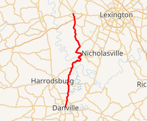
KY 33 highlighted in red | ||||
| Route information | ||||
| Maintained by KYTC | ||||
| Length | 32.094 mi[1] (51.650 km) | |||
| Major junctions | ||||
| South end | ||||
| North end | ||||
| Location | ||||
| Counties | Boyle, Mercer, Jessamine, Woodford | |||
| Highway system | ||||
| ||||

KY 33 begins at US 150 in Danville and proceeds north through Boyle, Mercer, Jessamine, and Woodford counties before terminating at US 62 in Versailles. It shares the road with US 68 in Jessamine and Mercer counties and crosses the Kentucky River near Wilmore.
Major intersections
| County | Location | mi[1] | km | Destinations | Notes |
|---|---|---|---|---|---|
| Boyle | Danville | 0.000 | 0.000 | Southern terminus | |
| 0.220 | 0.354 | Western terminus of KY 2324 | |||
| 2.279 | 3.668 | ||||
| | 4.407 | 7.092 | Western terminus of KY 1896 | ||
| Mercer | Burgin | 7.719 | 12.423 | ||
| 8.219 | 13.227 | Southern terminus of KY 342 | |||
| | 11.354 | 18.272 | Northern terminus of KY 342 | ||
| | 12.689 | 20.421 | South end of US 68 overlap | ||
| Jessamine | | 21.311 | 34.297 | North end of US 68 overlap | |
| Woodford | | 19.090 | 30.722 | Southern terminus of KY 1965 | |
| | 21.312 | 34.298 | Western terminus of KY 1267 | ||
| | 28.929 | 46.557 | Northern terminus of KY 169 | ||
| | 30.170 | 48.554 | BG Pkwy exit 68 | ||
| Versailles | 30.628 | 49.291 | Southern terminus of KY 2113 | ||
| 32.094 | 51.650 | Northern terminus | |||
| 1.000 mi = 1.609 km; 1.000 km = 0.621 mi | |||||
Alternate names
KY 33 has other names along its path:
- Third Street in Danville
- Shakertown Road in Boyle County and Danville
- Danville Burgin Road in Mercer County
- Danville Street in Burgin
- Pleasant Hill Road in Burgin and Mercer County
- Shakertown Road in Mercer County
- Lexington Road (US 68) in Mercer County
- Harrodsburg Road (US 68) in Jessamine County
- Pekin Pike in Woodford and Jessamine Counties
- Troy Pike in Woodford County
- Main Street in Versailles
References
- "Kentucky Transportation Cabinet - Division of Planning". Archived from the original on 2007-04-30. Retrieved 2008-10-08.
External links
This article is issued from Wikipedia. The text is licensed under Creative Commons - Attribution - Sharealike. Additional terms may apply for the media files.