Kent County, Ontario
Kent County, area 2,458 km2 (949 sq mi) is a historic county in the Canadian province of Ontario.
Kent County | |
|---|---|
Dissolved County | |
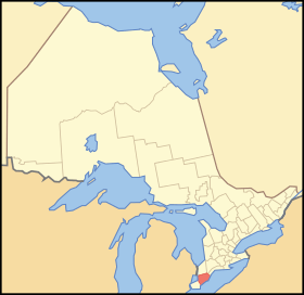 Location of Kent County in Ontario | |
| Coordinates: 42°22′37″N 82°11′20″W | |
| Country | |
| Province | |
| Settled | 1792 |
| Dissolved | 1998 - merged to form Chatham-Kent |
| County seat | Chatham |
| Municipalities | List
|
| Time zone | UTC-5 (EST) |
| • Summer (DST) | UTC-4 (EDT) |
| Area code(s) | 519/226 |
The county was created in 1792 and named by John Graves Simcoe in honour of the English County. The county is in an alluvial plain between Lake St. Clair, and Lake Erie, watered by two navigable streams, the Thames River and the Sydenham River.
On January 1, 1998, the county, its townships, towns, and Chatham were amalgamated into the single-tier city of Chatham-Kent.
Original townships
Camden
Area: 40,625 acres (164 km2). Surveyed in 1794 and named from the Earl of Camden. Community centres: (Dresden, Thamesville)
Chatham
Area: 83,964 acres (340 km2) Surveyed in 1794. Community centres: (City of Chatham, Wallaceburg)
Dover
Area: 68,617 acres (278 km2). Dover Township was named after Dover, England. It was surveyed in 1794 and incorporated in 1850. Within the boundaries of Dover along the Chenal Ecarte of the river St. Clair is the site of Lord Selkirk's Baldoon Settlement, established in 1803. Community centres: (Mitchell's Bay, Grande Pointe, Dover Centre and Pain Court)
Harwich
Area: 88,349 acres (358 km2). Surveyed in 1794 and named from the English port at the mouth of the Thames. A resident of Harwich, Valintine Zimmer, co-founded with friends of the same nationality the German Concession of Harwich. Community centres: (Blenheim, Erieau, Erie Beach, Shrewsbury)
Howard
Area: 58,607 acres (237 km2). Surveyed in 1794 and named after Thomas Howard, Earl of Effingham, father-in-law of Sir Guy Carleton. Community centres: (Morpeth, Ridgetown)
Orford
Area: 49,677 acres (201 km2). Surveyed in 1794 and named from the English port of Orford, Suffolk. Community centres: (Highgate)
Raleigh
Area: 72,100 acres (292 km2). Surveyed in 1794. Likely named for Walter Raleigh. Community centres: (Charing Cross)
Romney
Area: 26,193 acres (106 km2), Surveyed in 1794. Named for the Kentish port in England. Community centres: (Wheatley)
Tilbury East
Area: 54,116 acres (219 km2). Surveyed in 1794, named for the English Tilbury fort in Essex. Community centres: (Merlin, Tilbury)
Zone
Area: 27,154 acres (110 km2). Separated from Orford in 1821 to provide a special organizational district, "the zone", for the Indians of the Moravian Mission on the Thames. Community centres: (Bothwell)
Municipalities (as of 1997)
- Town of Chatham: County Seat, largest population centre in the county.
- Town of Blenheim: Incorporated in 1885.
- Town of Bothwell: Incorporated in 1867.
- Town of Dresden: Incorporated in 1882.
- Town of Ridgetown: Incorporated in 1875.
- Town of Tilbury: Incorporated as Village of Tilbury Centre in 1887 and Town of Tilbury in 1910.
- Town of Wallaceburg: Incorporated as a village in 1875 and a town in 1896.
- Village of Erie Beach
- Village of Erieau
- Village of Highgate
- Village of Thamesville
- Village of Wheatley
- Township of Camden
- Township of Chatham
- Township of Dover
- Township of Harwich
- Township of Howard
- Township of Orford
- Township of Raleigh
- Township of Romney
- Township of Tilbury East
- Township of Zone
See also
- List of Ontario census divisions
- List of townships in Ontario
- Chatham-Kent, Ontario