Kenabeek, Ontario
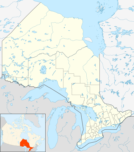
Kenabeek (pronounced Ken-a-beck) is a locality and unincorporated community in geographic Henwood Township[3] in the Unorganized West Part of Timiskaming District, in northeastern Ontario, Canada.[1] The community is located on Ontario Highway 65, approximately halfway between Elk Lake and New Liskeard.
Kenabeek | |
|---|---|
Locality | |
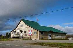 Kenabeek community centre | |
 Kenabeek Location in Ontario | |
| Coordinates: 47°38′22″N 79°59′44″W[1] | |
| Country | Canada |
| Province | Ontario |
| District | Timiskaming |
| Geographic township | Hendon |
| Elevation | 286 m (938 ft) |
| Time zone | UTC-5 (Eastern Time Zone) |
| • Summer (DST) | UTC-4 (Eastern Time Zone) |
| Postal Code | P0J 1M0 |
| Area code(s) | 705, 249 |
Geography
Kenabeek and its surrounding area is mostly sand with a bit of rock, and a shallow amount of topsoil, and therefore is not good agricultural land. There are a number of small lakes within two or three miles (5 km) of Kenabeek, mostly privately owned. Many are muskeg lakes and others are surrounded by swamp. Several of the lakes are home to loons. Land in the Kenabeek area is mostly used for growing hay and potatoes, and in a few cases for grazing a small number of cattle for local use.
History
Kenabeek was founded at some time in the early 1920s as a post office, since the nearest post office at the time was in Thornloe, about 15 miles (24 km) away, a long distance by horse and wagon. Other than farms (160 acre plots, a few with multiple homes, usually multi-generation family) there are no houses falling within the village, so the town is considered to be the General Store, Post Office and volunteer Fire Station.
Kenabeek and the surrounding area was hit by the Great Fire of 1922 (the Haileybury fire of 1922) which wiped out hundreds of acres of land and many homes in and around Kenabeek.
Most of the residents of the Kenabeek area can trace their families back two and three generations.
Boundaries and residents
The Kenabeek town signs are placed about 3 miles (4.8 km) from the General Store and Post Office, but the surrounding homes are mostly on the original 160-acre (0.65 km2) farm plots, except for a few homes carved out of those plots for extended family or friends, and are not town-homes.
In addition to the General Store and Post Office, there is a volunteer fire department and building and a community centre. The community centre is the original one-room schoolhouse which housed grades 1 to 8 until sometime in the 1960s. The current caretaker of the Community Center is Jean Byerlay.
Other attractions
Except for the residents, their families and friends and a few who trace their families back to the Kenabeek area, there are no real attractions, no public lakes or cottage areas. The main attraction for visitors is the remoteness and wildness of the land and forests, a great contrast to the larger metropolitan areas to the south.
References
- "Kenabeek". Geographical Names Data Base. Natural Resources Canada. Retrieved 2017-01-02.
- Elevation taken at geographic coordinates from Google Maps. Accessed 2017-01-02.
- "Henwood" (PDF). Geology Ontario - Historic Claim Maps. Ontario Ministry of Northern Development, Mines and Forestry. Retrieved 2017-01-02.
External links
- Map 12 (PDF) (Map). 1 : 1,600,000. Official road map of Ontario. Ministry of Transportation of Ontario. 2015-01-01. Retrieved 2017-01-02.
- Restructured municipalities - Ontario map #4 (Map). Restructuring Maps of Ontario. Ontario Ministry of Municipal Affairs and Housing. 2006. Retrieved 2017-01-03.