Kawakawa, New Zealand
Kawakawa is a small town in the Bay of Islands area of the Northland Region of New Zealand. Kawakawa developed as a service town when coal was found there in the 1860s, but coal mining ceased in the early 20th century. The economy is now based on farming.[2] The town is named after the kawakawa shrub.[3]
Kawakawa | |
|---|---|
.jpg) The main street of Kawakawa | |
| Motto(s): Train Town | |
 Kawakawa | |
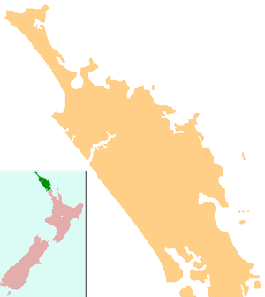
| Coordinates: 35°22′48″S 174°4′8″E | |
| Country | New Zealand |
| Region | Northland Region |
| District | Far North District |
| Population (June 2019)[1] | |
| • Total | 1,510 |
| Postcode(s) | 0210 |
History and culture
Kawakawa starting developing as a town with the mining of coal, which was discovered there in 1861.[2] A horse-drawn tramway was opened in 1868 to carry coal from the mines to the Taumarere wharf. In 1871 two steam locomotives were acquired and the tramway was upgraded to railway standard. In 1884 a railway line from Kawakawa to Opua was opened, and this replaced the line to Taumarere wharf.
By 1899 there were about 1,000 residents in the town, which was built mainly on the hillside. In 1899 a fire destroyed all but a few of the buildings. The town was rebuilt on the flat, alongside the railway tracks. The present railway station was built in 1911.[4]
A railway line south to Whangarei was completed in 1911. Coal mining ceased at Kawakawa in the early 20th century.
The Bay of Islands County headquarters were in Kawakawa[2] until the county was disestablished in 1989.
Kawakawa has three marae affiliated with hapū of Ngāpuhi. Mohinui Marae and its Hohourongo meeting house are affiliated with Ngāti Hine and Ngāti Kahu o Torongare. Kawiti Marae and Te Tawai Riri Maihi Kawiti meeting house, and Miria Marae and Te Rapunga meeting house are also connected to Ngāti Hine.[5][6]
Demographics
| Historical population | ||
|---|---|---|
| Year | Pop. | ±% p.a. |
| 2006 | 1,326 | — |
| 2013 | 1,215 | −1.24% |
| 2018 | 1,464 | +3.80% |
| Source: [7] | ||
Kawakawa had a population of 1,464 at the 2018 New Zealand census, an increase of 249 people (20.5%) since the 2013 census, and an increase of 138 people (10.4%) since the 2006 census. There were 426 households. There were 732 males and 732 females, giving a sex ratio of 1.0 males per female. Of the total population, 405 people (27.7%) were aged up to 15 years, 297 (20.3%) were 15 to 29, 606 (41.4%) were 30 to 64, and 156 (10.7%) were 65 or older. Figures may not add up to the total due to rounding.
Ethnicities were 41.6% European/Pākehā, 73.8% Māori, 8.2% Pacific peoples, 4.5% Asian, and 1.0% other ethnicities. People may identify with more than one ethnicity.
The percentage of people born overseas was 9.4, compared with 27.1% nationally.
Although some people objected to giving their religion, 43.0% had no religion, 37.1% were Christian, and 13.9% had other religions.
Of those at least 15 years old, 123 (11.6%) people had a bachelor or higher degree, and 231 (21.8%) people had no formal qualifications. The median income was $22,800. The employment status of those at least 15 was that 465 (43.9%) people were employed full-time, 156 (14.7%) were part-time, and 102 (9.6%) were unemployed.[7]
Features

The town is known as "Train Town", because the Bay of Islands Vintage Railway runs down the middle of its main street on the former Opua Branch railway line. Eight km of the 17 km track reopened in 2008.[8] At present trains cannot go over "Long Bridge" because rails have not been relaid since it was re-piled, and the track between this bridge at Taumarere and Opua is being used as part of the Twin Coast Cyclepath. When the rails have been relaid, the cyclepath will be moved next to the track.
The town is also famous for its Hundertwasser toilet block, designed by Austrian artist Friedensreich Hundertwasser, who was a resident of the town from 1975 until his death in 2000.
The Kawiti glowworm caves at nearby Waiomio are also an attraction.
Education
Kawakawa Primary School is a full primary (years 1–8) school with a roll of 168 students.[9]
Bay of Islands College is a secondary (years 9–13) school with a roll of 366 students.[10] It takes students from around the Bay of Islands and middle Northland, with 85% of its students travelling daily by bus to attend.[11]
Both schools are coeducational. Rolls are as of March 2020.[12]
Karetu School is located nearby, in Karetu.
Notable people
- Kelvin Davis – politician
- Jack Goodhue – rugby player
- Pita Paraone – politician
- Willow-Jean Prime – politician
- Joe Schmidt – rugby coach
References
- "Subnational Population Estimates: At 30 June 2019". Statistics New Zealand. 22 October 2019. Retrieved 11 January 2020.
- "Northland places – The Waiōmio valley". Te Ara: The Encyclopedia of New Zealand. 4 May 2015. Retrieved 13 January 2019.
- "Kawakawa, New Zealand history online". nzhistory.govt.nz. Retrieved 11 November 2018.
- "Our history". Bay of Islands Vintage Railway Trust. Retrieved 13 January 2019.
- "Te Kāhui Māngai directory". tkm.govt.nz. Te Puni Kōkiri.
- "Māori Maps". maorimaps.com. Te Potiki National Trust.
- "Statistical area 1 dataset for 2018 Census". Statistics New Zealand. March 2020. Kawakawa (104600). 2018 Census place summary: Kawakawa
- "Kawakawa Travel Guide". Jasons Travel Media.
- Education Counts: Kawakawa Primary school
- Education Counts: Bay of Islands College
- "Bay of Islands College – School Information". Archived from the original on 8 August 2007.
- "New Zealand Schools Directory". New Zealand Ministry of Education. Retrieved 26 April 2020.