Katsuta, Okayama
Katsuta (勝田町, Katsuta-chō) was a town located in Katsuta District, Okayama Prefecture, Japan.
Katsuta 勝田町 | |
|---|---|
Town | |
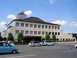 Former Katsuta town hall | |
 Katsuta Location in Japan | |
| Coordinates: 35°4′24.4″N 134°11′28.0″E | |
| Country | Japan |
| Region | Chūgoku |
| Prefecture | Okayama Prefecture |
| District | Katsuta |
| Merged | March 31, 2005 (now part of Mimasaka) |
| Area | |
| • Total | 87.29 km2 (33.70 sq mi) |
| Population (2003) | |
| • Total | 3,660 |
| • Density | 41.93/km2 (108.6/sq mi) |
| Symbols | |
| • Tree | Cryptomeria japonica |
| • Flower | Lilium |
| Time zone | UTC+9 (JST) |
As of 2003, the town had an estimated population of 3,660 and a density of 41.93 persons per km². The total area was 87.29 km².
On March 31, 2005, Katsuta, along with the towns of Mimasaka (former), Aida, Ōhara and Sakutō, and the village of Higashiawakura (all from Aida District), was merged to create the city of Mimasaka.
Geography
Adjoining municipalities
- Okayama Prefecture
- Mimasaka (town)
- Sakutō
- Ōhara
- Nishiawakura
- Shōō
- Nagi
- Tottori Prefecture
Education
- Katsuta Elementary School
- Katsuta-Higashi Elementary School
- Kajinami Elementary School
- Katsuta Junior High School
Transportation
Road
- National highways:
- Prefectural roads:
External links
- Official website of Mimasaka in Japanese
| Authority control |
|
|---|
This article is issued from Wikipedia. The text is licensed under Creative Commons - Attribution - Sharealike. Additional terms may apply for the media files.