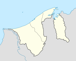
Katok, Brunei
Katok, locally known in Malay as Kampung Katok or Kampong Katok, is a village administrative division in Brunei-Muara District, Brunei. It is a village subdivision under the mukim or subdistrict of Gadong 'A'. The community of Katok is jointly led with that of Tungku subdivision by a ketua kampung or village head, and the incumbent is Ismail bin Rajab.[1] Katok is also a designated postcode area with the postcode BE2319.[2]
Katok Kampung Katok Kampong Katok | |
|---|---|
 | |
| Coordinates: 4°54′58.3″N 114°53′36.7″E | |
| Country | Brunei |
| District | Brunei-Muara |
| Mukim | Gadong 'A' |
| Government | |
| • Village head | Ismail bin Rajab |
| Postcode | BE2319 |
Geography
Katok is primarily a residential area on the outskirts of Bandar Seri Begawan, the capital of Brunei. It is the original settlement area for which Katok 'A' and Katok 'B', two housing areas under the government's Landless Indigenous Citizens' Housing Scheme (Malay: Skim Tanah Kurnia Rakyat Jati or simply STKRJ), are named after. However, the two areas are not contiguous to Katok; Katok 'A' is regarded part of Tungku and hence its other full name Tungku Landless Indigenous Citizens' Housing Scheme Area 3, where as Katok 'B' is part of the Mata-Mata settlement and hence its alternative full name Mata-Mata Landless Indigenous Citizens' Housing Scheme. Nevertheless, Katok is contiguous to both Tungku and Mata-Mata to its north and south respectively.
As a village subdivision, Katok technically borders Tungku and Katok 'A' Landless Indigenous Citizens' Housing Scheme (also Tungku Landless Indigenous Citizens' Housing Scheme Area 3) to the north, Tungku Landless Indigenous Citizens' Housing Scheme Area 1 to the north-east, Mata-Mata to the east and south, Mata-Mata Landless Indigenous Citizens' Housing Scheme Area 2 to the south, Tanjong Bunut to the south-west, Selayun to the west, and Peninjau to the north-west.[3]
References
- "FAPW participants visit Madu Kelulut farm in Kg Tungku – Borneo Bulletin Online". Borneo Bulletin Online. 2017-03-14. Retrieved 2018-02-19.
- "Brunei Postal Services - postcodes". post.gov.bn. Retrieved 2018-02-19.
- Brunei Darussalam street directory : quick & easy reference maps., Brunei Press Sdn. Bhd., 2014, pp. 60–61 & 72–73, ISBN 9789991732411, OCLC 932264901