Kamphaeng Phet
Kamphaeng Phet is a town (thesaban mueang) in central Thailand, former capital of the Kamphaeng Phet Province. It covers the complete tambon Nai Mueang of the Mueang Kamphaeng Phet district. As of 2005 it has a population of 30,114.
Kamphaeng Phet กำแพงเพชร | |
|---|---|
Town | |
 Ruins inside the Kamphaeng Phet Historical Park | |
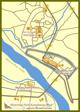 Map of Kamphaeng Phet | |
| Country | |
| Province | Kamphaeng Phet Province |
| Population (2005) | |
| • Total | 30,114 |
| Time zone | UTC+7 (ICT) |
Climate
| Climate data for Kamphaeng Phet (1981–2010) | |||||||||||||
|---|---|---|---|---|---|---|---|---|---|---|---|---|---|
| Month | Jan | Feb | Mar | Apr | May | Jun | Jul | Aug | Sep | Oct | Nov | Dec | Year |
| Record high °C (°F) | 37.0 (98.6) |
39.8 (103.6) |
40.8 (105.4) |
43.0 (109.4) |
41.8 (107.2) |
39.6 (103.3) |
38.0 (100.4) |
37.8 (100.0) |
36.2 (97.2) |
36.1 (97.0) |
36.5 (97.7) |
35.4 (95.7) |
43.0 (109.4) |
| Average high °C (°F) | 32.1 (89.8) |
34.4 (93.9) |
36.0 (96.8) |
37.3 (99.1) |
35.2 (95.4) |
33.6 (92.5) |
33.0 (91.4) |
32.6 (90.7) |
32.7 (90.9) |
32.2 (90.0) |
31.6 (88.9) |
30.8 (87.4) |
33.5 (92.3) |
| Daily mean °C (°F) | 24.8 (76.6) |
26.8 (80.2) |
28.7 (83.7) |
30.4 (86.7) |
29.2 (84.6) |
28.4 (83.1) |
28.1 (82.6) |
27.8 (82.0) |
27.6 (81.7) |
27.2 (81.0) |
25.9 (78.6) |
24.1 (75.4) |
27.4 (81.3) |
| Average low °C (°F) | 18.5 (65.3) |
20.3 (68.5) |
22.7 (72.9) |
24.9 (76.8) |
25.2 (77.4) |
25.1 (77.2) |
24.8 (76.6) |
24.7 (76.5) |
24.4 (75.9) |
23.8 (74.8) |
21.5 (70.7) |
18.5 (65.3) |
22.9 (73.2) |
| Record low °C (°F) | 10.1 (50.2) |
12.2 (54.0) |
14.8 (58.6) |
19.9 (67.8) |
20.8 (69.4) |
22.3 (72.1) |
21.4 (70.5) |
22.5 (72.5) |
21.6 (70.9) |
17.0 (62.6) |
12.6 (54.7) |
8.2 (46.8) |
8.2 (46.8) |
| Average rainfall mm (inches) | 2.3 (0.09) |
13.1 (0.52) |
36.7 (1.44) |
52.8 (2.08) |
195.5 (7.70) |
165.1 (6.50) |
159.4 (6.28) |
170.5 (6.71) |
268.8 (10.58) |
191.7 (7.55) |
42.0 (1.65) |
6.7 (0.26) |
1,304.6 (51.36) |
| Average rainy days | 0.8 | 2.3 | 4.2 | 5.6 | 14.8 | 17.7 | 18.3 | 19.1 | 18.8 | 14.6 | 4.4 | 1.2 | 121.8 |
| Average relative humidity (%) | 71 | 66 | 66 | 66 | 77 | 82 | 82 | 84 | 85 | 84 | 79 | 74 | 76 |
| Mean monthly sunshine hours | 257.3 | 243.0 | 238.7 | 243.0 | 198.4 | 156.0 | 120.9 | 117.8 | 144.0 | 179.8 | 219.0 | 257.3 | 2,375.2 |
| Mean daily sunshine hours | 8.3 | 8.6 | 7.7 | 8.1 | 6.4 | 5.2 | 3.9 | 3.8 | 4.8 | 5.8 | 7.3 | 8.3 | 6.5 |
| Source 1: Thai Meteorological Department[1] | |||||||||||||
| Source 2: Office of Water Management and Hydrology, Royal Irrigation Department (sun and humidity)[2] | |||||||||||||
References
- "Climatological Data for the Period 1981–2010". Thai Meteorological Department. p. 8. Retrieved 1 August 2016.
- "ปริมาณการใช้น้ำของพืชอ้างอิงโดยวิธีของ Penman Monteith (Reference Crop Evapotranspiration by Penman Monteith)" (PDF) (in Thai). Office of Water Management and Hydrology, Royal Irrigation Department. p. 36. Retrieved 1 August 2016.
External links

- http://www.kppcity.com Website of town (Thai only)
This article is issued from Wikipedia. The text is licensed under Creative Commons - Attribution - Sharealike. Additional terms may apply for the media files.