Jones Peninsula
Jones Peninsula (71°55′S 100°50′W) is an ice-covered peninsula 5 nautical miles (9 km) west of Hughes Peninsula in northwest Thurston Island, Antarctica. It was named by the Advisory Committee on Antarctic Names after Ensign Robert H. Jones, navigator and second pilot of PBM Mariner aircraft in the Eastern Group of U.S. Navy Operation Highjump, which obtained aerial photographs of this peninsula and coastal areas adjacent to Thurston Island, 1946–47.[1]

Map of Thurston Island.
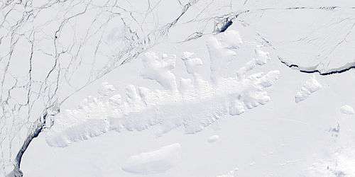
Satellite image of Thurston Island.
Maps
- Thurston Island – Jones Mountains. 1:500000 Antarctica Sketch Map. US Geological Survey, 1967.
- Antarctic Digital Database (ADD). Scale 1:250000 topographic map of Antarctica. Scientific Committee on Antarctic Research (SCAR). Since 1993, regularly upgraded and updated.
References
- "Jones Peninsula". Geographic Names Information System. United States Geological Survey. Retrieved 2013-04-05.
![]()
This article is issued from Wikipedia. The text is licensed under Creative Commons - Attribution - Sharealike. Additional terms may apply for the media files.