Jarbidge Peak
Jarbidge Peak is the second highest mountain in the Jarbidge Mountains of northern Elko County, Nevada, United States.[3] It is located within the Jarbidge Ranger District of the Humboldt-Toiyabe National Forest. The boundary of the Jarbidge Wilderness crosses the peak.[4]
| Jarbidge Peak | |
|---|---|
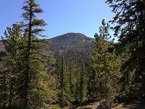 Jarbidge Peak viewed from the ridge south of Bonanza Gulch | |
| Highest point | |
| Elevation | 10,799 ft (3,292 m) NAVD 88[1] |
| Prominence | 621 ft (189 m) [2] |
| Coordinates | 41°50′25″N 115°23′25″W [1] |
| Geography | |
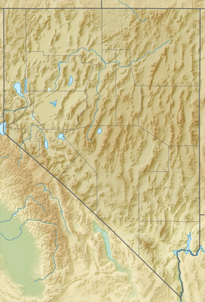 Jarbidge Peak Nevada, U.S. | |
| Location | Elko County, Nevada, U.S. |
"Jarbidge" is a name derived from the Shoshone language meaning "devil".[5] Indians believed the hills were haunted.[6]
Summit panorama

References
- "Jarbidge". NGS data sheet. U.S. National Geodetic Survey. Retrieved 2014-01-27.
- "Jarbridge Peak, Nevada". Peakbagger.com. Retrieved 2014-01-27.
- "Jarbidge Mountains". Peakbagger.com. Retrieved 2013-08-16.
- "Jarbidge Wilderness map". Wilderness.net. Retrieved 2013-08-16.
- Nestor, Sandy (29 November 2004). Indian Placenames in America. McFarland. p. 104. ISBN 978-0-7864-7167-6.
- Federal Writers' Project (1941). Origin of Place Names: Nevada (PDF). W.P.A. p. 25.
External links
- "Jarbidge Peak". Geographic Names Information System. United States Geological Survey. Retrieved August 16, 2013.
| Wikimedia Commons has media related to Jarbidge Peak. |
This article is issued from Wikipedia. The text is licensed under Creative Commons - Attribution - Sharealike. Additional terms may apply for the media files.