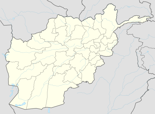
Jabal Saraj
Jabal Saraj (Persian/Pashto: جبل سراج) is a town in the Jabal Saraj District of Parwan Province, Afghanistan.
Jabal Saraj جبل سراج | |
|---|---|
Town | |
 Jabal Saraj Location | |
| Coordinates: 35.11833°N 69.23778°E | |
| Country | |
| Province | Parwan Province |
| District | Jabal Saraj District |
| Elevation | 1,573 m (5,161 ft) |
| Time zone | +4:30 |
Climate
Jabal Saraj town has a Mediterranean climate (Köppen climate classification Csa) with hot, dry summers and cold, wet winters. Snow is not unusual in winter. Nearby areas may have a cold semi-arid climate (Köppen climate classification BSk) or a humid continental climate (Köppen climate classification Dsa/Dsb) depending on altitude and topography.
| Climate data for Jabal Saraj | |||||||||||||
|---|---|---|---|---|---|---|---|---|---|---|---|---|---|
| Month | Jan | Feb | Mar | Apr | May | Jun | Jul | Aug | Sep | Oct | Nov | Dec | Year |
| Record high °C (°F) | 17.4 (63.3) |
19.4 (66.9) |
26.6 (79.9) |
29.7 (85.5) |
34.0 (93.2) |
38.4 (101.1) |
36.7 (98.1) |
36.3 (97.3) |
35.4 (95.7) |
30.4 (86.7) |
24.7 (76.5) |
18.5 (65.3) |
38.4 (101.1) |
| Average high °C (°F) | 5.5 (41.9) |
6.2 (43.2) |
13.2 (55.8) |
19.6 (67.3) |
24.4 (75.9) |
29.5 (85.1) |
31.7 (89.1) |
31.0 (87.8) |
27.6 (81.7) |
23.0 (73.4) |
15.5 (59.9) |
8.9 (48.0) |
19.7 (67.4) |
| Daily mean °C (°F) | 1.2 (34.2) |
2.6 (36.7) |
9.0 (48.2) |
15.1 (59.2) |
19.8 (67.6) |
25.3 (77.5) |
27.3 (81.1) |
26.3 (79.3) |
22.6 (72.7) |
17.2 (63.0) |
10.7 (51.3) |
4.2 (39.6) |
15.1 (59.2) |
| Average low °C (°F) | −2.0 (28.4) |
−0.3 (31.5) |
5.0 (41.0) |
10.9 (51.6) |
15.1 (59.2) |
20.7 (69.3) |
23.1 (73.6) |
21.9 (71.4) |
18.2 (64.8) |
12.8 (55.0) |
5.9 (42.6) |
0.8 (33.4) |
11.0 (51.8) |
| Record low °C (°F) | −15.4 (4.3) |
−14.7 (5.5) |
−5 (23) |
0.3 (32.5) |
6.0 (42.8) |
9.4 (48.9) |
14.7 (58.5) |
13.0 (55.4) |
6.4 (43.5) |
2.8 (37.0) |
−2.4 (27.7) |
−12.9 (8.8) |
−15.4 (4.3) |
| Average precipitation mm (inches) | 60.7 (2.39) |
88.0 (3.46) |
107.6 (4.24) |
97.2 (3.83) |
29.8 (1.17) |
1.4 (0.06) |
3.0 (0.12) |
2.1 (0.08) |
3.3 (0.13) |
10.7 (0.42) |
21.2 (0.83) |
37.2 (1.46) |
462.2 (18.19) |
| Average rainy days | 2 | 5 | 10 | 10 | 6 | 1 | 1 | 1 | 1 | 3 | 3 | 3 | 46 |
| Average snowy days | 6 | 5 | 2 | 0 | 0 | 0 | 0 | 0 | 0 | 0 | 0 | 4 | 17 |
| Average relative humidity (%) | 56 | 59 | 49 | 48 | 38 | 26 | 28 | 27 | 26 | 33 | 37 | 51 | 40 |
| Mean monthly sunshine hours | 167.3 | 163.8 | 195.6 | 217.1 | 304.1 | 353.1 | 354.7 | 329.8 | 306.1 | 275.9 | 224.4 | 167.3 | 3,059.2 |
| Source: NOAA (1961-1983) [1] | |||||||||||||
References
- "Jabulsaraj Climate Normals 1961-1983". National Oceanic and Atmospheric Administration. Retrieved December 25, 2012.
This article is issued from Wikipedia. The text is licensed under Creative Commons - Attribution - Sharealike. Additional terms may apply for the media files.