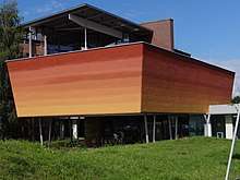
International Soil Reference and Information Centre
(ISRIC - World Soil Information)
Mission
ISRIC - World Soil Information, legally registered as the International Soil Reference and Information Centre, is an independent, science-based foundation. The institute was founded in 1966 following a recommendation of the International Society of Soil Science (ISSS, now International Union of Soil Sciences| (IUSS)) and the United Nations Educational, Scientific and Cultural Organization (UNESCO). It has a mission to serve the international community with information about the world’s soil resources to help addressing major global issues.[1]
Main focus areas
Recent developments at ISRIC are succinctly described in a series of Annual Highlights.[2][3][4]
Together with partners, ISRIC produces, gathers, compiles and serves quality-assessed soil information at global, national and regional levels. Work is organised according to 4 workstreams: Setting Standards and References, Soil Information Provisioning, Capacity Building and Advocacy, and Derived products.[5][6]
ISRIC stimulate the use of this information to address global challenges through capacity building, awareness raising and direct cooperation with users and clients. Details are provided on the following website website.
Data holdings and webservices
Our reference collection includes country documentation (reports, maps and slides), soil specimens (monoliths, samples, thin sections, hand specimens). Physical examples of our soil monolith collection are on permanent display in the World Soil Museum.

ISRIC also manages and develops geo-referenced databases (point, polygon, and raster). Since 2010, ISRIC has been developing its cyber- infrastructure for safeguarding, handling and producing of open soil data. Freely available products provided by ISRIC include a set of standardised soil profile data for the world served from WoSIS[7] and a collection of updatable soil property and class maps of the world at 1 km[8] and 250 m[9] spatial resolution (SoilGrids) produced using semi-automated soil mapping based on machine learning algorithms.
Our on-line resources can be accessed via:
- WoSIS - Providing standardised soil profile data for the world (WFS and TXT)
- SoilGrids250m - Soil property and class maps for the world at 250m resolution derived from digital soil mapping
- Soil data hub - ISRIC's central location for searching and downloading soil data layers from around the world
- Metadata catalogue - Search soil-related metadata from ISRIC and other organisations from around the world
- World soil library and map collection - On-line search and download facility
- World soil museum - Take a virtual tour of the museum and reference collections
- Capacity building - Provides an overview of ISRIC's training and educational modules

World Data Centre for Soils (WDC - Soils)
ISRIC became a regular member of the ICSU World Data System in 2011; it has been a member of the former ICSU World Data Center since 1989. Within the ISC (International Science Council, includes former ICSU) World Data System (WDS), ISRIC is still known as the WDC-Soils.
Re-accreditation as a regular ICS-WDS member is on a three yearly basis, and this includes certification as a CoreTrustSeal trustworth repository.
Useful links
- ISRIC World Soil Information website
- ICSU World Data System (ICS-WDS)
- CoreTrustSeal certified repositories (CTS)
- International Union of Soil Sciences (IUSS)
- Global Soil Partnership (GSP)
- GlobalSoilMap.net
- GODAN Soil Data Working Group (Global Open Data for Agriculture and Nutrition)
- European Soil Data Centre (ESDAC)
- Soil data access, USDA
References
- IYPE (2005). Soil - Earth’s living skin, International Year of Planet Earth, Tronsheim (NO) (PDF) (Report). p. 16.
- ISRIC (2018). Highlights 2016-2017 (PDF) (Report). p. 16.
- ISRIC (2016). Highlights 2014-2015 (PDF) (Report). p. 9.
- ISRIC (2014). Highlights 2012-2013 (PDF) (Report). p. 12.
- ISRIC (2018). Highlights 2016-2017 (PDF) (Report). p. 16.
- Batjes, Niels H.; van den Bosch, Rik (2018). "How well is the WDC-Soils serving its user groups?". SciDataCon-IDW2018. doi:10.17027/6F38-HN42.
- Batjes, Niels H.; Ribeiro, Eloi; van Oostrum, Ad (2019). "Standardised soil profile data to support global mapping and modelling (WoSIS snapshot 2019)". Earth System Science Data Discussions. doi:10.5194/essd-2019-164.
- Hengl, Tom; Mendes de Jesus, Jorge; McMillan, R.A.; Batjes, Niels H.; Heuvelink, G.B.M.; Ribeiro, Eloi C.; Samuel-Rosa, Allesandro; Kempen, Bas; Leenaars, J.G.B.; Walsh, M.G.; Ruiperez Gonzalez, Maria G. (2014). "SoilGrids1km — global soil information based on automated mapping". PLoS ONE. 9 (8): e105992. Bibcode:2014PLoSO...9j5992H. doi:10.1371/journal.pone.0105992. PMC 4149475. PMID 25171179.
- Hengl, Tom; Mendes de Jesus, Jorge; Heuvelink, G.B.M.; Ruiperez Gonzalez, Maria; Kilibarda, M; Blagotic, A.; Shangguan, W.; Wright, W.M.; Geng, X.; Bauer-Marschallinger, B.; Guevara, M.A.; Geng, X.; Bauer-Marschallinger, B.; Guevara, M.A.; Vargas, R.; MacMillan, R.A.; Batjes, Niels H.; Leenaars, J.G.B.; Wheeler, I.; Mantel, S.; Kempen, B. (2017). "SoilGrids250m: Global gridded soil information based on machine learning". PLoS ONE. 12 (2): e0169748. Bibcode:2017PLoSO..1269748H. doi:10.1371/journal.pone.0169748. PMC 5313206. PMID 28207752.