Indian Path, Nova Scotia
Indian Path, Nova Scotia | |
|---|---|
Community | |
 The River Can't Divide | |
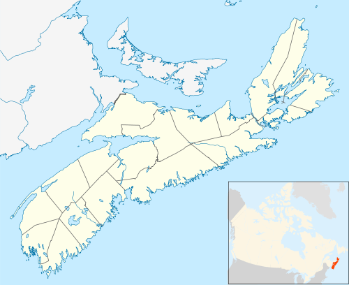 Indian Path, Nova Scotia Location within Nova Scotia | |
| Coordinates: 44°18′39.87″N 64°20′41.51″W | |
| Country | Canada |
| Province | Nova Scotia |
| Municipality | Lunenburg Municipality |
| Elevation | 0 m (0 ft) |
| Highest elevation | 119 m (390 ft) |
| Lowest elevation | 0 m (0 ft) |
| Time zone | UTC-4 (AST) |
| • Summer (DST) | UTC-3 (ADT) |
| Canadian Postal code | B0J 2W0 |
| Area code(s) | 902 |
| Telephone Exchanges | 764, 766 |
| NTS Map | 021A08 |
| GNBC Code | CBFUW |
| Website | www |
Indian Path
Indian Path is part of the Riverport District, a community in the Canadian province of Nova Scotia, in Lunenburg County.
Much of the rural infrastructure for Bayport is centered in Riverport, Nova Scotia. This includes the Riverport & District Fire Department, Riverport & District Community Center, Riverport Community School and Riverport Post Office. Rose Bay General Store offers a wide range of locally based goods and services.
This article is issued from Wikipedia. The text is licensed under Creative Commons - Attribution - Sharealike. Additional terms may apply for the media files.