Hungarton
Hungarton (or Hungerton) is a small village and civil parish in the Harborough district, in the county of Leicestershire, England, about 10 miles (16.1 km) north-east of Leicester and 13 miles (21 km) south-west of Melton Mowbray. The population of the civil parish was 269 at the 2001 census, including Ingarsby, and increased to 289 at the 2011 census.[2]
| Hungarton | |
|---|---|
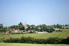 Hungarton seen from near Quenby Hall | |
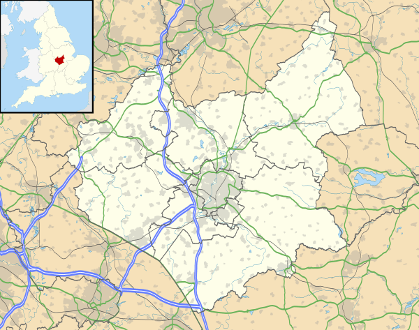 Hungarton Location within Leicestershire | |
| Population | 269 (2001 Census)[1] |
| OS grid reference | SK690073 |
| Civil parish |
|
| District | |
| Shire county | |
| Region | |
| Country | England |
| Sovereign state | United Kingdom |
| Post town | LEICESTER |
| Postcode district | LE7 |
| Dialling code | 0116 |
| Police | Leicestershire |
| Fire | Leicestershire |
| Ambulance | East Midlands |
| UK Parliament | |
Amenities
The village has a church, a village hall, a small stream and a Millennium Green. It also has a pub called The Black Boy. Stilton cheese was first produced in a dairy in the grounds of Quenby Hall.
The Anglican Church of St John the Baptist is part of a group benefice with Keyham, Billesdon, Goadby and Skeffington. A service is held twice a month.[3]
Heritage
The village features in the 1086 Domesday Book as Hungretone.
The parish of Hungarton covers over 4000 acres (16 km²) and includes with the village the estates of Quenby Hall, Baggrave and Ingarsby.[4]
A bill to enclose common lands in the village was introduced in 1762.[5]
The village layout follows the model village built in 1764–1776 by Shukburgh Ashby, then owner of nearby Quenby Hall. There are a few cottages that pre-date this and several houses built since.
John Marius Wilson: Imperial Gazetteer of England and Wales (1870–72):
- "HUNGERTON, a village, a township, and a parish in Billesdon district, Leicestershire. The village stands between the two branches of the river Wreak, 6 miles SE by E of Syston Junction r. station, and 7 NE by E of Leicester; and has a post office under Leicester. The township includes the village. Real property, £1,565. Pop., 196. Houses, 48. The parish contains also the liberty of Baggrave, and the hamlets of Ingarsby and Quenby. Acres, 2,910. Real property, £5,945. Pop., 302. Houses, 64. The property is divided among a few. Baggrave Hall is the seat of E. A. Burnaby, Esq. Quenby Hall has, for upwards of seven centuries, belonged to the Ashbys. Ingarsby Hall, an old moated building, is now a farmhouse. The living is a vicarage, united with the vicarage of Twyford and the p. curacy of Thorpe-Satchville, in the diocese of Peterborough. Value, £320. Patron, the Rev. E. Q. Ashby. The church is ancient; was restored in 1851; and consists of nave, chancel, and S aisle, with porch and lofty spire. There are a Wesleyan chapel and some charities."[6]
Samuel Lewis, editor: A Topographical Dictionary of England (1848):
- "HUNGERTON (St. John the Baptist), a parish, in the union of Billesdon, chiefly in the hundred of Gartree, S. division, but partly in that of East Goscote, N. division, of the county of Leicester, 7 miles (E. by N.) from Leicester; comprising the liberty of Baggrave, and the hamlets of Ingarsby and Quenby; and containing 267 inhabitants. The living is a discharged vicarage, with that of Twyford and the chapelry of Thorp-Satchville united in 1732, valued in the king's books at £9. 8. 1½., and in the alternate patronage of the families of Peacocke and Ashby; net income, £220."[7]
Notable people
In birth order
- George Ashby (1656–1728), politician, was born at Quenby Hall and buried at Hungarton.
- Shukburgh Ashby (1724–1792), landowner and politician, was buried at Hungarton.
- Andrew Burnaby (1732–1812), travel writer and cleric, was buried at Hungarton.
- Louisa Cavendish-Bentinck (née Burnaby, c. 1831–1918), a great-grandmother of Queen Elizabeth II, was baptised at Hungarton.
- Algernon Edwyn Burnaby (1868–1938) of Baggrave Hall, was Master of the Quorn Hunt.
References
- "2001 Census: Key Statistics: Parish Headcounts: Area: Hungarton CP (Parish)". Office for National Statistics. Retrieved 28 September 2008.
- "Civil Parish population 2011". Neighbourhood Statistics. Office for National Statistics. Retrieved 14 June 2016.
- "Hungarton: St John the Baptist, Hungarton". achurchnearyou.com. 2015. Retrieved 2 November 2015.
- Somerville, Christopher (2015). "Hungarton and the Deserted Villages, Leicestershire". christophersomerville.co.uk. Retrieved 2 November 2015.
- "House of Lords Journal Volume 30: April 1762, 1-10". British History Online. 2015. Retrieved 2 November 2015.
- "Hungarton with Twyford and Thorpe Satchville". familysearch.org. 2015. Retrieved 2 November 2015.
- "Hungerton". British History Online. 2015. Retrieved 2 November 2015.
External links
| Wikimedia Commons has media related to Hungarton. |