Humber Gap
The Humber Gap is a term for the geographic gap between the roughly north-south running line of hills formed by the Yorkshire Wolds and the Lincolnshire Wolds, formed by the west-east running Humber Estuary.[1]
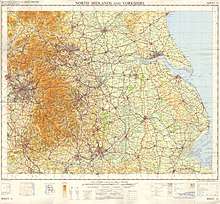
Map showing the Lincolnshire Wolds and the southern part of the Yorkshire Wolds, separated by the Humber west of Kingston upon Hull
In the geological past the gap has formed part of an ice barrier due to glaciers during the ice age resulting in damming and formation of a 'Humber Lake',[2][3] and also forms a geological division.[4]
In modern times the gap has formed a natural choice for transport routes, such as the railways.[5] The Humber Bridge also crosses the Humber close to the gap.[1]
See also
- Humberhead Levels: very heavily silted area formed west of the gap as a result of the damming of the gap, and subsequent lake formation
- North Ferriby and South Ferriby, villages on the two sides of the Humber named after the ferries across the gap.
References
- I. Shennan; J.E. Andrews, eds. (2000), "Holocene land-ocean interaction and environmental change around the North Sea", Geological Society Special Publication, Geological Society (166), pp. 97, 146–7, Fig.1, p.146
- J. Ehlers; P.L. Gibbard; P.D. Hughes, eds. (2011), "Quaternary Glaciations - Extent and Chronology: A Closer Look", Developments in Quaternary Science, Elsevier (15), p. 88
- P. J. Brenchley; P.F. Rawson, eds. (2007), The geology of England and Wales, 2nd edition, Geological Society, p. 454
- Allan Straw; Keith M. Clayton (1979), Eastern and central England, Methuen & Co., p. 39
- Maria Raimonda Usai (2005), Centre for Archaeology Report 54/2005 : Geoarchaeology in Northern England I. :The Landscape and Geography of Northern England (PDF), English Heritage, 2.1 Introduction, ISSN 1473-9224, archived from the original (PDF) on 4 March 2016
External links
This article is issued from Wikipedia. The text is licensed under Creative Commons - Attribution - Sharealike. Additional terms may apply for the media files.