Hujing Island
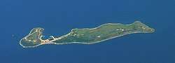
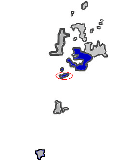
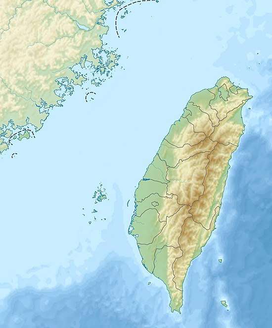
Hujing Island[3] / Huching Island[4][5][6] / Hujing Islet[7][8] (Chinese: 虎井嶼; pinyin: Hǔjǐng Yǔ; Wade–Giles: Hu3-ching3 Yü3; Pe̍h-ōe-jī: Hó͘-chéⁿ-sū) is an islet in Hujing Village (虎井里), Magong City, Penghu County (the Pescadores), Taiwan.[9] The island has also been known as Da'anshan (大案山) and the nearby Tongpan Island as Xiao'anshan (小案山).[10]:19 The southern part of the island is crossed by the Tropic of Cancer.[7][11] Hujing Island is the seventh largest island in Penghu (the Pescadores). The island is 7 nmi (13 km) from Penghu Main Island. There are mountains on the eastern end (Dongshan) and western end (Sishan) of the island.[12]
| Native name: 虎井嶼 | |
|---|---|
 Hujing Island | |
 Hujing Island in Magong City, Penghu County | |
| Geography | |
| Location | southwestern Magong City, Penghu County (the Pescadores), Republic of China (Taiwan) |
| Area | 1.9972 km2 (0.7711 sq mi)[1] |
| Administration | |
Republic of China (Taiwan) | |
| Province | Taiwan (streamlined) |
| County | Penghu |
| County-administered city | Magong |
| Demographics | |
| Population | ~100 (2017)[2] |
| Additional information | |
| Time zone | |
Ferries run three times a day between Magong on the main island of Penghu and Hujing Island.[13] It takes about twenty minutes to reach Hujing Island from Penghu's main island by boat.[2]
History

The island takes its current name from a tradition in which a tiger was found in a dry cave (or well[5]) near the south end of the island.[3]
According to tradition, the Dutch built a fortress on the island which sank into the sea. No significant discoveries have been made in the area.[3]
On July 12, 1683, Qing Empire naval forces took Hujing Island and Tongpan Island in the early stages of the Battle of Penghu.[10]:42
A World War II-era Japanese bomb shelter built on the island survives and is accessible to the public free of charge.[5]
In January 2019, there were noted complaints about collapsing roads and slow repair times around the western mountain area of the island.[14]
In June 2019, there were a total of six students in the island's primary school.[15]
Geography
The population of Hujing (Huching) village, noted for its seafood restaurants, is concentrated on the southwest end of the island.[5]
The island's geology is noted for black volcanic rock formations.[5] The island is higher in altitude than nearby Tongpan Island with a plain between the mountainous areas where most of the population lives.[7][12]
Gallery
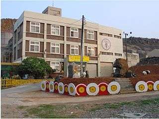 Power Station
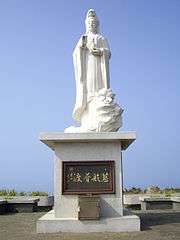 Guanyin Statue
%E9%A0%82%E6%A1%8C%E8%88%87%E7%BF%B9%E9%A0%AD%E6%A1%88.jpg) Guanyin Temple
Guanyin Temple Guanyin Temple
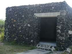 Command Post
See also
References
- 澎湖的島嶼. 澎湖國家風景區管理處 (in Chinese). Retrieved 2 November 2019.
# 行政區域 島嶼名稱 經度 緯度 面積 (平方公里) 有人居住 (*) {...}7 馬公巿 虎井嶼 119° 31' 33.20" 23° 29' 25.70" 1.9972 *
- 虎井海島休閒民宿. 澎湖國家風景區管理處 (in Chinese). 3 October 2017. Retrieved 2 November 2019.
位於馬公市南方約20分鐘船程的一個島嶼。{...}人口約一百人的小漁村,
- "Hujing Island". Tourism Bureau, Republic of China (Taiwan). 18 March 2019. Retrieved 2 November 2019.
In the 17th century, it is said, the Dutch came here and built a fortress that later sank into the sea in the midst of a battle. Scholars who have come to explore the area in recent years have made no significant discoveries, leaving the sunken fortress a 300-year mystery.{...}It' s named according to a legend that there was once a tiger crouching in a dry cave at the southeast of the island.
- "Beauty spot". Magong City Office, Penghu County. Retrieved 2 November 2019.
Huching Island
- Robert Storey (1998). Taiwan. p. 304 – via Internet Archive.
Huching Island (hǔjǐng yǔ) 虎井嶼
- Robert Kelly; Joshua Samuel Brown, eds. (March 2011). Taiwan. Lonely Planet (8 ed.). Singapore. p. 292. ISBN 9781741790436.
Huching Island
- "PENGHU From island to island" (PDF). Penghu County Government. 2010s. p. 2. Retrieved 2 November 2019.
Dongshan Hujing Deep Sea Shadow Hujing Islet Hujing Port Guanyin Temple Sishan{...}In recent years, to mark the Tropic of Cancer passing through Hujing Island, a new structure was built
- Stephen Keeling and Brice Minnigh (2007). The Rough Guide to Taiwan. Rough Guides. London. p. 445 – via Internet Archive.
Hujing Islet
CS1 maint: uses authors parameter (link) - 澎湖縣土地段名代碼表 (in Chinese). Department of Land Administration. 8 April 2019. Retrieved 2 November 2019.
地政事務所名稱(代碼) 澎湖(XA) 鄉鎮市區名稱(代碼) 馬公市(01) 段 小段 代碼 備註{...}虎井 0023
- 臺灣歷史地圖 增訂版 [Taiwan Historical Maps, Expanded and Revised Edition] (in Chinese). Taipei: National Museum of Taiwan History. February 2018. pp. 19, 42. ISBN 978-986-05-5274-4.
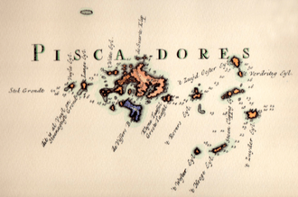
福爾摩沙島與澎湖群島圖{...}I. 小案山(桶盤嶼) J. 大案山(虎井嶼){...}7.12 奪虎井、桶盤
- Shyi-Liang Yu, Ying-Chien Chu, Huei-Min Tsai (December 2016). "Environmental changes and building resilient community in Penghu Islands". Journal of Marine and Island Cultures. 5 (2). Retrieved 2 November 2019 – via ScienceDirect.
The Tropic of Cancer at 23 ° 27′ goes through the southern part of Huching Islet of the islands.
CS1 maint: uses authors parameter (link) - 虎井嶼遊憩區. 澎湖國家風景區管理處 (in Chinese). 11 October 2016. Retrieved 2 November 2019.
虎井嶼是澎湖群島的第七大島,距馬公市7海浬,島上有壯觀的玄武岩柱狀節理。{...}全島分為東西二山,村落就位在東、西山之間,
- 交通船時間表. 澎湖縣馬公市公所 Magong City Office, Penghu County (in Chinese). 31 October 2019. Retrieved 2 November 2019.
- 劉禹慶 (21 January 2019). 虎井嶼西山道路崩塌多時 民怨官速度太慢. Liberty Times (in Chinese). Retrieved 2 November 2019.
- 劉禹慶 (11 June 2019). 虎井嶼人口嚴重外流 僅有一名國小畢業生. Liberty Times (in Chinese). Retrieved 2 November 2019.
位在澎湖南海的虎井嶼,與其他離島一樣,面臨人口嚴重流失問題,虎井國小全校僅6位學生,
External links
| Wikimedia Commons has media related to Hujing Island. |
- 【澎湖踩點】遺世小島虎井嶼 島上貓比人多 | 台灣蘋果日報 ('Understanding Penghu- The Forgotten Little Island: Hujing Island- More Cats than People on the Island- Taiwan Apple Daily') (in Chinese)