Horohoro, New Zealand
Horohoro is a rural farming community 15 kilometres (9.3 mi) south-west of Rotorua, New Zealand. Horohoro is a prominent landmark in the Rotorua area: a flat topped mountain with perpendicular cliffs. It is the traditional home of Ngāti Kea Ngāti Tuarā, whose ancestors related an incident in which Kahumatamomoe, a Te Arawa chief, washed his hands in a stream at the northern end of the Horohoro mountain. Hence the full name of the mountain is Te Horohoroinga o ngā ringa o Kahumatamomoe.[1]
Horohoro was one of the first areas in Āpirana Ngata’s 1929 land development scheme, which established farms on Māori land a farming district.[2]
Horohoro has two marae belonging to Ngāti Kea Ngāti Tuarā:[3] Kearoa Marae and meeting house, and Rongomaipapa Marae and Maruahangaroa meeting house.[4]
Education
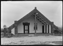
Horohoro School is a co-educational state primary school for Year 1 to 8 students,[5] with a roll of 56 as of March 2020.[6]
References
- Ngati Kea Ngati Tuara (2017). "History=Te Runanga o Ngati Kea Ngati Tuara". Ngati Kea Ngati Tuara.
- Malcolm McKinnon (March 2009). "Volcanic Plateau places - Rotorua to Taupō". Te Ara - the Encyclopedia of New Zealand.
- "Te Kāhui Māngai directory". tkm.govt.nz. Te Puni Kōkiri.
- "Māori Maps". maorimaps.com. Te Potiki National Trust.
- "Ministry of Education School Profile". educationcounts.govt.nz. Ministry of Education.
- "Education Review Office Report". ero.govt.nz. Education Review Office.