Hondius Inlet
Hondius Inlet is the 5.7 km wide ice-filled inlet indenting for 6.7 km the tip of Joerg Peninsula, Bowman Coast on the Antarctic Peninsula southeast of Three Slice Nunatak. Its head is fed by Getman Ice Piedmont.
Location of Joerg Peninsula in Graham Land, Antarctic Peninsula.
The feature is named after the Flemish cartographer Jodocus Hondius (a.k.a. Joost de Hondt, 1563–1612), whose 1595 map depicted the southern continent Terra Australis separated from both Tierra del Fuego and New Guinea.
Location
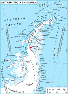
Hondius Inlet is centred at 68°04′50″S 64°55′00″W. British mapping in 1963 and 1976.
Maps
- British Antarctic Territory. Scale 1:200,000 topographic map. DOS 610 Series, Sheet W 68 64. Directorate of Overseas Surveys, Tolworth, UK, 1963.
- British Antarctic Territory: Palmer Land. Scale 1:250,000 topographic map. BAS 250 Series, Sheet SR 19–20. London, 1976.
- Antarctic Digital Database (ADD). Scale 1:250,000 topographic map of Antarctica. Scientific Committee on Antarctic Research (SCAR). Since 1993, regularly upgraded and updated.
References
- Hondius Inlet. SCAR Composite Antarctic Gazetteer.
- Bulgarian Antarctic Gazetteer. Antarctic Place-names Commission. (details in Bulgarian, basic data in English)
External links
- Hondius Inlet. Copernix satellite image
This article includes information from the Antarctic Place-names Commission of Bulgaria which is used with permission.
This article is issued from Wikipedia. The text is licensed under Creative Commons - Attribution - Sharealike. Additional terms may apply for the media files.