High Cross, Leicestershire
High Cross is the name given to the crossroads of the Roman roads of Watling Street and Fosse Way in Leicestershire, England. It is about a mile west of the village of Claybrooke Magna and was in the hundred of Guthlaxton. It was the site of a Romano-British settlement known as Venonae or Venonis, with a nearby fort.
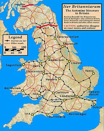
In modern times, this section of Watling Street is now a dual carriageway section of the A5, the southern part of the Fosse Way is a B road, and the northern route of the Fosse is now a track which is a part of a long-distance path called the Leicestershire Round.
High Cross is depicted on the coat of arms of Blaby District Council, which is the local authority for the area. Two black diagonal lines on the shield, depict the Fosse Way and Watling Street.
External links
- "Venonis". Roman Britain. Archived from the original on 10 October 2018. Retrieved 22 November 2019.
- The Mirror of Literature, Amusement, and Instruction, Vol. X, No. 272, published 8 September 1827
- Burbage the Centre of England, Sylvia Whitworth, Burbage Heritage group.