Henties Bay
Henties Bay (English, literally: Henty's Bay. Afrikaans: Hentiesbaai, German: Hentiesbucht) is a coastal town[2] in the Erongo Region of western Namibia. It is located 70 km north of Swakopmund and is an important holiday settlement. 70 kilometres to the north of the town is the seal colony of Cape Cross. The town had 4,720 inhabitants in 2011, up from 3,285 in 2001.[1] The mayor of Henties Bay is Herman /Honeb.[3]
Henties Bay | |
|---|---|
City | |
 Henties Bay (2018) | |
 Seal | |
 Henties Bay | |
| Coordinates: 22.1184°S 14.2824°E | |
| Country | |
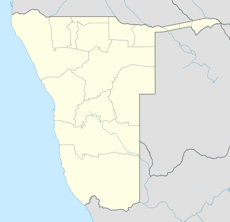
| Region | Erongo Region |
| Constituency | Arandis Constituency |
| Established | 1929 |
| Government | |
| • Mayor | Herman Honeb |
| Population (2011)[1] | |
| • Total | 4,720 |
| Time zone | UTC+2 (South African Standard Time) |
| Climate | BWk |
| Website | hentiesbaytourism |


History
Bartolomeu Dias sailed along the Atlantic coast in 1488. Near the area of today's Henties Bay he discovered such an abundance of fish that he named this coastline Praia das Sardinhas, Coast of Fish. The fresh water source was first discovered by Schutztruppe soldiers in 1886. In 1920, a minerals prospector stayed overnight. After tasting the water he was said to be healed from an affliction.[4]
The namesake of the town is major Hendrik "Henty" Stefanus van der Merwe who discovered the place in 1929 while looking for water. He had been hunting a rhinoceros in the arid hinterland of the Namibian coast near the Brandberg in order to collect a reward from a museum in Pennsylvania that was in search of a rhino skeleton. After shooting the rhino and scraping meat from the bones, water resources of the expedition diminished and forced the party to load the decomposing carcass and search for water.[5][6]
They chose to head into the direction of the Atlantic coast and reached it close to Cape Cross. From there van der Merwe and his fellows searched southwards for the mouth of Omaruru River. A few miles south of the mouth they discovered a deep sand valley with reed grass growing in it, advertising the presence of fresh water. Van der Merwe liked the place and after delivering the bones and collecting his reward, returned the following Christmas to build a wooden hut in the riverbed. The place became known as Henty se baai (Henty's Bay) and developed into a holiday hideout,[5] mainly because of the abundance of fish at this spot.[4]
In 1951 the South–West Africa Administration mandated to South Africa, proclaimed erven in the Omaruru riverbed that were available for rent, but the erection of permanent structures was not allowed. The first shop was established during that time. A lighthouse was erected to guide ships along the dangerous Namibian coast. In the 1960s mining holes were dug after diamonds had been found in the area on a few occasions. A few years later mining was abandoned due to lack of success. In 1966 it was decided that the riverbed must not be settled in, and property north and south of it was sold. A hotel was built one year later, and the town began to develop.[6]
Environment and tourism
The town is predominantly a tourist destination for anglers and 4x4 enthusiasts. Its property market has expanded significantly since the late 1990s, particularly for upmarket holiday accommodation.[4]
Henties Bay is situated in the National West Coast Recreation Area but there are few restrictions, particularly for driving off-road on the beach and across the plains. This lures tourists into the area but puts a burden on the sensitive environment. Specifically in danger are the lichen fields which take decades to recover from tracks cut through them, and the Damara tern which is endemic to the Skeleton Coast and threatened by habitat loss.[7] A new multimillion-dollar Tourism Center was inaugurated in October 2016.[8]
Industry
Areva, a French company who has built the first desalination plant in Southern-Africa at Wlotzkasbaken, 30 kilometres (19 mi) north of Swakopmund,[9] has proposed developing a desalination facility north of Henties Bay. Plans also include the production of a non-toxic plant for Jatropha, a source of bio-fuel which is adapted to arid environments. According to designers, the desalination plant would have capacity to supply the nearby towns of Uis, Okombahe and Henties Bay.[10]
The University of Namibia (UNAM) in July 2017 revealed plans to establish a marine engineering and mining training facility at the coast. An eight-hectare piece of property has been donated by the town's municipality which would house the School of Marine Engineering and Maritime Studies.[11]
Politics
Henties Bay is governed by a municipal council that has seven seats.[12] Henties Bay is home to the Civic Association of Henties Bay, a local political party which contests local elections.
From 2004–10, the local authority of Henties Bay included 3 members of the Civic Association, 3 SWAPO members and 1 member of the United Democratic Front (UDF).[13] In the 2010 local election, the Civic Association received the most votes (approximately 44%), while SWAPO finished in 2nd place with approximately 37%. The Rally for Democracy and Progress, which was the party of opposition in the National Assembly following the 2009 general election, also contested the election and received 4%.[14]
The 2015 local authority elections were won by SWAPO who gained 3 seats (702 votes). 2 seats went to the UDF (357 votes), while the Civic Association and the Democratic Turnhalle Alliance (DTA) gained one seat each with 266 and 129 votes, respectively.[15]
Town council corruption affair
In November 2009, three town councillors, the town human resources manager and the town CEO were arrested on corruption charges stemming from the hiring of friends of the officials as general labourers in 2007.[16]
References
- "Table 4.2.2 Urban population by Census years (2001 and 2011)" (PDF). Namibia 2011 - Population and Housing Census Main Report. Namibia Statistics Agency. p. 40. Retrieved 19 May 2017.
- "Local Authorities". Association of Local Authorities in Namibia (ALAN). Archived from the original on 10 June 2013. Retrieved 1 October 2012.
- "Machtwechsel in Henties Bay" [=Change of Power in Henties Bay]. Allgemeine Zeitung (in German). 14 December 2012.
- "Henties Bay Namibia". Namibia 1on1. Retrieved 24 December 2010.
- "Dors en 'half verrotte renosterkarkas lei tot Hentiesbaai se ontstaan" [Thirst and a decomposing rhinoceros carcass lead to the foundation of Henties Bay]. Die Republikein (in Afrikaans). Reprint of an interview with Henty van der Merwe in the magazine 'Die Brandwag' on 29 April 1977, published as 'Gondwana History#20' on 24 December 2010.
- "History Henties Bay Namibia". Henties Bay Tourism. Archived from the original on 18 October 2010. Retrieved 24 December 2010.
- "Conservation in Henties Bay". Henties Bay Tourism. Archived from the original on 19 January 2011. Retrieved 24 December 2010.
- "New Tourism Information Centre inaugurated". Henties Bay Tourism Association. 12 October 2016.
- "Areva Resources Namibia". Areva. Retrieved 12 August 2017.
- Hartman, Adam (7 June 2016). "New desalination plans for coast". The Namibian. p. 5.
- "Namibia to establish mining and marine institutes at the coast". eNews Channel Africa. 3 July 2017.
- "Know Your Local Authority". Election Watch (3). Institute for Public Policy Research. 2015. p. 4.
- New mayor to heal rift in Henties community The Namibian, 4 June 2004
- Swapo Dominates Local Polls The Namibian, 1 December 2010
- "Local elections results". Electoral Commission of Namibia. 28 November 2015. p. 1. Archived from the original on 10 December 2015. Retrieved 11 August 2017.
- Hartmann, Adam (6 November 2009). "Five Henties Council officials arrested". The Namibian.