Hengill
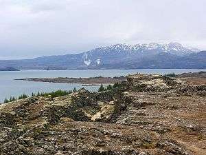
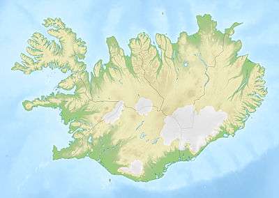
Hengill (Icelandic, pronounced [hɛɪŋcɪtl̥]) volcano is situated in the southwest of Iceland, to the south of Þingvellir. The volcano covers an area of about 100 km².
| Hengill | |
|---|---|
 Hengill, 2004 | |
| Highest point | |
| Elevation | 803 m (2,635 ft) [1] |
| Listing | List of volcanoes in Iceland |
| Coordinates | 64°05′08″N 21°18′48″W |
| Geography | |
 Hengill | |
| Geology | |
| Mountain type | Shield volcano, fissure vents |
| Last eruption | 150 CE ± 75 years [1] |
| Climbing | |
| Easiest route | Hike |
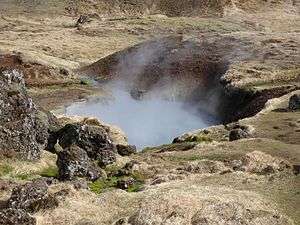
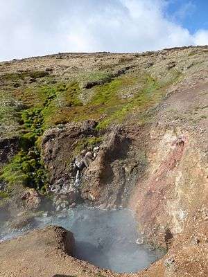
The volcano is still active, evidenced by its numerous hot springs and fumaroles, but the last eruption occurred approximately 2,000 years ago.
The volcano is an important source of energy for the south of the country, which is captured at the Nesjavellir power station (near the western shore of the lake Þingvallavatn) and the Hellisheiði power station (approximately 11 km southwest of Nesjavellir). Both stations are operated by Orkuveita Reykjavíkur (Reykjavik Energy).
The area with its mountains and hot springs is well suited for hiking and there are a lot of hiking trails. The small town of Hveragerði with its multitude of hot springs is also part of the Hengill area.
Some folk tales and sagas are connected to the region. For example, a young farmer is said to have killed the sleeping troll woman Jóra while she lay in wait for innocent wanderers or horsemen on the trail over Dyrafjöll.

See also
- Geography of Iceland
- List of lakes of Iceland
- Volcanism in Iceland
External links
- Hengill in the Catalogue of Icelandic Volcanoes
- Map