Helgbustadøya
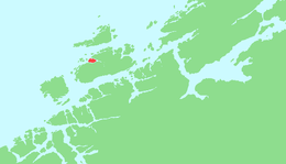
Helgbustadøya (sometimes Helgebustad or Helgebostad) is an island in the municipality of Hitra in Trøndelag county, Norway. It is an island located in the Straumsfjorden just off the northwestern coast of the island of Hitra, just east of the Bispøyan islands, about 10 kilometres (6.2 mi) northeast of the village of Kvenvær, and about 8 kilometres (5.0 mi) southwest of the village of Melandsjøen.[1]
 Location in southern Trøndelag | |
 Helgbustadøya Location of the island  Helgbustadøya Helgbustadøya (Norway) | |
| Geography | |
|---|---|
| Location | Trøndelag, Norway |
| Coordinates | 63.5791°N 08.5286°E |
| Area | 13 km2 (5.0 sq mi) |
| Length | 3.5 km (2.17 mi) |
| Width | 6.5 km (4.04 mi) |
| Coastline | 22 km (13.7 mi) |
| Highest elevation | 75 m (246 ft) |
| Highest point | Reitmarkåsen |
| Administration | |
Norway | |
| County | Trøndelag |
| Municipality | Hitra |
The eastern third of the island has a pine forest that is a nature reserve and the western two-thirds is a rocky, barren plateau that has many ponds and marsh areas.
See also
This article is issued from Wikipedia. The text is licensed under Creative Commons - Attribution - Sharealike. Additional terms may apply for the media files.