Height of Land Portage (St. Louis County)
Height of Land Portage is a historic portage route between the Embarrass River and the Pike River in St. Louis County, Minnesota, United States. The 4.6-mile (7.4 km) route crosses the Laurentian Divide, providing access between the Hudson Bay drainage basin and the Great Lakes Basin. The portage was a key connection for canoe-based travelers from the 1630s to the 1870s.[2] It was listed on the National Register of Historic Places in 1992 for its state-level significance in the themes of archaeology, exploration/settlement, and transportation.[3] It was nominated for its potential archaeological resources and associations with the fur trade and European expansion in North America.[2]
Height of Land Portage | |
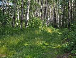 A modern snowmobile trail along the portage route | |
  | |
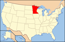
| Location | Off County Road 138 in Embarrass, White, and Pike Townships, Minnesota |
|---|---|
| Coordinates | 47°36′49″N 92°18′6″W |
| Area | 163.2 acres (66.0 ha) |
| Built | c. 1630s–1870s |
| MPS | Portage Trails in Minnesota MPS |
| NRHP reference No. | 92000842[1] |
| Added to NRHP | July 23, 1992 |
References
- "National Register Information System". National Register of Historic Places. National Park Service. July 9, 2010.
- Vogel, Robert C.; David G. Stanley (1991-09-26). "National Register of Historic Places Registration Form: Height of Land Portage". National Park Service. Retrieved 2019-02-09. Cite journal requires
|journal=(help) With eight accompanying photos from 1991 - "Height of Land Portage". Minnesota National Register Properties Database. Minnesota Historical Society. 2009. Retrieved 2019-02-09.
This article is issued from Wikipedia. The text is licensed under Creative Commons - Attribution - Sharealike. Additional terms may apply for the media files.