Hathlangoo
Hathlangoo (English: The Hundred Branches) previously known as Hashmatpora is a village in the Sopore tehsil of Baramulla District in Jammu and Kashmir. It is located 8 km (5.0 mi) away from sub-district headquarter Sopore and 22 km (14 mi) away from district headquarter Baramulla. It is one of the largest village in Zaingair. The Hathlangoo village has Borders with Janwara in South, Magraypora in North, Botingoo in Northwest, Malmapanpora in West and Wular Lake in East .
Hathlangoo | |
|---|---|
Village | |
| The Hundred Branches | |
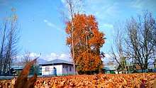
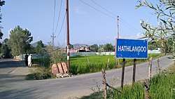 The Entrance Road to The Village | |
.jpg) | |
| Coordinates: 34.3456°N 74.5039°E | |
| State | Jammu and Kashmir |
| District | Baramulla |
| Tehsil Administration | Sopore |
| Area | |
| • Total | 2.529 km2 (625 acres) |
| Population | |
| • Total | 3,200 |
| Languages | |
| • Official | Kashmiri, English, Urdu, and Hindi |
| • Summer (DST) | IST (UTC+05:30) |
| PIN | 193201 |
| Telephone Code | 01954 |
| Vehicle registration | JK05 |
| Literacy | 63.1% |
| Village Code | 002191 |
Etymology
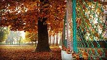
The name Hathlangoo is a Kashmiri word made up of two words: Hath means (hundred) and Langoo means (branches). The ancestors of this village said that there was a chinar tree in the village which had a hundred branches and then the elders of the village used this as a secondary name for the village initially named as "Hashmatpora". That chinar tree is still present in the cemetery of the village. Later on with the passing of time, the secondary name of the village permanently replaced the original name.

Demographic data
The village has a literacy rate of 63.1%. As per the 2011 census, the population of the village is about 3,000 of which 1,522 were male and 1,466 were female.[1]
Tribes
There are several tribes in Hathlangoo sopore village, some are native and some are refugees. The Dar and Lone are the native tribes of the village. These two tribes have lived there for many hundreds of years. Once only eight families were living in a village which include four families from Dar tribe, two families from Lone tribe, one family from Ganie tribe and the other one from the Mir tribe.
Other tribes include Wani, Ganie, Mir, and Bhat. There are also other tribes of which the four families are from, the Shah tribes, one family from the 'Tantray' tribe, one family from 'Baba' tribe, four families from 'Parray' tribe. All of these tribes are refugees from the adjoining areas. The 'Wani' tribe is the biggest refugees tribe in the village. They are from the Southern parts of Kashmir which once was called the 'Maraaz'. Now they have been living in the village for many decades. This village is in the Northern part of the Kashmir which once was called 'Kamraaz'.
Geography
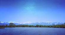
Hathlangoo is located at 34.3456°N 74.5039°E. The village occupies an area of 2.529 sq km (about 625 acres). On the east side Hathlangoo is 1 km (0.62 mi) from Wular Lake, one of the largest fresh water lakes in Asia. On a hill top on the north side is the Baba Shukur-ud-Din shrine.

Wular lake is rich in flora and fauna. The fish of Wular lake are famous for their taste and look. There are two islands in the middle of the lake.


Educational institutions
Hathlangoo village has one government run high school and around one middle and three primary SSA schools. Bilal Memorial English Medium School is the only private school. Taleem Ul quran is an Islamic institution where boys in morning and girls after Asr attend separate classes for learning the Quran freely. The public library has all types of Islamic books.
The village is home to a range of professionals such as IT workers, professors, and engineers. Some work overseas in countries such as the United States, Sudan, UAE, and the Middle East. Education level is almost good.
Places of interest
There are six mosques in Hathlangoo, two of which are Jama Masjids. All the people of this village are Muslims. Eid prayers are mostly offered in Eidgah which is located near Dar mohalla.
Hathlangoo consists of more than twelve mohallas: from the front of village is Nishat Colony and one of the biggest mohalla of village is Dar mohalla known as Danger mohalla.

Amenities
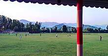
The village has a vast land for playing. It has the biggest stadium in the Sopore block. Cricket and football are a popular sports. Hathlangoo has produced some talented cricket players that have played at inter-college level. The Hathlangoo sports ground holds various regional sporting events. The Hathlangoo Premier League is a cricket tournament held in Hatlangoo every year.[2][3]
Healthcare
The village has one government-run allopathic medicine dispensary with almost all the basic needs. Some patients prefer the healthcare facilities in the neighbouring Sopore, Baramulla towns.
The village has four clinics for local residents, three at Dar Mohllah and the fourth in Kus pora.
References
- "Hasmat Pora Village Population". Census 2011 India.
- "Cricket Tournament concludes in Hatlangoo Sopore | Kashmir Despatch". kashmirdespatch.com. Archived from the original on 17 January 2018. Retrieved 4 December 2017.
- Muhammad, Ghulam (28 November 2017). "HPL cricket tourney concludes". Greater Kashmir. Retrieved 28 December 2018.