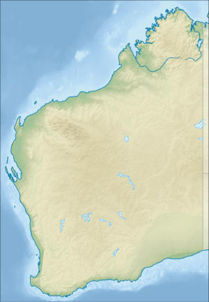
Hamersley Range
The Hamersley Range is a mountainous region of the Pilbara region of Western Australia. The range was named on 12 June 1861 by explorer Francis Thomas Gregory after Edward Hamersley, a prominent promoter of his exploration expedition to the northwest.[1] Juukan Gorge lies within the ranges, about 60 kilometres (37 mi) from the mining town of Tom Price, as does Karijini National Park.
| Hamersley Range | |
|---|---|
 Outside the town of Paraburdoo, showing part of the Hamersley Range in the background | |
| Highest point | |
| Peak | Mount Meharry |
| Elevation | 1,249 m (4,098 ft) |
| Coordinates | 22°58′S 118°35′E |
| Geography | |
 | |
| Country | Australia |
| State | Western Australia |
| Region | Pilbara |
| Range coordinates | 21°53′S 116°46′E |
History
The traditional Aboriginal owners of the area that the range runs through are the Puutu Kunti Kurrama and Pinikura peoples.[2]
In 1999 a small range within the Hamersley was named the Hancock Range after the Hancock family, who were pioneers in the area. The Hancock range is east of Karijini National Park in a region of broad valleys and peaks that rise to almost 1,200 metres (3,937 ft). The Hancock Range is close to Mulga Downs Station, a property owned by the Hancock family and where Lang Hancock is buried.[3]
Geography
The range runs from the Fortescue River in the northeast, 460 kilometres (290 mi) to the south. The range contains Western Australia's highest point, Mount Meharry, which reaches approximately 1,249 metres (4,098 ft) AHD. There are many extensively eroded gorges, such as Wittenoom Gorge. The twenty highest peaks in Western Australia are in the Hamersley Range.[4] Peaks in the range include Mount Bruce (1,234 metres (4,049 ft)), Mount Nameless/Jarndunmunha (1,115 metres (3,658 ft)), Mount Reeder Nichols (1,109 metres (3,638 ft)), Mount Samson (1,107 metres (3,632 ft)), Mount Truchanas (1,148 metres (3,766 ft)) and Mount Tom Price (775 metres (2,543 ft)).[5]
Karijini National Park (formerly Hamersley National Park), one of Australia's largest national parks, is centred in the range.

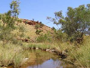
Juukan Gorge
A cave in Juukan Gorge, about 60 kilometres (37 mi) from Mt Tom Price, is one of the oldest in the western Pilbara region, and the only inland site in Australia to show signs of continuous human occupation through the Ice Age.[6]
Mining company Rio Tinto received ministerial consent to damage the site in 2013, but a year later, an archaeological dig discovered the site was more than twice as old as previously thought and rich in cultural artefacts, including sacred objects. One particularly significant finding was a length of plaited human hair, woven together from strands from the heads of several different people, about 4,000 years old. DNA testing revealed that the hair had belonged to the direct ancestors of Puutu Kunti Kurrama and Pinikura people alive today. However, the Aboriginal Heritage Act 1972 (WA) does not allow for mining consent to be renegotiated on the basis of new information.[6]
The cave was ultimately blasted along with another Aboriginal sacred site on 24 May 2020.[6]
Mining
The range contains large deposits of iron ore, producing a large proportion of Australia's iron ore exports. It is predominately associated with banded iron formation.[7][8][9] Western Australia's major iron producers have mines, communities and railways that occur along the range.[10] Rio Tinto operates several iron ore mines within the range, including Mount Tom Price, Marandoo, Brockman, Channar, West Angelas, Mesa A mine, and Paraburdoo. Over 100 million tonnes of iron ore is removed from the range every year.[11]
See also
References
- "North-Western Australia: Gregory's Expedition". Empire. Sydney, NSW. 3 January 1862. p. 2. Retrieved 2 June 2017.
- "Country and Region". PKKP Aboriginal Corporation. Retrieved 11 June 2020.
- "The naming of Hancock Range within Hamersley Range honours Hancock family". Government of Western Australia. 23 July 1999. Archived from the original on 4 September 2008. Retrieved 20 October 2013.
- "Landgate - Interesting facts about Western Australia". 2009. Archived from the original on 12 April 2009. Retrieved 23 April 2009.
- "Bonzle Digital Atlas - Map of Mount Tom Price". 2009. Retrieved 23 April 2009.
- "Rio Tinto blasts 46,000-year-old Aboriginal site to expand iron ore mine". The Guardian. 26 May 2020. Retrieved 27 May 2020.
- MacLeod, W. N. (1966) The geology and iron deposits of the Hamersley Range area. Bulletin Archived 4 March 2016 at the Wayback Machine (Geological Survey of Western Australia), No. 117
- "Geology". Rio Tinto Iron Ore. Archived from the original on 23 October 2012. Retrieved 7 August 2012.
- "Iron 2002 - Key Iron Deposits of the World - Module 1, Australia". Portergeo.com.au. 18 September 2002. Retrieved 7 August 2012.
- Iron fact sheet - Australian Resources and Deposits Archived 2011-02-18 at the Wayback Machine Geoscience Australia website, accessed: 7 November 2010
- "Rio Tinto Iron Ore - Mining". 2010. Archived from the original on 12 June 2010. Retrieved 6 November 2010.
Further reading
- Marshall, Lloyd (1966) New Iron Age in the Hamersleys in the Weekend News, Sept. 3, 1966.
- Powell, C. M.; Horwitz, R. C. (1994). Late Archaean and Early Proterozoic tectonics and basin formation of the Hamersley Ranges (PDF). Geological Society of Australia (WA Division), Excursion guidebook 4. ISBN 0-909869-90-1.