Hain, Thuringia
Hain is a village and a former municipality in the district of Greiz, in Thuringia, Germany. Since 31 December 2013, it is part of the municipality Langenwetzendorf. The small village Hainsberg, also part of the municipality Langenwetzendorf, is located 1.8 km (1.1 mi) southeast of Hain.
Hain | |
|---|---|
Ortsteil of Langenwetzendorf | |
Location of Hain 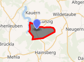
| |
 Hain  Hain | |
| Coordinates: 50°42′28″N 12°4′58″E | |
| Country | Germany |
| State | Thuringia |
| District | Greiz |
| Municipality | Langenwetzendorf |
| Area | |
| • Total | 2.72 km2 (1.05 sq mi) |
| Elevation | 340 m (1,120 ft) |
| Population (2012-12-31) | |
| • Total | 74 |
| • Density | 27/km2 (70/sq mi) |
| Time zone | CET/CEST (UTC+1/+2) |
| Postal codes | 07957 |
| Dialling codes | 036625 |
| Vehicle registration | GRZ |
| Website | www.leubatal.de |
References
| Authority control |
|
|---|
This article is issued from Wikipedia. The text is licensed under Creative Commons - Attribution - Sharealike. Additional terms may apply for the media files.