Gomia
Gomia (also spelled as Gumia) is a census town in Gomia block in Bermo subdivision of Bokaro district in the Indian state of Jharkhand. The modern name is a transformation of Gumia over the years. Though, today, it is still listed as Gumia by the South Eastern Railway (India) (station code GMIA).
Gomia | |
|---|---|
Town | |
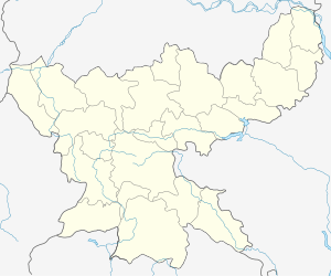
 Gomia Location in Jharkhand, India  Gomia Gomia (India) | |
| Coordinates: 23.78°N 85.82°E | |
| Country | |
| State | Jharkhand |
| District | Bokaro |
| Elevation | 238 m (781 ft) |
| Population (2011) | |
| • Total | 48,141 |
| Languages | |
| • Official | Hindi and Khortha |
| Time zone | UTC+5:30 (IST) |
| PIN | 829112 |
| Vehicle registration | JH-09 |
| Website | bokaro |
Geography
Gumia is located at 23.78°N 85.82°E.[1] It has an average elevation of 238 metres (780 feet) and lies within the deciduous forests of Chota Nagpur Plateau
Police station
There are two police stations in gomia, Gomia police station is located at Gomia 829111 .[2] And another is I.E.L. Police station 829112 on the another side of the gomia block.
History
Gomia took shape around the year 1956, when the Imperial Chemical Industries (ICI as its popularly known as), set up a commercial explosives (IEL) factory there. It was developed together a residential colony to house the 3500 employees that would work in the factory. Since then, Gomia has been known as an example of diversity - with people of different nationalities, cultures and religious beliefs coming together to write a new chapter in the history of the then Hazaribagh district. Since the late 1950s, it has switched districts twice, first becoming a part of Giridih and then becoming a part of Bokaro district.
Demographics
As of the 2011 Census of India, Gumia had a population of 48,141, with 25,119 males and 23,022 females. Scheduled Castes numbered 9,667 and Scheduled Tribes numbered 3,635.[4]
As of 2001 India census,[5] Gumia had a population of 45,532. Males constitute 53% of the population and females 47%. Gumia has an average literacy rate of 64%, higher than the national average of 59.5%: male literacy is 74%, and female literacy is 52%. In Gumia, 14% of the population is under 6 years of age.
Literacy
As of the 2011 census, the total number of literate citizens in Gumia was listed as 32,968, out of which 19,240 were males and 13,728 were females.[4]
Economy
The people of Gomia also depend on Central Coal Field Limited's CCL Colliery. Bokaro Thermal Power Station B is also near Gomia (approx. 5 km)
Connectivity
Gomia lies on one of the first railway links that was set up in Chota Nagpur Plateau. It is on the Gomoh-Barkakhana line. It is well connected with trains to many places.It is well connected through the roadways having well built two-lane roads to the grand trunk road and is also connected well to the capital Ranchi.
It is having a well connected railways to the major states of India like to west Bengal and to Delhi also.
Tourism
Tenughat dam is one of the famous dam to gather the beauty of nature.It is the largest dam of aisa made up of soil barrier. Konar dam is about 20 km from Gomia. Lugu buru ghantabadi dhoromgadh is the famous fair for the tribals.It was announced as state fair in the year of 2018.
See also
References
- Falling Rain Genomics, Inc - Gumia
- "Jharkhand Police Official Website". Contact Bokaro Police. Jharkhand Police. Archived from the original on 14 February 2014. Retrieved 6 October 2017.
- Orica to form Explosives Venture with ICI India
- "2011 Census C.D. Block Wise Primary Census Abstract Data(PCA)". Jharkhand – District-wise CD Blocks. Registrar General and Census Commissioner, India. Retrieved 5 December 2015.
- "Census of India 2001: Data from the 2001 Census, including cities, villages and towns (Provisional)". Census Commission of India. Archived from the original on 16 June 2004. Retrieved 1 November 2008.