Guiers Vif
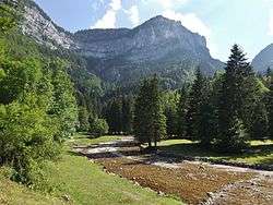
The Guiers Vif is a river in Auvergne-Rhône-Alpes in eastern France.[1] It is located in the Regional Natural Park of Chartreuse, on the border between the municipalities of Saint-Pierre-d'Entremont (Isère) and Saint-Pierre-d'Entremont (Savoie). It flows towards the northwest. For most of its course, the river forms the border between the departments of Isère and Savoie. Near the communes of Entre-deux-Guiers and Les Echelles, it ends after 16.9 km (10.5 mi) as a right tributary of the Guiers.[2]
| Guiers Vif | |
|---|---|
 | |
| Location | |
| Country | France, Switzerland |
| Physical characteristics | |
| Mouth | Guiers |
⁃ coordinates | 45.4368°N 5.7404°E |
| Length | 16.9 km (10.5 mi) |
| Basin features | |
| Progression | Guiers→ Rhône→ Mediterranean Sea |
References
- "le Guiers". avant-pays-savoyard.com. Retrieved April 17, 2016.
- Sandre. "Fiche cours d'eau - Le Guiers Vif (V1510500)".
This article is issued from Wikipedia. The text is licensed under Creative Commons - Attribution - Sharealike. Additional terms may apply for the media files.