Guatemala City
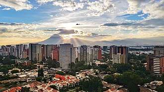
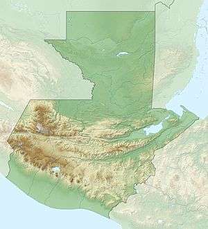
Guatemala City (Spanish: Ciudad de Guatemala), locally known as Guatemala or Guate, officially Nueva Guatemala de la Asunción (New Guatemala of the Assumption), is the capital and largest city of Guatemala,[5] and the most populous urban area in Central America. The city is located in the south-central part of the country, nestled in a mountain valley called Valle de la Ermita (English: Hermitage Valley). It is estimated that its population is about 1 million. Guatemala City is also the capital of the Municipality of Guatemala and of the Guatemala Department.
Guatemala City Guatemala | |
|---|---|
Capital City | |
| Nueva Guatemala de la Asunción[1] | |
 .jpg) 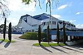 .jpg) .jpeg) 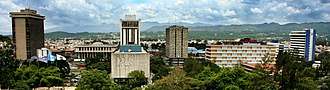 Collage of several city landmarks | |
 Flag  Coat of arms | |
| Motto(s): "Todos somos la ciudad" (We are all the city), "Tú eres la ciudad" (You are the city). | |

Interactive map outlining Guatemala City | |
 Guatemala City Location within Guatemala [2] 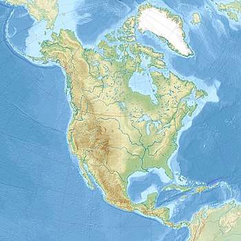 Guatemala City Guatemala City (North America) | |
| Coordinates: 14°36′48″N 90°32′7″W | |
| Country | Guatemala |
| Department | Guatemala |
| Established | 1776 |
| Government | |
| • Type | Municipality |
| • Mayor | Ricardo Quiñónez Lemus (Unionist) |
| Area | |
| • Capital City | 220 km2 (80 sq mi) |
| • Water | 0 km2 (0 sq mi) |
| Elevation | 1,500 m (4,900 ft) |
| Population (2018) | |
| • Capital City | 923,392[3] |
| • Density | 4,196/km2 (10,870/sq mi) |
| • Urban | 2,750,965 |
| • Metro | 3,700,000[4] |
| Time zone | UTC−06:00 (Central America) |
| Climate | Cwb |
| Website | www |
Guatemala City is the site of the Mayan city of Kaminaljuyu, founded around 1500 BC. Following the Spanish conquest, a new town was established, and in 1776 it was made capital of the Kingdom of Guatemala. In 1821, Guatemala City was the scene of the declaration of independence of Central America from Spain, after which it became the capital of the newly established United Provinces of Central America (later the Federal Republic of Central America). In 1847, Guatemala declared itself an independent republic, with Guatemala City as its capital. The city was almost completely destroyed by the 1917–18 earthquakes. Reconstructions following the earthquakes have resulted in a more modern architectural landscape.
Today, Guatemala City is the political, cultural, and economic center of Guatemala. It is served by La Aurora International Airport.
History
Early history
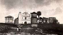
Human settlement on the present site of Guatemala City began with the Maya who built a city at Kaminaljuyu. The Spanish colonists established a small town, which was made a capital city in 1775. At this period the Central Square with the Cathedral and Royal Palace were constructed. After Central American independence from Spain the city became the capital of the United Provinces of Central America in 1821.
The 19th century saw the construction of the monumental Carrera Theater in the 1850s, and the Presidential Palace in the 1890s. At this time the city was expanding around the 30 de junio Boulevard and elsewhere, displacing native settlements from the ancient site. Earthquakes in 1917–1918 destroyed many historic structures. Under Jorge Ubico in the 1930s a hippodrome and many new public buildings were constructed, although peripheral poor neighborhoods that formed after the 1917–1918 earthquakes continued to lack basic amenities.
During the Guatemalan Civil War, terror attacks beginning with the burning of the Spanish Embassy in 1980 led to severe destruction and loss of life in the city. In May 2010 two disasters struck: the eruption of the Pacaya volcano, and two days later Tropical Storm Agatha.
Contemporary history

Guatemala City serves as the economic, governmental, and cultural epicenter of the nation of Guatemala. The city also functions as Guatemala's main transportation hub, hosting an international airport, La Aurora International Airport, and serving as the origination or end points for most of Guatemala's major highways. The city, with its robust economy, attracts hundreds of thousands of rural migrants from Guatemala's interior hinterlands and serves as the main entry point for most foreign immigrants seeking to settle in Guatemala.
In addition to a wide variety of restaurants, hotels, shops, and a modern BRT transport system (Transmetro), the city is home to many art galleries, theaters, sports venues and museums (including some fine collections of Pre-Columbian art) and provides a growing number of cultural offerings. Guatemala City not only possesses a history and culture unique to the Central American region, it also furnishes all the modern amenities of a world class city, ranging from an IMAX Theater to the Ícaro film festival (Festival Ícaro), where independent films produced in Guatemala and Central America are debuted.
Structure and growth
Guatemala City is located in the mountainous highlands of the country, between the Pacific coastal plain to the south and the northern lowlands of the Peten region.
The city's metropolitan area has recently grown very rapidly and has absorbed most of the neighboring municipalities of Villa Nueva, San Miguel Petapa, Mixco, San Juan Sacatepequez, San José Pinula, Santa Catarina Pinula, Fraijanes, San Pedro Ayampuc, Amatitlán, Villa Canales, Palencia and Chinautla forming what is now known as the Guatemala City Metropolitan Area.
The city is subdivided into 22 zones ("Zonas") designed by the urban engineering of Raúl Aguilar Batres, each one with its own streets ("Calles"). avenues ("Avenidas") and sometimes "Diagonal" Streets, making it pretty easy to find addresses in the city. Zones are numbered 1-25 with Zones 20, 22 and 23 not existing as they would have fallen in two other municipalities' territory.[6] Addresses are assigned according to the street or avenue number, followed by a dash and the number of metres it is away from the intersection.[7]
For example, the INGUAT Office on "7a Av. 1-17, Zona 4" is a building which is located on Avenida 7, 17 meters away from the intersection with Calle 1, toward Calle 2 in zone 4.
7a Av. 1-17, Zona 4; and 7a Av. 1-17, Zona 10, are two radically different addresses.
Short streets/avenues do not get new sequenced number, for example, 6A Calle is a short street between 6a and 7a.
Some "avenidas" or "Calles" have a name in addition to their number, if it is very wide, for example Avenida la Reforma is an avenue which separates Zone 9 and 10 and Calle Montúfar is Calle 12 in Zone 9.
Calle 1 Avenida 1 Zona 1 is the center of every city in Guatemala.
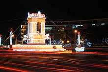
Zone One is the Historic Center, (Centro Histórico), lying in the very heart of the city, the location of many important historic buildings including the Palacio Nacional de la Cultura (National Palace of Culture), the Metropolitan Cathedral, the National Congress, the Casa Presidencial (Presidential House), the National Library and Plaza de la Constitución (Constitution Plaza, old Central Park). Efforts to revitalize this important part of the city have been undertaken by the municipal government.
Besides the parks, the city offers a portfolio of entertainment in the region, focused on the so-called Zona Viva and the Calzada Roosevelt as well as four degrees North. Casino activity is considerable, with several located in different parts of the Zona Viva. The area around the East market is being redeveloped.
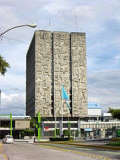
Within the financial district are the tallest buildings in the country including: Club Premier, Tinttorento, Atlantis building, Atrium, Tikal Futura, Building of Finances, Towers Building Batteries, Torres Botticelli, Tadeus, building of the INTECAP, Royal Towers, Towers Geminis, Industrial Bank towers, Holiday Inn Hotel, Premier of the Americas, among many others to be used for offices, apartments etc. Also included are projects such as Zona Pradera and Interamerica's World Financial Center.
One of the most outstanding mayors was the engineer Martin Prado Vélez, who took over in 1949, and ruled the city during the reformist Presidents Juan José Arévalo and Jacobo Arbenz Guzman, although he was not a member of the ruling party at the time and was elected due his well-known capabilities. Of cobanero origin, married with Marta Cobos, he studied at the University of San Carlos; under his tenure, among other modernist works of the city, infrastructure projects included El Incienso bridge, the construction of the Roosevelt Avenue, the main road axis from East to West of the city, the town hall building, and numerous road works which meant the widening of the colonial city, its order in the cardinal points and the generation of a ring road with the first cloverleaf interchange in the city.[8]
In an attempt to control the rapid growth of the city, the municipal government (Municipalidad de Guatemala) headed by longtime Mayor Álvaro Arzú, has implemented a plan to focus growth along important arterial roads and apply Transit-oriented development (TOD) characteristics. This plan denominated POT (Plan de Ordenamiento Territorial) aims to allow taller building structures of mixed uses to be built next to large arterial roads and gradually decline in height and density moving away from such. It is also worth mentioning, that due to the airport being in the south of the city, height limits based on aeronautical considerations have been applied to the construction code. This limits the maximum height for a building, at 60 metres (200 feet) in Zone 10, up to 95 metres (312 feet) in Zone 1.[6]
Climate
Despite its location in the tropics, Guatemala City's relatively high altitude moderates average temperatures. The city has a tropical savanna climate (Köppen Aw) bordering on a subtropical highland climate (Cwb). Guatemala City is generally very warm, almost springlike, throughout the course of the year. It occasionally gets hot during the dry season, but not as hot and humid as in Central American cities at sea level. The hottest month is April. The rainy season extends from May to October, coinciding with the tropical storm and hurricane season in the western Atlantic Ocean and Caribbean Sea, while the dry season extends from November to April. The city can at times be windy, which also leads to lower ambient temperatures.
The average annual temperature ranges from 22 to 28 °C (71.6 to 82.4 °F) during the day, and 12 to 17 °C (53.6 to 62.6 °F) at night.
Average morning relative humidity: 82%, evening relative humidity: 58%. Average dew point is 16 °C (61 °F).[9]
| Climate data for Guatemala City (1990-2011) | |||||||||||||
|---|---|---|---|---|---|---|---|---|---|---|---|---|---|
| Month | Jan | Feb | Mar | Apr | May | Jun | Jul | Aug | Sep | Oct | Nov | Dec | Year |
| Record high °C (°F) | 30.0 (86.0) |
32.1 (89.8) |
32.0 (89.6) |
33.9 (93.0) |
33.9 (93.0) |
31.2 (88.2) |
29.1 (84.4) |
30.2 (86.4) |
29.8 (85.6) |
28.6 (83.5) |
29.9 (85.8) |
28.8 (83.8) |
33.9 (93.0) |
| Average high °C (°F) | 24.3 (75.7) |
25.8 (78.4) |
26.8 (80.2) |
27.8 (82.0) |
27.1 (80.8) |
25.8 (78.4) |
25.4 (77.7) |
25.5 (77.9) |
25.1 (77.2) |
24.7 (76.5) |
24.2 (75.6) |
23.9 (75.0) |
25.5 (77.9) |
| Daily mean °C (°F) | 18.7 (65.7) |
19.7 (67.5) |
20.7 (69.3) |
21.9 (71.4) |
21.9 (71.4) |
21.3 (70.3) |
20.8 (69.4) |
21.0 (69.8) |
20.7 (69.3) |
20.3 (68.5) |
19.4 (66.9) |
18.8 (65.8) |
20.4 (68.7) |
| Average low °C (°F) | 13.2 (55.8) |
13.6 (56.5) |
14.6 (58.3) |
16.0 (60.8) |
16.8 (62.2) |
16.8 (62.2) |
16.3 (61.3) |
16.5 (61.7) |
16.4 (61.5) |
16.0 (60.8) |
14.7 (58.5) |
13.7 (56.7) |
15.4 (59.7) |
| Record low °C (°F) | 6.0 (42.8) |
7.8 (46.0) |
8.4 (47.1) |
8.6 (47.5) |
12.3 (54.1) |
11.2 (52.2) |
12.1 (53.8) |
13.5 (56.3) |
13.0 (55.4) |
11.4 (52.5) |
9.4 (48.9) |
7.6 (45.7) |
6.0 (42.8) |
| Average rainfall mm (inches) | 2.8 (0.11) |
5.4 (0.21) |
6.0 (0.24) |
31.0 (1.22) |
128.9 (5.07) |
271.8 (10.70) |
202.6 (7.98) |
202.7 (7.98) |
236.6 (9.31) |
131.6 (5.18) |
48.8 (1.92) |
6.6 (0.26) |
1,274.8 (50.18) |
| Average rainy days | 1.68 | 1.45 | 2.00 | 4.73 | 12.36 | 21.14 | 18.59 | 19.04 | 20.82 | 14.59 | 6.18 | 2.64 | 125.22 |
| Average relative humidity (%) | 74.3 | 73.4 | 73.2 | 74.3 | 77.3 | 82.4 | 80.8 | 80.9 | 84.5 | 82.0 | 79.2 | 76.0 | 77.8 |
| Mean monthly sunshine hours | 248.4 | 236.2 | 245.6 | 237.9 | 184.4 | 155.3 | 183.4 | 191.8 | 159.0 | 178.0 | 211.7 | 209.2 | 2,440.9 |
| Source: Instituto Nacional de Sismologia, Vulcanologia, Meteorologia, e Hidrologia[10] | |||||||||||||
Volcanic activity
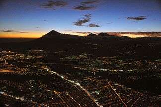
Four stratovolcanoes are visible from the city, two of them active. The nearest and most active is Pacaya, which at times erupts a considerable amount of ash.[11] These volcanoes lie to the south of the Valle de la Ermita, providing a natural barrier between Guatemala City and the Pacific lowlands that define the southern regions of Guatemala. Agua, Fuego, Pacaya and Acatenango comprise a line of 33 stratovolcanoes that stretches across the breadth of Guatemala, from the Salvadorian border to the Mexican border.
Earthquakes
Lying on the Ring of Fire, the Guatemalan highlands and the Valle de la Ermita are frequently shaken by large earthquakes. The last large tremor to hit the Guatemala City region occurred in the 1976, on the Motagua Fault, a left-lateral strike-slip fault that forms the boundary between the Caribbean Plate and the North American Plate. The 1976 event registered 7.5 on the moment magnitude scale. Smaller, less severe tremors are frequently felt in Guatemala City and environs.
Mudslides
Torrential downpours, similar to the more famous monsoons, occur frequently in the Valle de la Ermita during the rainy season, leading to flash floods that sometimes inundate the city. Due to these heavy rainfalls, some of the slums perched on the steep edges of the canyons that criss-cross the Valle de la Ermita are washed away and buried under mudslides, as in October 2005.[12] Tropical waves, tropical storms and hurricanes sometimes strike the Guatemalan highlands, which also bring torrential rains to the Guatemala City region and trigger these deadly mudslides.
Piping pseudokarst
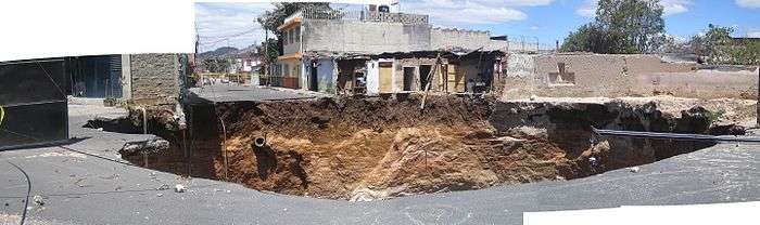
In February 2007, a very large, deep circular hole with vertical walls opened in northeastern Guatemala City (14°39′1.40″N 90°29′25″W), killing five people. This sinkhole, which is classified by geologists as either a "piping feature" or "piping pseudokarst", was 100 metres (330 ft) deep, and apparently was created by fluid from a sewer eroding the loose volcanic ash, limestone, and other pyroclastic deposits that underlie Guatemala City.[13][14] As a result, one thousand people were evacuated from the area.[15] This piping feature has since been mitigated by City Hall by providing proper maintenance to the sewerage collection system[1] and plans to develop the site have been proposed. However, critics believe municipal authorities have neglected needed maintenance on the city's aging sewerage system, and have speculated that more dangerous piping features are likely to develop unless action is taken.[16]
3 years later the 2010 Guatemala City sinkhole arose.
Demographics
.jpg)
It is estimated that the population of Guatemala City proper is about 1 million,[17][18] while its urban area is almost 3 million.[19] The growth of the city's population has been robust since then, abetted by the mass migration of Guatemalans from the rural hinterlands to the largest and most vibrant regional economy in Guatemala.[20] The inhabitants of Guatemala City are incredibly diverse given the size of the city, with those of Spanish and Mestizo descent being the most numerous.[20] Guatemala City also has sizable indigenous populations, divided among the 23 distinct Mayan groups present in Guatemala. The numerous Mayan languages are now spoken in certain quarters of Guatemala City, making the city a linguistically rich area. Foreigners and foreign immigrants comprise the final distinct group of Guatemala City inhabitants, representing a very small minority among the city's citizens.[20]
Due to mass migration from impoverished rural districts wracked with political instability, Guatemala City's population has exploded since the 1970s, severely straining the existing bureaucratic and physical infrastructure of the city. As a result, chronic traffic congestion, shortages of safe potable water in some areas of the city, and a sudden and prolonged surge in crime have become perennial problems. The infrastructure, although continuing to grow and improve in some areas,[21] it is lagging in relation to the increasing population of those less fortunate.[22] Guatemala City is not unique in facing and tackling problems all too common among rapidly expanding cities around the world.
Communications
Guatemala City is headquarters to many communications and telecom companies, among them Tigo, Claro-Telgua, and Movistar-Telefónica. These companies also offer cable television, internet services and telephone access. Due to Guatemala City's large and concentrated consumer base in comparison to the rest of the country, these telecom and communications companies provide most of their services and offerings within the confines of the city. There are also seven local television channels, in addition to numerous international channels. The international channels range from children's programming, like Nickelodeon and the Disney Channel, to more adult offerings, such as E! and HBO. While international programming is dominated by entertainment from the United States, domestic programming is dominated by shows from Mexico. Due to its small and relatively income-restricted domestic market, Guatemala City produces very little in the way of its own programming outside of local news and sports.
Economy and Finance
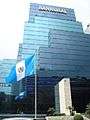
Guatemala City, as the capital, is home to Guatemala's central bank, from which Guatemala's monetary and fiscal policies are formulated and promulgated. Guatemala City is also headquarters to numerous regional private banks, among them CitiBank, Banco Agromercantil, Banco Promerica, Banco Industrial, Banco GyT Continental, Banco de Antigua, Banco Reformador, Banrural, Grupo Financiero de Occidente, BAC Credomatic, and Banco Internacional. By far the richest and most powerful regional economy within Guatemala, Guatemala City is the largest market for goods and services, which provides the greatest number of investment opportunities for public and private investors in all of Guatemala. Financing for these investments is provided by the regional private banks, as well as by foreign direct and capital investment, mostly from the United States. Guatemala City's ample consumer base and sophisticated service sector is represented by the large department store chains present in the city, among them Siman, Hiper Paiz & Paiz (Walmart), Price Smart, ClubCo, Cemaco, Sears and Office Depot.
 Banrural Bank.
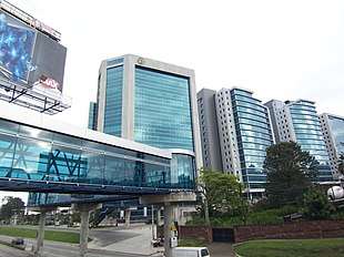 Pradera Zone.
 Agromercantil Bank.
 G&T Continental Bank.
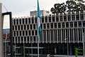 CHN Bank.
Places of interest by zones
Guatemala City is divided into 22 zones in accordance with the urban layout plan designed by Raúl Aguilar Batres. Each zone has its own streets and avenues, facilitating navigation within the city. Zones are numbered 1 through 25. However, numbers 20, 22 and 23 have not been designated to zones, thus these zones do not exist within the city proper.[6]
| Zone | Main places | Pictures |
|---|---|---|
| Zone 1 |
|
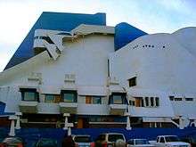 Guatemala National Theater. |
| Zone 2 |
|
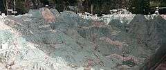 Relief Map of Guatemala. |
| Zone 3 | ||
| Zone 4 |
|
|
| Zone 5 |
|
|
| Zone 6 | ||
| Zone 7 |
|
|
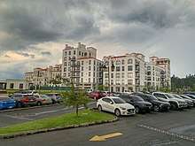
| Zone 9 |
|
|
| Zone 10 |
|
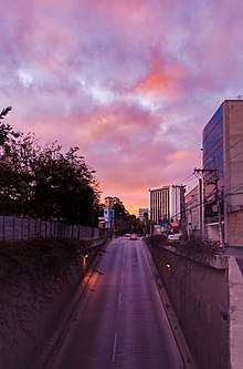 Sunrise on Diagonal 6. |
| Zone 11 |
|
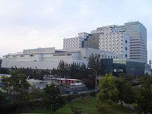 Hotel Tikal Futura, zone 11. |
| Zone 12 |
|
 University of San Carlos Central Campus. |
| Zone 13 |
|
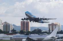
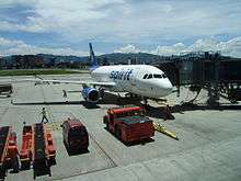 La Aurora International Airport |
| Zone 14 |
|
|
| Zone 15 |
|
 Latter Day Saints Guatemala City Temple |
| Zone 16 |
|
 Universidad Rafael Landívar |
Transportation
- Renovated and expanded, La Aurora International Airport lies to the south of the city center. La Aurora serves as Guatemala's principal air hub.
- Public transport is provided by buses and supplemented by a BRT system. The three main highways that bisect and serve Guatemala start in the city. (CA9 Transoceanic Highway - Puerto San Jose to Puerto Santo Tomas de Castilla-, CA1 Panamerican Highway - from the Mexican border to Salvadorian border - and to Peten.) Construction of freeways and underpasses by the municipal government, the implementation of reversible lanes during peak rush-hour traffic, as well as the establishment of the Department of Metropolitan Transit Police (PMT), has helped improve traffic flow in the city. Despite these municipal efforts, the Guatemala City metropolitan area still faces growing traffic congestion.
- A BRT (Bus Rapid Transit) system called Transmetro, consisting of special-purpose lanes for high-capacity buses, began operating in 2007, and aimed to improve traffic flow in the city through the implementation of an efficient mass transit system. The system consists of five lines. It is expected to be expanded around 10 lines, with some over-capacity expected lines being considered for Light Metro or Heavy Metro.
Traditional buses are now required to discharge passengers at transfer stations at the city's edge to board the Transmetro. This is being implemented as new Transmetro lines become established. In conjunction with the new mass transit implementation in the city, there is also a prepaid bus card system called Transurbano that is being implemented in the metro area to limit cash handling for the transportation system. A new fleet of buses tailored for this system has been purchased from a Brazilian firm.
A light rail line known as Metro Riel is proposed.
Universities and schools
Guatemala City is home to ten universities, among them the oldest institution of higher education in Central America, the University of San Carlos of Guatemala. Founded in 1676, the Universidad de San Carlos is older than all North American universities except for Harvard University.
The other nine institutions of higher education to be found in Guatemala City include the Universidad Mariano Gálvez, the Universidad Panamericana, the Universidad Mesoamericana, the Universidad Rafael Landivar, the Universidad Francisco Marroquín, the Universidad del Valle, the Universidad del Istmo, Universidad Galileo, Universidad da Vinci and the Universidad Rural. Whereas these nine named universities are private, the Universidad de San Carlos remains the only public institution of higher learning.
Sports
Guatemala City possesses several sportsgrounds and is home to many sports clubs. Football is the most popular sport, with CSD Municipal, Aurora FC and Comunicaciones being the main clubs. The Estadio Mateo Flores, located in the Zone 5 of the city, is the largest stadium in the country, followed in capacity by the Estadio Cementos Progreso, Estadio del Ejército & Estadio El Trébol. An important multi-functional hall is the Domo Polideportivo de la CDAG.
The city has hosted several promotional functions and some international sports events: in 1950 it hosted the VI Central American and Caribbean Games, and in 2000 the FIFA Futsal World Championship. On July 4, 2007 the International Olympic Committee gathered in Guatemala City and voted Sochi to become the host for the 2014 Winter Olympics and Paralympics.[28] In April 2010, it hosted the XIVth Pan-American Mountain Bike Championships.[29]
Guatemala City hosted the 2008 edition of the CONCACAF Futsal Championship, played at the Domo Polideportivo from June 2 to June 8, 2008.[30]
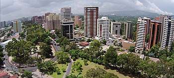
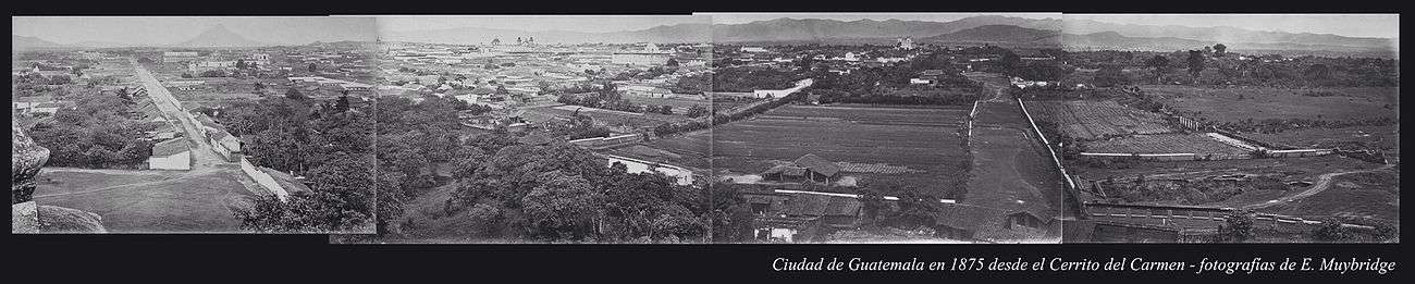
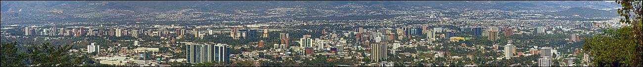
Panoramic views of Guatemala City
1875
2008

International relations
International organizations with headquarters in Guatemala City
Twin towns — sister cities
Guatemala City is twinned with:
| City | Jurisdiction | Country | Year |
|---|---|---|---|
| Caracas | Capital District | 1969 | |
| San Salvador | San Salvador | 1979 | |
| Madrid | Madrid | 1983[31] | |
| Lima | Lima | 1987 | |
| Santiago de Chile | Metropolitan Santiago | 1991 | |
| Saltillo | Coahuila | 1993 | |
| La Habana | La Habana | 1997 | |
| Bogotá | Distrito Capital | 1997 | |
| San Pedro Sula | Cortés | 1999 | |
| Santa Cruz de Tenerife | Santa Cruz de Tenerife | 2002 | |
| San José | San José | 2005 | |
| Ciudad de Panamá | Panamá | 2005 | |
| Taipei | Northern Taiwan | 2007[32] | |
| Managua | Managua | 2008 | |
| Beijing | Beijing | 2009 | |
| Providence | Rhode Island | 2016[33] | |
Notable residents
- Raúl Aguilar Batres, engineer, creator of Guatemala City's system of avenue/street notation
- María Dolores Bedoya, Central American independence activist[34]
- Alejandro Giammattei, President of Guatemala
- Miguel Ángel Asturias, writer and diplomat, Nobel Prize Laureate
- Ricardo Arjona, singer /songwriter
- Manuel Colom Argueta, former mayor of Guatemala City and politician
- Toti Fernández, triathlete and ultramarathon runner
- Juan José Gutiérrez, CEO of Pollo Campero and on the board of directors of Corporación Multi Inversiones. Has been featured on the cover of Newsweek as Super CEO and named one of the Ten Big Thinkers for Big Business.[35]
- Ted Hendricks, Oakland Raiders NFL Hall Of Fame Linebacker. 5-time Super Bowl Champion
- Jorge de León, performance artist[36]
- Carlos Mérida, painter
- Jimmy Morales, Former President of Guatemala
- Gaby Moreno, singer/ songwriter
- Carlos Peña, singer, winner of Latin American Idol 2007
- Georgina Pontaza, actress and artistic director of the Teatro Abril and Teatro Fantasía
- Fernando Quevedo, theoretical physicist, professor of High Energy Physics at the University of Cambridge
- Rodolfo Robles, physician, discovered onchocercosis "Robles' Disease"
- Fabiola Rodas, winner of The Third TV Azteca's Desafio de Estrellas 2nd Place in The Last Generation of La Academia
- Carlos Ruíz, football/soccer player
- Shery, singer / songwriter
- Jaime Viñals, mountaineer (scaled seven highest peaks in the world)
- Luis von Ahn, computer scientist, CAPTCHA's creator and Researcher at Carnegie Mellon University
- Rodrigo Saravia, Guatemala national team footballer
See also
- 2007 Guatemala earthquake
- La Aurora International Airport
- List of places in Guatemala
Notes and references
References
- Municipalidad de Guatemala 2014.
- "United Nations "Map"" (PDF).
- Citypopulation.de Population of major cities in Guatemala
- Culture Trip 8 Surprising Facts You Never Knew About Guatemala City
- "Carlos Enrique Valladares Cerezo, "The case of Guatemala City, Guatemala"" (PDF).
- Municipalidad de Guatemala 2008.
- "City Layout in Guatemala City".
- Morán Mérida 1994, p. 9.
- "Guatemala City, Guatemala Travel Weather Averages (Weatherbase)". Weatherbase.
- "Ministerio de comunicaciones Infraestructura y Vivienda". Archived from the original on 4 June 2012. Retrieved 25 December 2012.
- "MTU-VP Pacaya Volcano, Guatemala". Geo.mtu.edu. 1995-06-01. Retrieved 2009-07-08.
- Carlos, Juan (2005-10-07). "Mudslide in Guatemala kills dozens | The San Diego Union-Tribune". Signonsandiego.com. Retrieved 2009-07-08.
- Waltham 2008, p. 291-300.
- Halliday 2007, p. 103-113.
- David L Miller (2009-07-04). "Massive Guatemala Sinkhole Kills 2 Teens". CBS News. Retrieved 2009-07-08.
- Constantino Diaz-Duran (2010-06-01). "Sinkhole in Guatemala City Might Not Be the Last". The Daily Beast. Retrieved 2010-06-03.
- "Guatemala: Estimaciones de la Población total por municipio. Período 2008-2020" [Guatemala: Estimates of the total population by municipality. 2008-2020 period.] (PDF). Organismo Judicial República de Guatemala. Archived (PDF) from the original on 23 July 2018. Retrieved 14 September 2018.
- "Productividad y eficiencia: La Municipalidad incorpora tecnología para atender al vecino" [Productivity and efficiency: The municipality incorporates technology to service the neighbor]. Muniguate. 21 Oct 2018. Archived from the original on 15 September 2018. Retrieved 15 September 2018.
- "CIA World Factbook, Guatemala". July 2011. Retrieved 22 December 2011.
- INE 2013, p. 13.
- Morán Mérida 1994, p. 14.
- Morán Mérida 1994, p. 14-17.
- FUNTEC n.d.
- Museo Ixchel 2008.
- Nature Reserse 2005.
- De Guate n.d.
- Zoológico La Aurora n.d.
- rga-online, Remscheid, Germany. "Topnews - Sport - Remscheid: Remscheider General-Anzeiger / rga-online ...weil wir hier zu Hause sind!". Rga-online.de. Archived from the original on 2010-06-05. Retrieved 2009-07-08.CS1 maint: multiple names: authors list (link)
- http://www.guatepanamericanomtb2010.com/ Archived 2010-03-13 at the Wayback Machine XIVth Pan-American Mountain Bike Championships
- "Futsal Championship 2008 Recap". CONCACAF.
- "Mapa Mundi de las ciudades hermanadas". Ayuntamiento de Madrid. Archived from the original on 2008-10-04. Retrieved 2009-07-25.
- "Taipei - International Sister Cities". Taipei City Council. Archived from the original on 2012-11-02. Retrieved 2013-08-23.
- "Guatemala City now sister city with Rhode Island's capital". AP NEWS. 2016-10-12. Retrieved 2019-08-18.
- AGN. "María Dolores, la única mujer que participó en la independencia de Guatemala | Agencia Guatemalteca de Noticias" (in Spanish). Retrieved 2020-01-02.
- Newsweek 2005, p. 4.
- Estey, Myles. "A generation of young artists is gaining recognition for their gritty depictions of the modern realities of the Central American nation." Archived 2013-01-02 at Archive.today Global Post. 15 Aug 2011. Retrieved 11 Feb 2012.
Bibliography
- Almengor, Oscar Guillermo (1994). "La Nueva Guatemala de la Asunción y los terremotos de 1917-18". Ciudad de Guatemala (in Spanish). Guatemala: Centro de estudios urbanos y regionales-USAC.CS1 maint: ref=harv (link)
- Assardo, Luis (2010). "Llueve ceniza y piedras del Volcán de Pacaya". El Periódico. Guatemala. Archived from the original on 4 July 2014. Retrieved 28 May 2010.CS1 maint: ref=harv (link)
- Baily, John (1850). Central America; Describing Each of the States of Guatemala, Honduras, Salvador, Nicaragua, and Costa Rica. London: Trelawney Saunders. p. 72.CS1 maint: ref=harv (link)
- Barrios Vital, Jenny Ivette (2006). "Restauración y revitalización del complejo arquitectónico de la Recolección" (PDF) (in Spanish). Guatemala: University of San Carlos of Guatemala thesis. Retrieved 2 September 2013. Cite journal requires
|journal=(help)CS1 maint: ref=harv (link) - Bascome Jones, J.; Scoullar, William T.; Soto Hall, Máximo (1915). El Libro azul de Guatemala (in Spanish). Searcy & Pfaff.
relato é historia sobre la vida de las personas más prominentes; historia condensada de la república; artículos especiales sobre el comercio, agricultura y riqueza mineral, basado sobre las estadísticas oficiales
CS1 maint: ref=harv (link) - Comisión para el Esclarecimiento Histórico: Vol. IV,2 (1999). "Atentados contra la libertad". Programa de Ciencia y Derechos Humanos, Asociación Americana del Avance de la Ciencia (in Spanish). Guatemala: memoria del silencio. Archived from the original (Online edition) on 22 May 2011. Retrieved 20 September 2014.CS1 maint: ref=harv (link)
- Comisión para el Esclarecimiento Histórico: Vol. IV (1999). "Atentados contra sedes municipales". Programa de Ciencia y Derechos Humanos, Asociación Americana del Avance de la Ciencia (in Spanish). Guatemala: memoria del silencio. Archived from the original (Online edition) on 6 May 2013. Retrieved 20 September 2014.CS1 maint: ref=harv (link)
- Conkling, Alfred R. (1884). Appleton's guide to Mexico, including a chapter on Guatemala, and a complete English-Spanish vocabulary. Nueva York: D. Appleton and Company.CS1 maint: ref=harv (link)
- Dary Fuentes, Claudia (1994). "Una ciudad que empezaba a crecer". Revista Crónica, suplemento Revolución (in Spanish). Guatemala: Editorial Anahté.CS1 maint: ref=harv (link)
- Diario de Navarra (2010). "El volcán Pacaya continúa activo y obliga a seguir con evacuaciones". Diario de Navarra (in Spanish). Archived from the original on 31 July 2014. Retrieved 5 June 2010.CS1 maint: ref=harv (link)
- El País (2010). "Socavón causado por la tormenta Agatha". El País (in Spanish). Madrid, Spain. Archived from the original on 18 February 2012.CS1 maint: ref=harv (link)
- El Periódico (31 January 2012). "Quema de embajada española". elPeriódico (in Spanish). Archived from the original on 30 October 2013. Retrieved 8 October 2013.CS1 maint: ref=harv (link)
- Figueroa, Luis (2011). "Bombazo en el Palacio Nacional". Luis Figueroa Blog (in Spanish). Archived from the original on 26 June 2014. Retrieved 25 October 2014.CS1 maint: ref=harv (link)
- Funtec (n.d.). "Mapa en Relieve de Guatemala". Funtec-Guatemala (in Spanish). Guatemala. Archived from the original on 9 February 2008. Retrieved 25 July 2009.CS1 maint: ref=harv (link)
- González Davison, Fernando (2008). La montaña infinita;Carrera, caudillo de Guatemala (in Spanish). Guatemala: Artemis y Edinter. ISBN 84-89452-81-4.CS1 maint: ref=harv (link)
- Guateantaño (17 October 2011). "Parques y plazas antiguas de Guatemala". Guatepalabras Blogspot. Guatemala. Archived from the original on 27 January 2015.CS1 maint: ref=harv (link)
- Halliday, W.R. (2007). "Pseudokarst in the 21st century". Journal of Cave and Karst Studies. 69 (1): 103–113.CS1 maint: ref=harv (link)
- Ine (2013). "Caracterización Departamental, Guatemala 2012" (PDF). Instituto Nacional de Estadística (in Spanish). Guatemala: Gobierno de Guatemala. Archived from the original (PDF) on 25 June 2014.CS1 maint: ref=harv (link)
- Hernández de León, Federico (1959). "El capítulo de las efemérides". Diario La Hora (in Spanish). Guatemala.CS1 maint: ref=harv (link)
- Hernández de León, Federico (1930). El libro de las efemérides (in Spanish). Tomo III. Guatemala: Tipografía Sánchez y de Guise.CS1 maint: ref=harv (link)
- La Hora (2013). "Una crónica impactante en el aniversario de la quema de la Embajada de España tras 33 años de impunidad". Diario La Hora (in Spanish). Archived from the original on 7 December 2013. Retrieved 8 October 2013.CS1 maint: ref=harv (link)
- La otra memoria histórica (5 December 2011). "Guatemala, viudas y huérfanos que dejó el comunismo". La otra memoria histórica (in Spanish). Guatemala. Archived from the original on 7 December 2013. Retrieved 10 October 2013.CS1 maint: ref=harv (link)
- Milla y Vidaurre, José (1980). Cuadros de Costumbres. Textos Modernos (in Spanish). Guatemala: Escolar Piedra Santa.CS1 maint: ref=harv (link)
- Moncada Maya, José Omar (n.d.). "En torno a la destrucción de la ciudad de Guatemala, 1773. Una carta del ingeniero militar Antonio Marín". Ub.es (in Spanish). Retrieved 8 July 2009.CS1 maint: ref=harv (link)
- Morán Mérida, Amanda (1994). "Movimientos de pobladores en la Ciudad de Guatemala (1944-1954)" (PDF). Boletín del CEUR-USAC (in Spanish). Guatemala: Centro de estudios urbanos y regionales-USAC (23). Archived from the original (PDF) on 18 October 2014. Retrieved 27 September 2014.CS1 maint: ref=harv (link)
- Mundo Chapín (2013). "La Aurora y el Hipódromo del Sur". Mundo Chapín. Guatemala. Archived from the original on 30 March 2014. Retrieved 23 September 2014.CS1 maint: ref=harv (link)
- Municipalidad de Guatemala (August 2008). "Paso a desnivel de Tecún Umán". Segmento cultural de la Municipalidad de Guatemala (in Spanish). Archived from the original on 24 February 2011. Retrieved 27 September 2014.CS1 maint: ref=harv (link)
- Municipalidad de Guatemala (2014). "Mi barrio querido, Ciudad de Guatemala" (in Spanish). Guatemala City. Archived from the original on 2008-08-28. Retrieved 2015-07-15.CS1 maint: ref=harv (link)
- Municipalidad de Guatemala (2007). "Conmemoración de los doscientos treinta años de fundación de la Ciudad de Guatemala". Boletín de la Municipalidad de Guatemala. Archived from the original on 20 March 2013. Retrieved 18 August 2009.CS1 maint: ref=harv (link)
- Municipalidad de Guatemala (2008). "Plan de Ordenamiento Territorial, Ciudad de Guatemala" (in Spanish). Archived from the original on 18 September 2009.CS1 maint: ref=harv (link)
- Museo Ixchel (2008). "Museo Ixchel". Museo Ixchel del traje indígena (in Spanish). Archived from the original on 2 February 2008. Retrieved 25 July 2009.CS1 maint: ref=harv (link)
- Natural Reserve (2005). "Jardin Botanico". Natureserve.org (in Spanish). Archived from the original on 24 May 2013. Retrieved 25 July 2009.CS1 maint: ref=harv (link)
- Newskeek (2005). "10 Big Thinkers for Big Business - The Daily Beast". Newsweek.com. Retrieved 15 September 2011.CS1 maint: ref=harv (link)
- Population data (2012). "Guatemala population". Population data. Archived from the original on 26 December 2013. Retrieved 12 December 2012.CS1 maint: ref=harv (link)
- Prensa Libre (6 September 1980). "Avalancha terrorista en contra de la manifestación de mañana; poder público y transporte extraurbano blancos de ataque". Prensa Libre (in Spanish). Guatemala.CS1 maint: ref=harv (link)
- Reilly, Michael (2 June 2010). "Don't Call the Guatemala Sinkhole a Sinkhole". Discovery News. Retrieved 9 June 2010.CS1 maint: ref=harv (link)
- Sharer, Robert J.; Traxler, Loa P. (2006). The Ancient Maya (6th (fully revised) ed.). Stanford, CA: Stanford University Press. ISBN 0-8047-4817-9. OCLC 57577446.CS1 maint: ref=harv (link)
- Sydney Morning Herald (2010). "Hole that swallowed a three-story building". Sydney Morning Herald. Archived from the original on 3 July 2014.CS1 maint: ref=harv (link)
- Walker, Peter (2010). "Tropical Storm Agatha blows a hole in Guatemala City". The Guardian. London, UK. Archived from the original on 19 March 2013.CS1 maint: ref=harv (link)
- Waltham, T. (2008). "Sinkhole hazard case histories in karst terrains". Quarterly Journal of Engineering Geology and Hydrogeology. 41 (3).CS1 maint: ref=harv (link)
- Woodward, Ralph Lee, Jr. (2002). "Rafael Carrera y la creación de la República de Guatemala, 1821–1871". Serie monográfica (in Spanish). CIRMA y Plumsock Mesoamerican Studies (12). ISBN 0-910443-19-X. Archived from the original on 2019-03-01. Retrieved 2015-02-01.CS1 maint: ref=harv (link)
- Woodward, Ralph Lee, Jr. (1993). Rafael Carrera and the Emergence of the Republic of Guatemala, 1821-1871 (Online edition). Athens, Georgia EE.UU.: University of Georgia Press. Retrieved 28 December 2014.CS1 maint: ref=harv (link)
External links


- Official Website of the Municipalidad de Guatemala
Capital: Guatemala City | ||
| Municipalities | 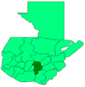 | |
| Authority control |
|
|---|