Guadarrama Pass
The Guadarrama Pass (Spanish: Puerto de Guadarrama), also known as Alto del León, is a mountain pass in Spain. It is located in the Sierra de Guadarrama, part of the Sistema Central system of ranges. Historically it has been an important communication line between Madrid and the North of Spain.[2]
| Guadarrama Pass | |
|---|---|
| Puerto de Guadarrama Alto del León | |
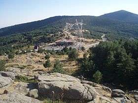 The cross at Guadarrama Pass. | |
| Elevation | 1,115 m (3,658 ft)[1] |
| Location | Segovia Province, Madrid Province |
| Range | Sierra de Guadarrama, Central System |
| Coordinates | 40°42′36″N 4°8′25″W |
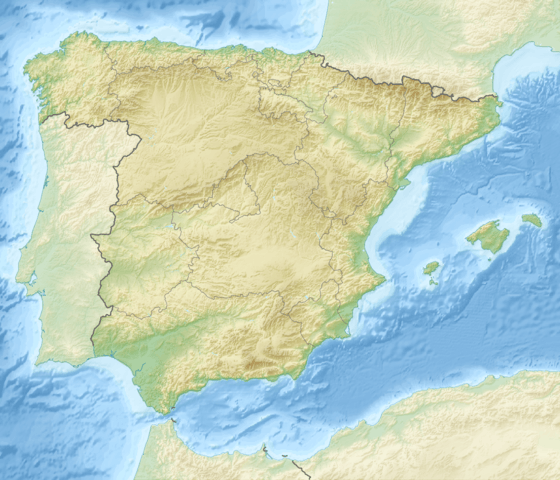 Guadarrama Pass Location of the Guadarrama Pass | |
Geography
This pass is part of San Rafael in El Espinar municipal term, Segovia Province, on its northern side and Guadarrama, Madrid Province, on its southern side. It is located in the southern slopes of the 1,556 m (5,105 ft) high Cerro de la Sevillana, between the 1,824 m (5,984 ft) high Cabeza Líjar and 1,945 m (6,381 ft) high La Peñota peaks.
The Guadarrama Pass is an important communication line between Segovia Province and the Madrid area through the N-VI highway between Madrid and Corunna.
History
There are remains of Spanish Civil War bunkers and trenches in the area of the pass. The rebel faction took the northern side of the range after the Battle of Guadarrama and the Second Division of the Spanish Republican Army operated in the area between December 1936 and March 1939.[3]
See also
- Central System
References
- GoogleEarth
- David Mathieson, Frontline Madrid: Battlefield Tours of the Spanish Civil War.
- Carlos Engel, Historia de las Brigadas Mixtas del E. P. de la República, 1999
External links
