Green River Ferry Road
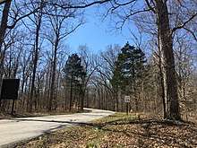
Green River Ferry Road is a park-maintained roadway located inside Mammoth Cave National Park in Edmonson County, Kentucky. The road is 5.63 miles (9.06 km) long. The name of the road was given due to the traversal of the Green River, connecting the Visitor's Center area to the Nolin Lake recreational areas.
| |
|---|---|
| Route information | |
| Maintained by NPS | |
| Length | 5.63 mi[1] (9.06 km) |
| Major junctions | |
| South end | Mammoth Cave Parkway at the Mammoth Cave Campground |
| Maple Springs Loop | |
| North end | |
| Highway system | |
| National Park Service Road | |
Route description
The road begins at an intersection with the Mammoth Cave Parkway just south of the park's visitor center near the campground, and immediately crosses the Mammoth Cave Railroad Bike and Hike Trail, a rail trail which marks the original railroad that went from the park's visitors center to Park City.[2] The road goes to a point along the Green River, and crosses it via the Green River Ferry[3]. That ferry recently became the only operational ferry in all of Edmonson County after the Bear Creek and Houchin's Ferries went out of service in the late 1960s and October 2013, respectively.[4]
After crossing the ferry the road traverses the north-central portions of the park, including passing sites such as the Maple Springs Research Center and the trailheads of the Big Hollow and Maple Springs Trails. The majority of the park's hiking trails are accessed via Green River Ferry and Maple Springs roads.[5][6] Green River Ferry Road ends at the park's northern boundary. Beyond this point, the road becomes Stockholm Road with the state highway designation, Kentucky Route 1352 (KY 1352), which connects the area with KY 1827 at the community of Stockholm.[6][7][8]
Major intersections
The entire route is in Edmonson County.
| Location | mi[1] | km | Destinations | Notes | |
|---|---|---|---|---|---|
| Mammoth Cave | 0.000 | 0.000 | Maintenance Road (to Ranger's Station) | Southern terminus | |
| 0.800 | 1.287 | Joppa Ridge Road west | Old KY 70; one-way road [1] | ||
| Green River | 1.300 | 2.092 | |||
| Mammoth Cave | 3.600 | 5.794 | Maple Springs Loop | Accesses Maple Springs Research Center and Good Spring Church | |
| Stockholm | 5.630 | 9.061 | Ugly Creek Road | Northern terminus at Mammoth Cave NP boundary; continues as KY 1352 | |
| 1.000 mi = 1.609 km; 1.000 km = 0.621 mi | |||||
References
- Kentucky Transportation Cabinet (1987). Edmonson County (PDF) (Map). Retrieved December 13, 2015. Editor's note: Local road list and mileage log included.
- Mammoth Cave National Park. Visitor's Center Area Map (PDF) (Map). National Park Service.
- Green River Ferry
- "Houchin's Ferry". Bridgehunter.com.
- Mayor, Jeffery P (August 14, 2015). "Mammoth Cave filled with geologic wonders". Tacoma, WA: The News Tribune. Retrieved October 4, 2018.
- Mammoth Cave National Park. Park Map (PDF) (Map). National Park Service.
- DeLorme (2010). Kentucky Atlas & Gazetteer (Map) (4th ed.). Yarmouth, ME: DeLorme. p. 65.
- Rand McNally (2016). "Kentucky" (Map). The Road Atlas (2016 Walmart ed.). 1 in≈30 mi. Chicago: Rand McNally. p. 43. Mammoth Cave National Park inset. §§ M20. ISBN 0-528-00626-6.