Great Hucklow
Great Hucklow (Old English Hucca's burial mound)[1] is a small village and civil parish in the Derbyshire Peak District which nestles under Hucklow Edge between the villages of Tideswell and Bradwell. It has a population of about 100, including Foolow , Grindlow plus Little Hucklow and being measured at 427 in the 2011 Census.[2] The area is now mainly agricultural, but the village was formerly a centre of the Derbyshire lead mining industry. The lead vein or rake outcrops to the surface to the west of the village and dives under the rocks of Hucklow Edge on the western side of the village where an adit, known as Milldam Mine, has recently been reopened by Glebe Mines Ltd that connects the various deep mines that had formerly been dug along the edge. This mine is being worked for fluorspar, which is frequently found associated with lead in the vein.
| Great Hucklow | |
|---|---|
 Great Hucklow Butter Cross | |
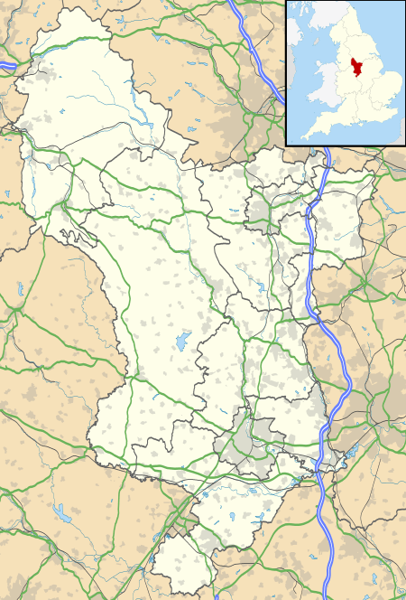 Great Hucklow Location within Derbyshire | |
| Population | 427 (2011) |
| OS grid reference | SK177777 |
| District | |
| Shire county | |
| Region | |
| Country | England |
| Sovereign state | United Kingdom |
| Post town | BUXTON |
| Postcode district | SK17 |
| Dialling code | 01298 |
| Police | Derbyshire |
| Fire | Derbyshire |
| Ambulance | East Midlands |
| UK Parliament | |
In the village, there is a thriving primary school, which is located up a short lane (School Lane), under the edge, and a pub, the Queen Anne.
It had a theatre for 40 years, which was run by L. du Garde Peach and the actors and staff were from the local area. The first production (The Merchant of Venice, Shakespeare) was in 1927 staged in the Hucklow Holiday Homes. The first set of plays in the New Play House was in 1938, with four one act plays written by Peach. The New Play House was in a converted lead mining building (known locally as cupolas from the lead smelting furnace). The first 200-second hand seats cost 1 shilling and 9 pence each. The stage was 28 feet (8.5 m) wide by 30 feet (9.1 m) deep. For many years the theatre brought many visitors to Great Hucklow from all parts of the north of England. The theatre building is still used as an activity centre.
The Unitarian Old Chapel was founded in 1696 and is still in use; it also has a small meeting room which is well used by the community. The Methodist Chapel, built in the early part of the 19th century, was converted to offices in 1999.
The Nightingale Centre, which belongs to the Unitarians, is in the middle of the village and accommodates groups for school and community visits to the area, conferences and provides country holidays for children from inner cities. The Centre brings many visitors to the village from all over the world.
Recently, Great Hucklow has taken control of the Silance Mine Heritage Site, jointly with the village of Foolow. This is a four hectare area of scrub, woodland and grassland on a south facing slope on Hucklow Edge which was the previous location for lead working at both Silence and Old Grove Mine and more recent re-working of the surface mineral heaps for fluorspar. The site straddles the parish boundary between Grindlow to the west and Foolow to the east. It is positioned on the boundary between the White and Dark Peak character areas. The long history of mining has resulted in the development of very complex surface soils with those derived from the shales lying in intimate association with soils developing from limestone and mineral material brought to the surface during the mining operations. Both Silence and Old Grove Mines have been extensively reworked for fluorspar at surface, but at the top end of Silence Mine there are the previously unrecognised remains of steam engine buildings and associated structures. These include the back walls of a horizontal engine house and boiler house, the possible base of a chimney, and a small sunken ‘chamber’ that originally was one half of a wheel pit which contained a large flywheel and/or winding drum associated with the engine house. Hillocks remain in the northern part of Old Grove Mine. The Peak District Mines Historical Society are currently excavating the remains of Silance Mine.
The village is twinned with Parisot, Tarn-et-Garonne which is a rural village of similar size in the south west of France.
The land rises steeply to the north of the village to Hucklow Edge and at Camphill on the plateau above it there is a popular gliding field, operated by the Derbyshire and Lancashire Gliding Club, which in July 1954 hosted the World Gliding Championships. On 9 August 2011 the UK's longest paraglider flight began in the village, ending over 250 km away in Suffolk.
The village is accessed from the B6049 about a mile north of where it crosses the A623 at the Anchor Inn. The road to the village goes off to the east at the Windmill triangle.
The village is host to an annual martial arts residency; this is a tradition dates back almost 30 years.
References
- "Great Hucklow". Key to English Place Names. English Place Name Society. Retrieved 10 May 2012.
- "Civil Parish population 2011". Neighbourhood Statistics. Office for National Statistics. Retrieved 24 March 2016.
External links
| Wikimedia Commons has media related to Great Hucklow. |