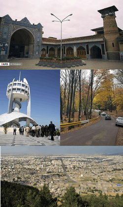
Gorgan
Gorgan (Persian: گرگان [ɡoɾˈɡɒːn] (![]()
Gorgan گرگان Esterabad | |
|---|---|
City | |
 | |
 Gorgan | |
| Coordinates: 36°50′19″N 54°26′05″E | |
| Country | |
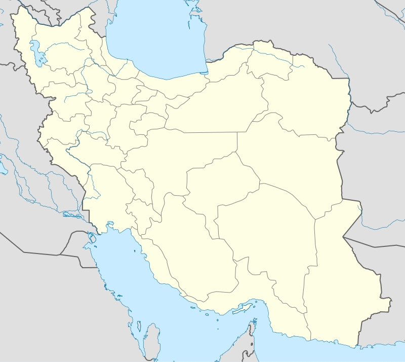
| Province | Golestan |
| County | Gorgan |
| Bakhsh | Central |
| Government | |
| • Mayor | Abdolreza Dadboud[1] |
| • City Council Chairman | Faezeh Abdollahi |
| Area | |
| • City | 1,700 km2 (656 sq mi) |
| Elevation | 155 m (509 ft) |
| Population (2016 Census) | |
| • Urban | 350,676 [2] |
| Time zone | UTC+03:30 (IRST) |
| • Summer (DST) | UTC+04:30 (IDST) |
| Climate | Csa |
| Gorgan at GEOnet Names Server | |
History
There are several archaeological sites near Gorgan, including Tureng Tepe and Shah Tepe, in which there are remains dating from the Neolithic and Chalcolithic eras. Some other important Neolithic sites in the area are Yarim Tepe, and Sange Chaxmaq. Also, the nearby Shahroud Plain has many such sites. The number of confirmed Neolithic sites on the Gorgan Plain now totals more than fifty.[5]
According to the Greek historian Arrian, Zadracarta was the largest city of Hyrcania and site of the "royal palace".[6] The term means "the yellow city", and it was given to it from the great number of oranges, lemons, and other fruit trees which grew in the outskirts of that city.[7]
Hyrcania became part of the Achaemenid Empire during the reign of Cyrus the Great (559–530 BC), its founder, or his successor Cambyses (530-522 BC).
The Great Wall of Gorgan, the second biggest defensive wall in the world, was built in the Parthian and Sassanian periods.
At the time of the Sassanids, "Gurgan" appeared as the name of a city, province capital, and province.[8]
Gorgan maintained its independence as a Zoroastrian state even after Persia was conquered by the Muslim Arabs in the 8th century.
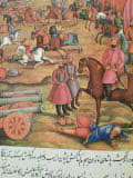
In 1210, the city was invaded and sacked by the army of Kingdom of Georgia under command of the brothers Mkhargrdzeli.[9][10]
"Old Gorgan" was destroyed during the Mongol invasion in the 13th century, and the center of the region was moved to what was called "Astarabad", which is currently called "Gorgan".
Gorgan with its surrounding regions was sometimes considered as part of the Parthia (the Greater Khorasan) or the Tabaristan regions.
Astarabad was an important political and religious city during the Qajar dynasty.
Geography and climate
The wide Dasht-e Gorgan (Plains of Gorgan) are located north of the city and geographically bounded by 37°00' - 37°30' north latitude and 54°00' - 54°30' east longitude, covering an area of about 170 square kilometres (66 sq mi).
Some 150 km (93 mi) east of Gorgan is the Golestan National Park, home to a large portion of the fauna of Iran.
Gorgan has a mediterranean climate (Köppen climate classification: Csa). In general, Golestan has a moderate and humid climate known as "the moderate Caspian climate." The effective factors behind such a climate are: Alborz mountain range, direction of the mountains, height of the area, neighborhood to the sea, vegetation surface, local winds, altitude and weather fronts. As a result of the above factors, three different climates exist in the region: plain moderate, mountainous, and semi-arid. Gorgan valley has a semi-arid climate. The average annual temperature is 17.7 °C (63.9 °F) and the annual rainfall is 601 millimetres (23.7 in).
| Climate data for Gorgan | |||||||||||||
|---|---|---|---|---|---|---|---|---|---|---|---|---|---|
| Month | Jan | Feb | Mar | Apr | May | Jun | Jul | Aug | Sep | Oct | Nov | Dec | Year |
| Record high °C (°F) | 29 (84) |
32.4 (90.3) |
35 (95) |
39 (102) |
43 (109) |
45 (113) |
44 (111) |
44 (111) |
41.6 (106.9) |
39 (102) |
36 (97) |
29.2 (84.6) |
45 (113) |
| Average high °C (°F) | 12.4 (54.3) |
13.1 (55.6) |
15.3 (59.5) |
21.2 (70.2) |
26.9 (80.4) |
30.9 (87.6) |
32.6 (90.7) |
32.7 (90.9) |
29.9 (85.8) |
24.8 (76.6) |
18.8 (65.8) |
14.3 (57.7) |
22.7 (72.9) |
| Daily mean °C (°F) | 7.9 (46.2) |
8.5 (47.3) |
10.7 (51.3) |
16.0 (60.8) |
21.2 (70.2) |
25.4 (77.7) |
27.7 (81.9) |
27.8 (82.0) |
24.8 (76.6) |
19.4 (66.9) |
13.9 (57.0) |
9.8 (49.6) |
17.8 (64.0) |
| Average low °C (°F) | 3.4 (38.1) |
3.8 (38.8) |
6.1 (43.0) |
10.7 (51.3) |
15.5 (59.9) |
19.9 (67.8) |
22.8 (73.0) |
22.9 (73.2) |
19.6 (67.3) |
13.9 (57.0) |
8.9 (48.0) |
5.2 (41.4) |
12.7 (54.9) |
| Record low °C (°F) | −10 (14) |
−6 (21) |
−3.2 (26.2) |
0 (32) |
2.8 (37.0) |
10 (50) |
15 (59) |
13 (55) |
9 (48) |
3 (37) |
−2 (28) |
−7 (19) |
−10 (14) |
| Average precipitation mm (inches) | 55.0 (2.17) |
55.8 (2.20) |
79.4 (3.13) |
52.8 (2.08) |
44.1 (1.74) |
33.4 (1.31) |
22.2 (0.87) |
27.3 (1.07) |
38.9 (1.53) |
66.1 (2.60) |
68.5 (2.70) |
57.5 (2.26) |
601 (23.66) |
| Average precipitation days (≥ 1.0 mm) | 7.4 | 8.0 | 10.5 | 8.0 | 6.1 | 4.2 | 3.7 | 4.2 | 5.2 | 5.7 | 6.7 | 6.8 | 76.5 |
| Average relative humidity (%) | 73 | 73 | 74 | 72 | 67 | 64 | 65 | 68 | 69 | 70 | 73 | 74 | 70 |
| Mean monthly sunshine hours | 135.3 | 128.1 | 132.3 | 164.6 | 207.6 | 220.4 | 221.9 | 220.5 | 196.3 | 196.4 | 151.1 | 132.8 | 2,107.3 |
| Source: Synoptic Stations Statistics | |||||||||||||
Notable people
Historical figures
- House of Karen, an aristocratic feudal family first attested in the Arsacid era, belonged to the region of Hyrcania.
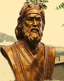
- Fakhroddin Asaad Gorgani, 11th-century Persian poet and the composer of Vis and Ramin.
- Abu Sa'id al-Darir al-Jurjani, 9th century astronomer and mathematician
- Al-Masihi, 10th century physician and teacher of Avicenna
- Abd al-Qāhir al-Jurjānī, 11th century grammarian and literary theorist
- Zayn al-Din al-Jurjani, 12th century royal physician
- Bahram al-Da'i, 12th-century Nizari Ismaili missionary and military leader in Syria
- Fazlallah Astarabadi (Naimi), 14th century mystic and founder of Hurufism
- Rustam Gorgani, 16th century physician
- Mir Fendereski, philosopher, poet and mysti
- Mir Damad, 17th century Islamic scholar and Neoplatonic philosopher
- Mirza Mehdi Khan Astarabadi, 18th century chief minister to Nader Shah
- Bibi Khatoon Astarabadi, a notable writer, satirist, and one of the pioneering figures of the women's movement of Iran
- Firishta, historian
- Sardar Rafie Yanehsari, Governor of Astarabad
Contemporary figures
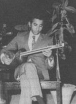
- Mohammad Reza Lotfi, Traditional Persian musician
- Nader Ebrahimi, author, poet, director, and researcher
- Maryam Zandi, photographer
Education
- Golestan University
- Golestan University of Medical Sciences[11]
- Gorgan University of Agricultural Sciences & Natural Resources
- Islamic Azad University of Gorgan
Sports
Shahrdari Gorgan competes in the Iranian Basketball Super League.
Currently the main football team of Gorgan is Etka Gorgan F.C., which competes in the Azadegan League.
Sister cities
See also
- Gorgan International Airport
- al-Jurjani
- Gorgan-rud River
- Gurganj
References
- "شهردار گرگان معرفی شد- اخبار استانها - اخبار تسنیم - Tasnim". خبرگزاری تسنیم - Tasnim.
- "Statistical Center of Iran > Home". www.amar.org.ir.
- Gorgan can be found at GEOnet Names Server, at this link, by opening the Advanced Search box, entering "-3064853" in the "Unique Feature Id" form, and clicking on "Search Database".
- "Census of the Islamic Republic of Iran, 1385 (2006)". Islamic Republic of Iran. Archived from the original (Excel) on 2011-11-11.
- Kourosh Roustaei (2017), Neolithic developments in the Gorgan Plain, south-east of the Caspian Sea. academia.edu
- Arrian (1884). . . 3. Translated by E.J. Chinnock. London: Hodder and Stoughton. p. .
- electricpulp.com. "GORGAN v. Pre-Islamic history – Encyclopaedia Iranica".
- Bivar, A.D.H. "Gorgan" Encyclopædia Iranica online
- Yar-Shater, Ehsan (2010). Encyclopaedia Iranica, Volume 2, Parts 5-8. Abingdon, United Kingdom: Routledge & Kegan Paul. p. 892.
- Brosset, Marie-Felicite (1858). Histoire de la Géorgie depuis l'Antiquité jusqu'au XIXe siècle. France: imprimerie de l'Académie Impériale des sciences. pp. 468–472.
- "Golestan University of Medical Sciences- دانشگاه علوم پزشكي گلستان - Golestan University of Medical Sciences - دانشگاه علوم پزشكي گلستان". GOUMS. Retrieved 2013-01-26.
- KZ-Today Archived 2008-06-04 at the Wayback Machine September 11, 2006
External links
| Wikimedia Commons has media related to Gorgan. |
| Capital | 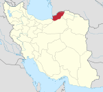 | |
|---|---|---|
| Counties and cities | ||
| Sights |
| |
| populated places | ||
| Capital | |||||||||||||||||||||||
|---|---|---|---|---|---|---|---|---|---|---|---|---|---|---|---|---|---|---|---|---|---|---|---|
| Districts |
| ||||||||||||||||||||||