Glynde Reach
Glynde Reach is a river in East Sussex, England and tributary of the River Ouse.[1] The main channel is fed from sources near Laughton, Rushy Green on the outskirts of Ringmer, two streams near Selmeston and several near Ripe.[2]
| Glynde Reach | |
|---|---|
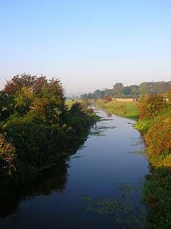 Glynde Reach near Glynde | |
| Location | |
| Country | England |
| County | East Sussex |
| Villages | Beddingham, Glynde, Ringmer, Laughton, Ripe, Selmeston |
| Physical characteristics | |
| Source | |
| ⁃ location | Selmeston, East Sussex, UK |
| ⁃ coordinates | 50.843594°N 0.140326°E |
| Mouth | River Ouse |
⁃ location | UK |
⁃ coordinates | 50.847698°N 0.038201°E |
| Length | 7.75 mi (12.47 km) |
Glynde Reach | ||||||||||||||||||||||||||||||||||||||||||||||||||||||||||||||||||||||||||||||||||||||||||||||||||||||||||||||||||||||||||||||||||||||||||||||||||||||||||
|---|---|---|---|---|---|---|---|---|---|---|---|---|---|---|---|---|---|---|---|---|---|---|---|---|---|---|---|---|---|---|---|---|---|---|---|---|---|---|---|---|---|---|---|---|---|---|---|---|---|---|---|---|---|---|---|---|---|---|---|---|---|---|---|---|---|---|---|---|---|---|---|---|---|---|---|---|---|---|---|---|---|---|---|---|---|---|---|---|---|---|---|---|---|---|---|---|---|---|---|---|---|---|---|---|---|---|---|---|---|---|---|---|---|---|---|---|---|---|---|---|---|---|---|---|---|---|---|---|---|---|---|---|---|---|---|---|---|---|---|---|---|---|---|---|---|---|---|---|---|---|---|---|---|---|
| ||||||||||||||||||||||||||||||||||||||||||||||||||||||||||||||||||||||||||||||||||||||||||||||||||||||||||||||||||||||||||||||||||||||||||||||||||||||||||
History
Glynde Reach and the River Ouse were almost certainly a tidal inlet at the time the Domesday book was produced in 1086. The main industry was the production of salt by the evaporation of sea water, and salt works were recorded at Ripe and Laughton.[3] During the early 14th century, meadows were created on parts of the flood plain by building embankments, but conditions worsened later in the century. Meadows at Beddingham were flooded in the summer for five years in the 1360s and three in the 1380s, but not at all in the 1370s. The state of the land was affected by the state of the Ouse, and reductions in the volume of water to scour the main outlet at Newhaven as a result of the embanking resulted in a large shingle bar forming, and the mouth moving eastwards to Seaford. Consequently, conditions on the floodplain, known as the Lewes and Laughton Levels, worsened. Some 400 acres (160 ha) of meadow owned by the Archbishop of Canterbury near the junction of the Glynde Reach and the Ouse became a permanent fishery called the Brodewater in the 15th century.[4]
In 1537, after the Prior of Lewes and various riparian landowners had consulted with Dutch drainage engineers, the Commissioners of the Levels raised a water scot, levied on all whose land was threatened by flooding, and by 1539 had cut a new outlet channel for the River Ouse through the shingle bank at Newhaven.[5] The improved drainage benefitted the levels, enabling the Archbishop of Canterbury's Brodewater to revert to meadow, and it was still in use as such in 1616. Conditions worsened later in the 17th century, again connected with the deteriorating outlet to the Ouse,[6] and so the Commissioners for the Levels employed the engineer John Smeaton to carry out a survey and recommend solutions. He visited the area on four days in June 1767, after a period of wet weather, to inspect the meadow lands, locally known as brooks. He found that the brooks at Ranscombe, near the junction between Glynde Reach and the Ouse, in common with those to the west of the Ouse, had low and poorly maintained embankments, and at high tide, the water level in the river was above the levels of the meadows.[7] To the east of Ranscombe, the brooks bordering Glynde Reach were generally at a higher level, but were affected by stagnant water lying on the surface. He attributed this to the fact that there was no gradient on the river, which followed a winding course, and was confident that if the issues at Ranscombe could be resolved, those on the Glynde would also be.[8]
He proposed that the River Ouse should be straightened, that embankments should be raised at Ranscombe and to the west of the Ouse, and that a huge sluice should be constructed on the Ouse at Piddinghoe, to prevent tides from entering the river system.[9] By 1768, the Commissioners had implemented some of Smeaton's suggestions, widening the Ouse below Lewes and dredging it to remove the worst shoals, but they did little to straighten the river, and his great sluice was not constructed.[10]
Development
The next great advance came not as a result of land drainage proposals, but from an attempt to make the Ouse navigable. William Jessop surveyed the Ouse with this in mind in 1768, and made two proposals. The Ouse would be made navigable above Lewes, almost to its source, by constructing locks and weirs. Below Lewes, he proposed radical reworking of the channel, to make it straighter, deeper and wider.[11] This second proposal was authorised by an Act of Parliament obtained in 1791,[12] and responsibility for the work was shared between a new body of Trustees for the river and the Commissioners of the Lewes and Laughton Levels. It would be funded by tolls for using the river, and by drainage rates for those who owned land on the levels. The balance between tolls and rates was too onerous for the landowners, and a second Act was obtained in 1800 to adjust them.[13] The project was managed by a Lewes schoolmaster and civil engineer called Cater Rand, who employed a team of several hundred navvies. Work on the Ouse was competed by 1795, and from 1796 to 1803 they tackled the Glynde Reach. The faster-moving water in the rivers and its scouring effect on the mouth of the Ouse meant that drainage was significantly improved. Ranscombe Brooks and the Laughton Levels could again be used for agriculture, although there were complaints from a group of chair-bottomers, who lost their source of reeds to make chair seats.[12]
From 1783 until his retirement in 1828, the Expenditor for the Lewes and Laughton Levels was John Ellman, better known for his agricultural achievements, particularly the improvement of the Southdown sheep breed.[14] He worked tirelessly to organise and supervise work carried out on the Glynde Reach and in the valley, where part of his farm was located on the levels.[15] Such improvements reduced the incidence of flooding, and improved the draining of the land if such an event occurred.[10] In 1973 a dam and pumping station was constructed across the channel at Beddingham, to prevent tidal water from entering the Laughton Level completely.[16]
Bibliography
- Bamber, Judith; Smith, Helena (2003). The Rough Guide to Walks in London and Southeast England. Rough Guides. ISBN 978-1-85828-938-0.CS1 maint: ref=harv (link)
- Brandon, P (1971). The Origin of Newhaven and the Drainage of the Lewes and Laughton Levels. 109. Sussex Archaeological Collections.CS1 maint: ref=harv (link)
- Brent, Colin (1993). Georgian Lewes 1714-1830: The Heyday of a Country Town. Colin Brent Books. ISBN 978-0-9522423-0-7.CS1 maint: ref=harv (link)
- Chantler, Bob; Chantler, Chris (2013). Kent & East Sussex River Walks. Amazon for Kindle.CS1 maint: ref=harv (link)
- Farrant, Sue (2008). John Ellman of Glynde in Sussex (PDF). British Agricultural History Society.CS1 maint: ref=harv (link)
- Hadfield, Charles (1969). The Canals of South and South East England. David and Charles. ISBN 978-0-7153-4693-8.CS1 maint: ref=harv (link)
- NRA (October 1991). "The River Ouse" (PDF). National Rivers Authority.CS1 maint: ref=harv (link)
- Priestley, Joseph (1831). "Historical Account of the Navigable Rivers, Canals and Railways of Great Britain".CS1 maint: ref=harv (link)
- Robinson, D A; Williams, R B G (1983). "Chapter 3. The Sussex Coast Past and Present". In Sutton, Alan (ed.). Sussex: Environment, Landscape and Society (PDF). Sussex University.CS1 maint: ref=harv (link)
- Smeaton, John (1812). Miscellaneous Papers of John Smeaton. Longman, Hurst, Rees, Orme and Brown.CS1 maint: ref=harv (link)
References
- Bamber & Smith 2003, p. 77.
- Chantler & Chantler 2013, p. 65.
- Robinson & Williams 1983, p. 3 (pdf).
- Brandon 1971, p. 96-97.
- Brandon 1971, pp. 98-99.
- Brandon 1971, p. 100.
- Smeaton 1812, p. 340.
- Smeaton 1812, p. 341.
- Smeaton 1812, pp. 343-344.
- Brent 1993, p. 21.
- Hadfield 1969, pp. 31-32.
- Brent 1973, p. 21.
- Priestley 1831, pp. 488-489.
- Farrant 2008, pp. 77-78.
- Farrant 2008, p. 85.
- NRA 1991, p. 5.