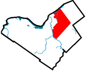
Gloucester, Ontario
Gloucester is a suburb in the City of Ottawa. Gloucester Township was established in 1792 and originally included lands east of the Rideau River from the Ottawa River south to Manotick. It was incorporated as a township in 1850 and became a city in 1981. Gloucester was one of the 11 municipalities that merged in 2001 to form the new city of Ottawa. As of the Canada 2016 Census, the former city of Gloucester had a population of 133,280.

Gloucester took its name from Prince William Frederick, Duke of Gloucester and Edinburgh.[1]
Demographics
Before amalgamating in 2001, Gloucester had a population of 110,264.
According to the Canada 2001 Census:
- Population: 110,264
- % Change (1996–2001): 6.0
- Dwellings: 38,542
- Area (km².): 293.86
- Density (persons per km².): 375.2
By the 2006 census, Gloucester's population had increased slightly, to 114,604.
Reeves
- 1850 James Sieveright
- 1851 John McKinnon
- 1852 Charles Billings
- 1852-1858 Peter Tompkins
- 1859-1862 Donald M. Grant
- 1863 James Brown
- 1864 Robert Blackburn
- 1865 James Sieveright
- 1866 John W. McGuire
- 1867 Peter Tompkins
- 1868-1872 Robert Cummings
- 1873 Henry Robillard
- 1874-1876 Robert Cummings
- 1877-1879 William H. Hurdman
- 1880 Robert Cummings
- 1881-1883 Alexander Robillard
- 1884-1887 Robert Cummings
- 1888-1891 James E. Spratt
- 1892-1894 Robert Hopkins
- 1895-1896 P. Cassidy
- 1897 W. Lennox
- 1898-1900 F. Caldwell
- 1901 O. Rocque
- 1902 F. Caldwell
- 1903-1912 R. Spratt
- 1913-1917 C. Hardy
- 1918-1926 R. Preston
- 1927-1930 T.A. Spratt
- 1930 R. Spratt
- 1931-1939 John Innes
- 1939 W.J. Perrault
- 1939 R. Preston
- 1940-1943 W.J. Perrault
- 1944-1945 John D. Boyce
- 1946-1947 J.B. Potvin
- 1948-1949 Alex Roger
- 1950-1951 A.E. Davidson
- 1952-1972 Earl R. Armstrong
- 1972-1978 Bob MacQuarrie
- 1978-1980 Elizabeth Stewart
Mayors
- 1981-1982 Elizabeth Stewart
- 1982-1984 Fred G. Barrett
- 1984-1985 Mitch Owens
- 1985-1991 Harry Allen
- 1991-2001 Claudette Cain
Communities and neighbourhoods
Prior to amalgamation, the following communities and neighbourhoods were within the city boundaries:
- Beacon Hill
- Beacon Hill North
- Beacon Hill South
- Beaconwood
- Blackburn Hamlet
- Blossom Park
- Emerald Woods
- Sawmill Creek
- Timbermill
- Upper Hunt Club
- Cardinal Heights
- Carlsbad Springs
- Carson Grove
- Cedardale
- Chapel Hill, Ottawa
- Cyrville
- Edwards
- Elizabeth Park
- Ficko
- Gloucester Glen
- Honey Gables
- Johnston Corners
- Kempark
- Leitrim
- Limebank
- Notre-Dame-des-Champs
- Ogilvie Walk
- Orléans
- Chapel Hill
- Chapel Hill South
- Chateau Neuf
- Convent Glen North
- Convent Glen South
- Hiawatha Park
- Orléans Village
- Queenswood Village
- Sunridge
- Pineview
- Piperville
- Ramseyville
- Riverside South
- Rothwell Heights
- South Gloucester
- Windsor Park Village
| Neighbourhood | Population (2016) | Population (2011) | Population (2006) | Area (km2.) | Density (per km2.) | Census Tracts |
|---|---|---|---|---|---|---|
| Beacon Hill North | 9,177 | 9,007 | 8,819 | 5.434 | 1688.811 | 5050120.03, 5050120.02 |
| Beacon Hill South | 7,319 | 7,312 | 6,953 | 2.258 | 3241.364 | 5050121.01, 5050121.02 |
| Blackburn Hamlet | 8,167 | 8,237 | 8,527 | 2.413 | 3384.584 | 5050125.01, 5050125.02 |
| Blossom Park | 14,190 | 14,060 | 12,361 | 6.193 | 2291.297 | 5050123.01, 5050123.02 |
| Chapel Hill | 8,293 | 8,521 | 8,566 | 3.398 | 2440.553 | 5050125.07, 5050125.04 |
| Chapel Hill South | 10,308 | 7,396 | 5,559 | 9.901 | 1041.149 | 5050125.06 |
| Chateau Neuf | 8,407 | 8,579 | 8,724 | 2.051 | 4098.976 | 5050125.08, 5050125.09 |
| Convent Glen | 6,456 | 6,572 | 6,568 | 4.006 | 1611.583 | 5050124.04, 5050124.01 |
| Cyrville-Carson Grove | 8,532 | 8,662 | 8,173 | 3.353 | 2544.587 | 5050122.01, 5050122.03 |
| Elizabeth Park-Kemp Park | 3,410 | 3,902 | 3,548 | 19.687 | 173.208 | 5050127.00 |
| Hiawatha Park | 4,841 | 4,821 | 5,138 | 4.418 | 1095.869 | 5050124.03 |
| Leitrim-Findlay Creek | 8,865 | 4,486 | 1,333 | 17.346 | 511.057 | 5050126.03 |
| Orleans Village | 5,229 | 5,195 | 5,497 | 1.984 | 2635.186 | 5050125.05 |
| Orleans Wood | 3,976 | 3,851 | 3,892 | 1.564 | 2541.549 | 5050124.02 |
| Pine View | 6,463 | 6,505 | 6,622 | 3.698 | 1747.512 | 5050122.02 |
| Riverside South | 12,342 | 10,908 | 6,844 | 14.136 | 873.090 | 5050126.05, 5050126.06 |
| Rothwell Heights | 1,664 | 1,686 | 1,673 | 1.593 | 1044.504 | 5050120.01 |
| Rural Gloucester | 5,641 | 3,978 | 4,732 | 195.066 | 28.918 | 5050126.04, 5050125.03 |
Education
Anglophone secular public schools are operated by the Ottawa-Carleton District School Board. Anglophone Catholic public schools are operated by the Ottawa Catholic School Board. French secular public schools are operated by the Conseil des écoles publiques de l'Est de l'Ontario (CÉPEO). The Conseil des écoles catholiques du Centre-Est (CECCE), formerly known as the Conseil des écoles catholiques de langue française du Centre-Est (CECLFCE), operates the French Catholic public schools.
The CECCE has its headquarters in Gloucester.[2] The predecessor school district, the Conseil Des Écoles Catholiques de Langue Française de la Région D'Ottawa-Carleton (CECLF), had its headquarters in the current CECCE headquarters.[3]
History
Gloucester Township, originally known as Township B, it was established in 1792. In 1800, it was part of Russell County, but became part of Carleton County in 1838 and was incorporated as a township in 1850. The first settler in the township was Braddish Billings in what is now the Billings Bridge area of Ottawa. Over the years, parts of Gloucester Township were annexed by the expanding city of Ottawa. Gloucester was incorporated as a city in 1981 and became part of the amalgamated city of Ottawa in 2001.
According to the Canada 2001 Census, the Township (original boundaries) had a population of 268,471.
Gloucester Township took its name from Prince William Frederick, Duke of Gloucester and Edinburgh.[4]
See also
References
- "Courageous settlers first located in Carleton back in 1818". Ottawa Citizen. Apr 28, 1953. pp. A20. Retrieved 2 December 2015.
- "Contact US." Conseil des écoles catholiques du Centre-Est. Retrieved on September 10, 2012. "Conseil des écoles catholiques du Centre-Est 4000 Labelle St. Ottawa (Ontario) K1J 1A1 Canada"
- "School Boards in Ontario Les conseils scolaires de l'Ontario." Province of Ontario. January 1996. Retrieved on September 10, 2012. "4000, rue Labelle, Gloucester (Ontario) K1J 1A1"
- "Courageous settlers first located in Carleton back in 1818". Ottawa Citizen. Apr 28, 1953. pp. A20. Retrieved 2 December 2015.
Bibliography
- Serré, Robert (2004), Pioneer families of the Gloucester Quarries in Eastern Ontario., Ottawa, Ontario: Gloucester Historical Society
- Gloucester Roots, L. Kemp (1991)
| History | |
|---|---|
| Geography | |
| Culture |
|
| Public services | |
| Education | |
| Government | |
| Transportation | |
| Features | |
| |