German Peninsula
German Peninsula (Bulgarian: полуостров Герман, romanized: Poluostrov German) is the mountainous peninsula projecting from the north end of Fallières Coast in Graham Land, Antarctica 11.4 km in west direction between Bourgeois Fjord to the north and west, and Dogs Leg Fjord to the south. It is extending 15.9 km between Thomson Head to the north and Bottrill Head to the southwest, with its interior occupied by Rudozem Heights.
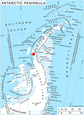
Location of German Peninsula in Graham Land, Antarctic Peninsula.
The peninsula is named after the settlement of German in Western Bulgaria, now part of the city of Sofia.
Location
German Peninsula is centred at 67°39′00″S 66°45′00″W. British mapping in 1978.
Maps
- British Antarctic Territory. Scale 1:200000 topographic map. DOS 610 Series, Sheet W 67 66. Directorate of Overseas Surveys, Tolworth, UK, 1978.
- Antarctic Digital Database (ADD). Scale 1:250000 topographic map of Antarctica. Scientific Committee on Antarctic Research (SCAR), 1993–2016.
References
- German Peninsula. SCAR Composite Antarctic Gazetteer.
- Bulgarian Antarctic Gazetteer. Antarctic Place-names Commission. (details in Bulgarian, basic data in English)
External links
- German Peninsula. Copernix satellite image
This article includes information from the Antarctic Place-names Commission of Bulgaria which is used with permission.
This article is issued from Wikipedia. The text is licensed under Creative Commons - Attribution - Sharealike. Additional terms may apply for the media files.