Forrest City Municipal Airport
Forrest City Municipal Airport (IATA: FCY, ICAO: KFCY, FAA LID: FCY) is a city-owned public-use airport located four nautical miles (5 mi, 7 km) south of the central business district of Forrest City, in St. Francis County, Arkansas, United States.[1] This airport is included in the FAA's National Plan of Integrated Airport Systems for 2011–2015, which categorized it as a general aviation facility.[2]
Forrest City Municipal Airport | |||||||||||
|---|---|---|---|---|---|---|---|---|---|---|---|
 | |||||||||||
| Summary | |||||||||||
| Airport type | Public | ||||||||||
| Owner | City of Forrest City | ||||||||||
| Serves | Forrest City, Arkansas | ||||||||||
| Elevation AMSL | 249 ft / 76 m | ||||||||||
| Coordinates | 34°56′31″N 090°46′30″W | ||||||||||
| Map | |||||||||||
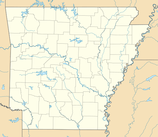 FCY Location of airport in Arkansas | |||||||||||
| Runways | |||||||||||
| |||||||||||
| Statistics (2010) | |||||||||||
| |||||||||||
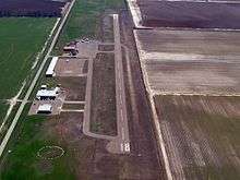
Facilities and aircraft
Forrest City Municipal Airport covers an area of 80 acres (32 ha) at an elevation of 249 feet (76 m) above mean sea level. It has one runway designated 18/36 with an asphalt surface measuring 3,014 by 50 feet (919 x 15 m). For the 12-month period ending July 31, 2010, the airport had 44,300 aircraft operations, an average of 121 per day: 99% general aviation and 1% military.[1]
References
- FAA Airport Master Record for FCY (Form 5010 PDF). Federal Aviation Administration. effective August 25, 2011.
- "2011–2015 NPIAS Report, Appendix A (PDF, 2.03 MB)" (PDF). 2011–2015 National Plan of Integrated Airport Systems. Federal Aviation Administration. October 4, 2010. Archived from the original (PDF) on 2012-09-27. External link in
|work=(help)
External links
- Aerial image as of 28 February 2001 from USGS The National Map
- FAA Terminal Procedures for FCY, effective May 21, 2020
- Resources for this airport:
- FAA airport information for FCY
- AirNav airport information for FCY
- FlightAware airport information and live flight tracker
- SkyVector aeronautical chart for FCY