Florida State Road 736
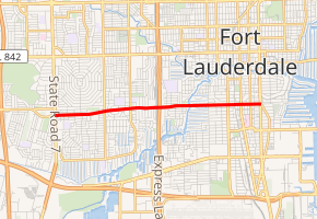
State Road 736 (SR 736) is a 4.033-mile-long (6.490 km) commuter highway serving central Fort Lauderdale, Broward County, Florida. It is locally known as Davie Boulevard and extends from its western terminus at an intersection with U.S. Route 441 (US 441 or SR 7) east to an intersection with Miami Road, just east of Federal Highway (US 1).
| ||||
|---|---|---|---|---|
| Davie Boulevard | ||||
| ||||
| Route information | ||||
| Maintained by FDOT | ||||
| Length | 4.033 mi[1] (6.490 km) | |||
| Major junctions | ||||
| West end | ||||
| East end | Miami Road in Fort Lauderdale | |||
| Location | ||||
| Counties | Broward | |||
| Highway system | ||||
| ||||

In the Fort Lauderdale street numbering system, Davie Boulevard is mainly Southwest 12th Street, becoming Southeast 12th Street for a short portion east of Andrews Avenue.
Route description
SR 736 begins at US 441, with heading east through a mix of commercial and residential areas in Fort Lauderdale. About two miles (3.22 km) east of the western terminus, SR 736 has an interchange with Interstate 95 (I-95) and continues through a residential area before crossing a drawbridge over the South New River Canal. East of the canal, it continues through the residential areas approaching central Fort Lauderdale. After crossing the Florida East Coast Railway tracks, SR 736 becomes a more commercial route as it quickly approaches US 1. About 60 feet (18 m) afterwards, the state road officially ends at an intersection with Miami Road however SE 12th Street continues east into a residential neighborhood.[2][1]
West of US 441, the road extends west as Peters Road and extends for 3.8 miles (6.1 km) to an intersection with Pine Island Road in Plantation.
History
The route was originally designated State Road 82 by the State Road Department, the forerunner of Florida Department of Transportation. In the 1980s, FDOT extended the State Road designation 3.1 miles (5.0 km) westward from US 441 along Peters Road and renumbered the route to SR 736. In the 2000s, the road was truncated back to the original US 441/SR 7 terminus.
Until the extension and redesignation in Broward County, SR 82 was an "interrupted" state road, for there was – and still is – a SR 82 in southwestern Florida (from Fort Myers to near Immokalee).
The SR 736 designation had previously extended west to University Drive / SR 817 in Plantation.[3]
Major intersections
The entire route is in Broward County.
| Location | mi[1] | km | Destinations | Notes | |
|---|---|---|---|---|---|
| Plantation–Fort Lauderdale line | 0.000 | 0.000 | Road continues west without designation | ||
| Fort Lauderdale | 2.034– 2.106 | 3.273– 3.389 | Exit 26 on I-95 (unsigned SR 9); direct connection to I-595 ramps | ||
| 2.620– 2.698 | 4.216– 4.342 | South New River Canal bridge | |||
| 3.833 | 6.169 | CR 811 (SE 3rd Avenue) | Former SR 811 | ||
| 4.022 | 6.473 | Road is unsigned SR 5 | |||
| 4.033 | 6.490 | Miami Road / SE 12th Street | Eastern terminus | ||
| 1.000 mi = 1.609 km; 1.000 km = 0.621 mi | |||||
References
- Transportation and Data Analytics Office (June 22, 2016). "Straight Line Diagram of Road Inventory". Florida Department of Transportation. Retrieved January 27, 2020.
- Google (January 27, 2020). "Florida State Road 736" (Map). Google Maps. Google. Retrieved January 27, 2020.
- General Highway Map - Broward County, Florida (PDF) (Map). Survey and Mapping Office - State of Florida Department of Transportation. February 2008. Retrieved January 27, 2020.