Farm to Market Road 869
Farm to Market Road 869 (FM 869) is a Farm to Market Road in the U. S. state of Texas maintained by the Texas Department of Transportation (TxDOT). The road, located in central Reeves County, connects State Highway 17 (SH 17) with Interstate 20 (I-20) to the north bypassing the city of Pecos. The road has an intersection with FM 1934.
| ||||
|---|---|---|---|---|
| ||||
| Route information | ||||
| Maintained by TxDOT | ||||
| Length | 13.804 mi[1] (22.215 km) | |||
| Existed | 1948[1]–present | |||
| Major junctions | ||||
| South end | ||||
| North end | ||||
| Location | ||||
| Counties | Reeves | |||
| Highway system | ||||
| ||||

Route description
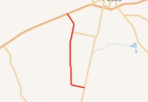
FM 869 begins at SH 17 14.5 miles (23.3 km) south of Pecos. The two-lane road immediately crosses the Pecos Valley Southern Railway and proceeds to the west for about 2 miles (3.2 km) then turns north. Beyond FM 1934, the route turns northwest and continues to I-20 from which the route is accessed at Exit 33.[1][2][3][4]
The rural road passes through no cities or towns, and encounters gentle terrain with little physical relief.[5]
History
FM 869 was designated along its present route on October 29, 1948.[1] Until 1991, the road intersected U.S. Route 80, the progenitor route of I-20 in western Texas, at its northern terminus.[1][1]
Major intersections
The entire route is in Reeves County.
| Location | mi[4] | km | Destinations | Notes | |
|---|---|---|---|---|---|
| | 0 | 0.0 | Southern terminus | ||
| | 10.6 | 17.1 | |||
| | 13.9 | 22.4 | Northern terminus | ||
| 1.000 mi = 1.609 km; 1.000 km = 0.621 mi | |||||
References
- Transportation Planning and Programming Division (n.d.). "Farm to Market Road No. 869". Highway Designation Files. Texas Department of Transportation. Retrieved April 23, 2012.
- Transportation Planning and Programming Division (2012). Texas County Mapbook (PDF) (Map) (2012 ed.). 1:120,000. Texas Department of Transportation. p. 116. OCLC 867856197. Retrieved April 23, 2012.
- Transportation Planning and Programming Division (2012). Texas County Mapbook (PDF) (Map) (2012 ed.). 1:120,000. Texas Department of Transportation. p. 115. OCLC 867856197. Retrieved April 23, 2012.
- Google (April 23, 2012). "Route of FM 869" (Map). Google Maps. Google. Retrieved April 23, 2012.
- Pecos, Texas (Map). 1:100,000. 30x60 Minute Series (Topographic). United States Geological Survey. 1986. Archived from the original (PDF) on April 8, 2013. Retrieved April 24, 2012.
External links
