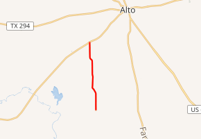
Farm to Market Road 220
Farm to Market Road 220, or FM 220, in eastern Texas (USA), runs about 4.07 miles (6.55 km) from an intersection with a county road, north to TX 21 southwest of Alto. Prior to 1951, the FM 220 designation belonged to a road in Hamilton County starting with a Minute Order on June 18, 1945. This version of FM 220 originally went from Lanham to Fairy. A November 23, 1948 Minute Order extended the road to Hico from Fairy, for 9.8 miles (15.8 km). Another addition came by Minute Order on July 14, 1949, for 4.7 miles (7.6 km) past Lanham. This FM 220 was cancelled on November 30, 1950 and changed designations to FM 1602 to avoid confusion with TX 220 in Hico.[1][2]
| ||||
|---|---|---|---|---|
| ||||
| Route information | ||||
| Length | 4.07 mi[1] (6.55 km) | |||
| Existed | 1951[1]–present | |||
| Major junctions | ||||
| South end | county road | |||
| North end | ||||
| Location | ||||
| Counties | Cherokee | |||
| Highway system | ||||
| ||||

FM 220 has no local street names. Rural for the most part, the landscape along the road includes rolling hills of alternating open pastures and trees. The road has 2 lanes and no shoulders for its entire length. All of FM 220 is in far southwest Cherokee County.
The road was commissioned On May 23, 1951, though it is unclear as to when FM 220 was completed. The road serves no towns but is closest to Alto. The road connects the rural area to TX 21, which goes southwest to Crockett and east to Alto and Nacogdoches. FM 220 only intersects with local county roads besides that of TX 21, its north terminus.
Major intersections
The entire route is in Cherokee County.
| Location | mi | km | Destinations | Notes | |
|---|---|---|---|---|---|
| | 0.00 | 0.00 | County road | Southern terminus | |
| | 4.07 | 6.55 | Northern terminus | ||
| 1.000 mi = 1.609 km; 1.000 km = 0.621 mi | |||||