Exmouth, Western Australia
Exmouth /ˈɛksmaʊθ/ is a town on the tip of the North West Cape in Western Australia. The town is located 1,270 kilometres (789 mi) north of the state capital Perth and 3,366 kilometres (2,092 mi) southwest of Darwin.
| Exmouth Western Australia | |
|---|---|
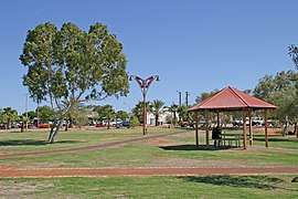 Main park | |
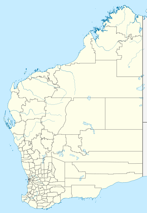 Exmouth Location in Western Australia | |
| Coordinates | 21°55′59″S 114°7′41″E |
| Population | 2,486 (2016 census)[1] |
| Established | 1964 |
| Postcode(s) | 6707 |
| Location | |
| LGA(s) | Shire of Exmouth |
| State electorate(s) | North West Coastal |
| Federal Division(s) | Durack |
The town was established in 1967 to support the nearby United States Naval Communication Station Harold E. Holt. Beginning in the late 1970s, the town began hosting U.S. Air Force personnel assigned to Learmonth Solar Observatory, a defence science facility jointly operated with Australia's Ionospheric Prediction Service.
History
In 1618, Dutch East India Company ship Mauritius under command of Supercargo Willem Janszoon, landed near North West Cape, just proximate to what would be Exmouth, and named Willem's River, which was later renamed Ashburton River.
The location was first used as a military base in World War II. US Admiral James F. Calvert in his memoir, Silent Running: My Years on a World War II Attack Submarine, and US Vice Admiral Charles A. Lockwood in Sink 'Em All, his narrative of Allied submarine warfare, describe its history. After the retreat from Java in March 1942, Allied naval forces had need of a forward base for replenishing submarines, then the sole form of offensive warfare against the Japanese. Both Darwin, Northern Territory, and Broome, Western Australia, were too exposed to air attack, so a 500-ton unmotorized lighter was placed as a refueling barge near the mouth of Exmouth Gulf, where the Allies were already maintaining a seaplane tender.
Code-named Potshot, the spartan base was also developed as an advanced base and rest camp for submariners using the tender USS Pelias. An airfield (now RAAF Learmonth) was constructed to provide fighter defense for the base. Z Special Unit used Potshot as a staging base for Operation Jaywick, a raid on Japanese shipping in Singapore Harbour, in September 1943.
Tourism

Nowadays, the town relies more on tourism than the station for its existence. At the 2016 census, Exmouth had a population of 2,486.[1] At the height of the tourist season, the population swells to 6,000.
Exmouth is one of the few areas in Australia that can boast the "Range to Reef" experience. The Cape Range National Park, which has several gorges, is an area of 506 square kilometres and its main area is focused on the west coast of the Cape which provides a large variety of camp sites on the coastal fringe of the Park. Some of the most famous snorkeling spots include Turquoise Bay and Oysters stacks. Yardie Creek and Charles Knife Gorge are land based attractions.
On 22 March 1999, Tropical Cyclone Vance reached category 5 status as it made landfall near Exmouth. This resulted in the highest ever wind gust reported on the Australian mainland of 267 km/h at Learmonth, only 35 km to the south.
Vance caused significant flooding and property damage. There were no casualties.[2][3]
In April 2014, Exmouth was hit by a massive flash flood, nearly destroying the caravan park and seriously damaging much of the town's infrastructure, causing a severe blow to tourism in the region.[4]
On 20 April 2023, Exmouth will be in the direct path of a total solar eclipse, which will be the first to be visible in Australia since November 2012.[5]
Climate
Exmouth has a hot semi-arid climate. Temperatures often reach over 40 °C in summer; however, winters are mild and pleasant with daytime temperatures around 25 °C. There is no specific wet and dry season in Exmouth, although rain is most likely to fall between January and July, usually with monsoonal showers and storms from January to April and from the northern edges of cold fronts in May, June and July. The period from August to December is usually dry.
| Climate data for Learmonth Airport | |||||||||||||
|---|---|---|---|---|---|---|---|---|---|---|---|---|---|
| Month | Jan | Feb | Mar | Apr | May | Jun | Jul | Aug | Sep | Oct | Nov | Dec | Year |
| Record high °C (°F) | 48.9 (120.0) |
47.7 (117.9) |
45.5 (113.9) |
42.5 (108.5) |
37.3 (99.1) |
31.9 (89.4) |
31.7 (89.1) |
35.3 (95.5) |
41.3 (106.3) |
43.0 (109.4) |
44.2 (111.6) |
48.9 (120.0) |
48.9 (120.0) |
| Average high °C (°F) | 37.9 (100.2) |
37.5 (99.5) |
36.5 (97.7) |
33.3 (91.9) |
28.5 (83.3) |
24.8 (76.6) |
24.3 (75.7) |
26.4 (79.5) |
29.4 (84.9) |
32.8 (91.0) |
34.6 (94.3) |
36.9 (98.4) |
31.9 (89.4) |
| Daily mean °C (°F) | 30.5 (86.9) |
30.8 (87.4) |
29.8 (85.6) |
26.9 (80.4) |
22.3 (72.1) |
19.0 (66.2) |
17.9 (64.2) |
19.3 (66.7) |
21.6 (70.9) |
24.6 (76.3) |
26.6 (79.9) |
28.9 (84.0) |
24.8 (76.6) |
| Average low °C (°F) | 23.0 (73.4) |
24.1 (75.4) |
23.0 (73.4) |
20.4 (68.7) |
16.1 (61.0) |
13.1 (55.6) |
11.4 (52.5) |
12.1 (53.8) |
13.8 (56.8) |
16.4 (61.5) |
18.5 (65.3) |
20.9 (69.6) |
17.7 (63.9) |
| Record low °C (°F) | 16.1 (61.0) |
17.4 (63.3) |
15.0 (59.0) |
12.9 (55.2) |
7.6 (45.7) |
4.9 (40.8) |
3.5 (38.3) |
4.2 (39.6) |
5.6 (42.1) |
7.9 (46.2) |
12.0 (53.6) |
14.2 (57.6) |
3.5 (38.3) |
| Average precipitation mm (inches) | 31.0 (1.22) |
40.9 (1.61) |
40.8 (1.61) |
17.6 (0.69) |
42.2 (1.66) |
43.2 (1.70) |
22.0 (0.87) |
11.4 (0.45) |
2.1 (0.08) |
1.6 (0.06) |
1.8 (0.07) |
6.1 (0.24) |
256.7 (10.11) |
| Average precipitation days | 2.7 | 3.3 | 2.4 | 1.8 | 3.7 | 5.1 | 3.6 | 2.1 | 0.9 | 0.4 | 0.5 | 0.8 | 27.3 |
| Source: [6] | |||||||||||||
References
- Australian Bureau of Statistics (27 June 2017). "Exmouth (Urban Centre/Locality)". 2016 Census QuickStats. Retrieved 29 October 2019.

- WA Tropical Cyclone Season Summary 1998-99
- "Cyclone leaves Aussie town in ruins". USA Today. 24 March 1999. Retrieved 6 November 2009.
- "Exmouth clean-up continues after heavy rains caused extensive flood damage". ABC News. 29 April 2014. Retrieved 29 April 2014.
- "Eclipses visible in Exmouth, Western Australia, Australia - Apr 20, 2023 Solar Eclipse". www.timeanddate.com. Retrieved 14 January 2020.
- "Climate statistics for Exmouth". Bureau of Meteorology. Retrieved 7 October 2018.
Further reading
- Barker, Anthony J; Ondaatje, Michael L (2015). A Little America in Western Australia: The US naval communication station at North West Cape and the founding of Exmouth. Crawley, WA: UWA Publishing. ISBN 9781742586854.
- Western Australia. Ministry for Planning.(1998) Exmouth-Learmonth (North West Cape) structure plan. Perth, W.A. : Western Australian Planning Commission. ISBN 0-7309-9007-9 (The draft Structure Plan for Exmouth-Learmonth (North West Cape) has been prepared by the Ministry for Planning under the guidance and direction of the Gascoyne Coast Planning Coordinating Committee (GCPCC) and the North West Cape Technical Advisory Group)
External links
| Wikivoyage has a travel guide for Exmouth, Western Australia. |