Estouteville-Écalles
Estouteville-Écalles is a former commune in the Seine-Maritime department in the region of Normandy, France. On 1 January 2017, it was merged into the commune Buchy.[1]
Estouteville-Écalles | |
|---|---|
Part of Buchy | |
Location of Estouteville-Écalles 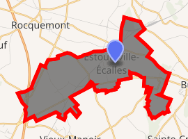
| |
 Estouteville-Écalles  Estouteville-Écalles | |
| Coordinates: 49°35′31″N 1°19′12″E | |
| Country | France |
| Region | Normandy |
| Department | Seine-Maritime |
| Arrondissement | Rouen |
| Canton | Le Mesnil-Esnard |
| Commune | Buchy |
| Area 1 | 8.46 km2 (3.27 sq mi) |
| Population (2006) | 492 |
| • Density | 58/km2 (150/sq mi) |
| Time zone | UTC+01:00 (CET) |
| • Summer (DST) | UTC+02:00 (CEST) |
| Postal code | 76750 |
| Elevation | 159–199 m (522–653 ft) (avg. 180 m or 590 ft) |
| 1 French Land Register data, which excludes lakes, ponds, glaciers > 1 km2 (0.386 sq mi or 247 acres) and river estuaries. | |
Geography
A farming village situated in the Pays de Caux, some 14 miles (23 km) northeast of Rouen, at the junction of the D98 and the D919 roads.
Population
| Year | 1962 | 1968 | 1975 | 1982 | 1990 | 1999 | 2006 |
|---|---|---|---|---|---|---|---|
| Population | 272 | 300 | 330 | 273 | 265 | 374 | 492 |
| From the year 1962 on: No double counting—residents of multiple communes (e.g. students and military personnel) are counted only once. | |||||||
Places of interest
- Three churches, in the three parts of the commune, dating from the seventeenth century.
- Evidence of a mediaeval fortress.
References
- Arrêté préfectoral 15 November 2016 (in French)
External links
| Wikimedia Commons has media related to Estouteville-Écalles. |
| Authority control |
|
|---|
This article is issued from Wikipedia. The text is licensed under Creative Commons - Attribution - Sharealike. Additional terms may apply for the media files.