Erebus and Terror Gulf
Erebus and Terror Gulf is a gulf on the southeast side of the tip of the Antarctic Peninsula, bordered on the northeast by the Joinville Island group and on the southwest by the James Ross Island group. It was named for HMS Erebus and HMS Terror, the vessels used by Sir James Clark Ross in exploring these waters in 1842–43[1][2]
| Erebus and Terror Gulf | |
|---|---|
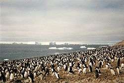 Adélie penguin rookery at Erebus and Terror Gulf on Paulet Island, 1996. | |
| Coordinates | 63°55′S 56°40′W |
| Type | Gulf |
| Ocean/sea sources | Weddell Sea |
This region contains tabular icebergs.[3]
See also
- Barker Bank
References
- "Erebus and Terror Gulf". Geographic Names Information System. United States Geological Survey. Retrieved 2012-03-02.
- "Erebus and Terror Gulf". Gna-GeographicNamesOfTheAntarctic1stEdition1981_djvu. p. 628. Retrieved 2012-03-02.
- pbs documentary NOVA
![]()
This article is issued from Wikipedia. The text is licensed under Creative Commons - Attribution - Sharealike. Additional terms may apply for the media files.