Ellesmere Rural
Ellesmere Rural is a civil parish in Shropshire, England.
| Ellesmere Rural | |
|---|---|
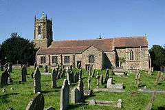 Dudleston St Mary the Virgin church | |
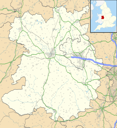 Ellesmere Rural Location within Shropshire | |
| Population | 2,484 (2011 Census) |
| Civil parish |
|
| Unitary authority | |
| Shire county | |
| Region | |
| Country | England |
| Sovereign state | United Kingdom |
| Post town | Ellesmere |
| Postcode district | SY12 |
| Dialling code | 01691 |
| Police | West Mercia |
| Fire | Shropshire |
| Ambulance | West Midlands |
In 2011 this parish covered a large area mainly to the west of the town of Ellesmere.[1] This rural parish consists of farmland and a number of small settlements including Dudleston Heath (also known as Criftins), Tetchill and Welsh Frankton.[2]
History
In the 1610 translated edition of William Camden's Britannia, this area is described as
- Ellesmer a little territorie but rich and fruitfull[3]
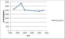
Ellesemere Rural was created in 1894 when the civil functions of the larger ancient parish of Ellesmere were abolished and divided between this parish and the town of Ellsemere, which became a separate civil parish called Ellesmere Urban.[4] Despite several changes to the parish boundary during the twentieth century[5] the parish population has remained relatively stable since the 1930s.[6]
See also
References
- "Ellesmere Rural Parish Description". Neighbourhood Statistics. Office for National Statistics. Retrieved 28 January 2015.
- "Ellesmere Rural location description". Ellesmere Rural Parish Council website. Ellesmere Rural Parish Council. Retrieved 22 January 2014.
- Camden, William (1610). Holland, Philemon (ed.). Britain, or, a Chorographicall Description of the most flourishing Kingdomes, England, Scotland, and Ireland. p. Shropshire and Cheshire. Retrieved 3 February 2014.
- "History of Ellesmere Rural CP". A Vision of Britain through Time. Great Britain Historical GIS. University of Portsmouth. 2009. Retrieved 22 January 2014.
- "Relationships and Changes for Ellesmere Rural CP;". A Vision of Britain through Time. Great Britain Historical GIS. University of Portsmouth. 2009. Retrieved 22 January 2015.
- "Historical population statistics for Ellesmere Rural CP". A Vision of Britain through Time. Great Britain Historical GIS. University of Portsmouth. 2009. Retrieved 22 January 2015.
- "Ellesmere Rural (Parish): Key Statistics for 2001 Census". Neighbourhood Statistics. Office for National Statistics. Retrieved 4 February 2014.
- "Ellesmere Rural (Parish): Key Statistics for 2011 Census". Neighbourhood Statistics. Office for National Statistics. Retrieved 4 February 2014.
External links