Hopefield, Western Cape
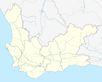
Hopefield is a settlement in West Coast District Municipality in the Western Cape province of South Africa on the R45[2] between Malmesbury and Vredenburg. The town is east of Saldanha Bay and Langebaan, 40 km (25 mi) southeast of Vredenburg and 120 km (75 mi) north of Cape Town.
Hopefield | |
|---|---|
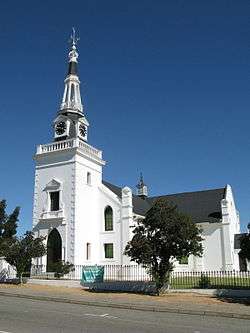 Hopefield Dutch Reformed Church | |
 Hopefield  Hopefield | |
| Coordinates: 33°03′56″S 18°21′03″E | |
| Country | South Africa |
| Province | Western Cape |
| District | West Coast |
| Municipality | Saldanha Bay |
| Area | |
| • Total | 32.41 km2 (12.51 sq mi) |
| Population (2011)[1] | |
| • Total | 6,460 |
| • Density | 200/km2 (520/sq mi) |
| Racial makeup (2011) | |
| • Black African | 2.6% |
| • Coloured | 81.5% |
| • Indian/Asian | 0.5% |
| • White | 14.4% |
| • Other | 1.0% |
| First languages (2011) | |
| • Afrikaans | 94.2% |
| • English | 3.5% |
| • Other | 2.3% |
| Time zone | UTC+2 (SAST) |
| Postal code (street) | 7355 |
| PO box | 7355 |
| Area code | 022 |
References
- "Main Place Hopefield". Census 2011.
- "Route 27 West Coast South Africa". Retrieved 26 June 2016.
- "Hopefield". West Coast Way. Retrieved 2020-05-24.
- NG Kerk Hopefield. URL last visited on 26 June 2016.
- "Dictionary of Southern African Place Names (Public Domain)". Human Science Research Council. p. 215.
- "Air Force Base Langebaanweg". Retrieved 26 June 2016.
- West Coast Fossil park
- "Elandsfontein". Encyclopædia Britannica.
- "Welkom by Hoërskool Hopefield" (in Afrikaans). Retrieved 26 June 2016.
Municipalities and communities of West Coast District Municipality, Western Cape | ||
|---|---|---|
District seat: Moorreesburg | ||
| Matzikama | .svg.png) West Coast District within South Africa | |
| Cederberg | ||
| Bergrivier | ||
| Saldanha Bay | ||
| Swartland | ||
This article is issued from Wikipedia. The text is licensed under Creative Commons - Attribution - Sharealike. Additional terms may apply for the media files.