El Papalonal Airport
El Papalonal Airport (ICAO: MNPP) is an airstrip serving the village of El Papalonal in León Department, Nicaragua[2]
El Papalonal Airport | |||||||||||
|---|---|---|---|---|---|---|---|---|---|---|---|
| Summary | |||||||||||
| Airport type | Public | ||||||||||
| Serves | El Papalonal | ||||||||||
| Elevation AMSL | 141 ft / 43 m | ||||||||||
| Coordinates | 12°28′15″N 86°28′25″W | ||||||||||
| Map | |||||||||||
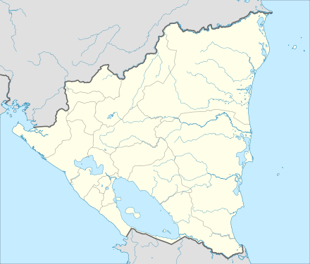 MNPP Location of the airport in Nicaragua | |||||||||||
| Runways | |||||||||||
| |||||||||||
Sources: Google Maps[1] | |||||||||||
In 1981, American intelligence officials discovered that the airstrip was used as a departure point for aircraft delivering weapons to El Salvadorian rebels.[3][4]
See also

- List of airports in Nicaragua
- Transport in Nicaragua
References
- Google Maps - El Papalonal
- "Airport Information for El Papalonal, El Papalonal Airport". AeroInside. Rahm Information Services. Retrieved 15 April 2016.
- Tai-Heng Cheng (2012). When International Law Works: Realistic Idealism After 9/11 and the Global Recession. Oxford University Press USA. pp. 171–. ISBN 978-0-19-537017-1.
- Robert Kagan (1996). A Twilight Struggle: American Power and Nicaragua, 1977-1990. The Free Press/Simon & Schuster. pp. 177–. ISBN 978-0-02-874057-7.
External links
This article is issued from Wikipedia. The text is licensed under Creative Commons - Attribution - Sharealike. Additional terms may apply for the media files.