Ebrington Hill
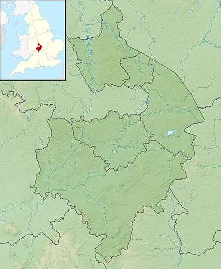
Ebrington Hill is a hill in Warwickshire, England, which at 261 m (856 ft) is the highest in the county. It is situated between the villages of Ebrington, Mickleton and Ilmington on the Warwickshire and Gloucestershire border in the Cotswolds.[1][2][3]
| Ebrington Hill | |
|---|---|
 Ebrington Hill | |
| Highest point | |
| Elevation | 261 m (856 ft) |
| Listing | County Top |
| Coordinates | 52°04′54″N 1°43′38″W |
| Geography | |
 Ebrington Hill Ebrington Hill in Warwickshire | |
| Location | Ebrington, England |
| Parent range | Cotswolds |
| OS grid | SP1878142634 |
| Topo map | OS Landranger 151 |
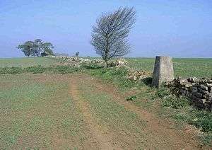
The summit lies within the modern administrative boundaries of Warwickshire following boundary changes over the last century, but technically the summit was historically (just) over the border in Gloucestershire. The true historic county top of Warwickshire thus lies about 30m south of the summit on a track (grid reference SP 18778 42599, height 260 metres (850 ft). The triangulation pillar at 259 metres (850 ft) is not the summit of the hill.
References
- Simon Edwardes (2001). "Historic County Tops". The Mountains of England and Wales. Retrieved 28 June 2013.
- Ordnance Survey (2012). 151 Stratford-upon-Avon, Warwick & Banbury. OS Landranger Map Series. Ordnance Survey. ISBN 9780319231784.
- Muir, Jonny (2011). The UK's County Tops: Reaching the top of 91 historic counties. Cicerone. ISBN 9781849655538.
This article is issued from Wikipedia. The text is licensed under Creative Commons - Attribution - Sharealike. Additional terms may apply for the media files.