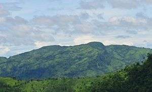
Dumlong
Dumlong mountain in Belaichori, Rangamati, Bangladesh may be the second highest mountain in the country, as claimed by Md.Wadud Mohosin Rubel with his three travel fellows, Asif Aminur Rashid, Nagib Meshkat & Abdul Haq in 2011.[1][2] On the basis of Garmin GPS they have measured the height of the mountain which is 3314 feet. The location he recorded, 22°02′02.1″N 92°35′36.3″E, accurately matches the location given by Google Earth.
| Dumlong | |
|---|---|
 Dumlong | |
| Highest point | |
| Elevation | 1,010 m (3,310 ft) |
| Prominence | 50 m (160 ft) |
| Isolation | 28 km (17 mi) |
| Listing | List of mountains of Bangladesh |
| Coordinates | 22°02′29″N 92°35′02″E |
| Geography | |
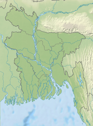 Dumlong Location in Bangladesh (on the border with Burma) | |
| Location | Belaichori, Rangamati |
| Parent range | Rang Tlang |
| Geology | |
| Mountain type | Mountain |
A few months after his expedition, the Travelers of Bangladesh team led by Zaqiul Deep measured this peak as 3,312 feet. After that Fahim Hasan of BD Explorer[3][4] reached the summit of Dumlong as a 3rd team. There is little doubt about the height of Dumlong peak but whether it is 2nd or 3rd highest peak in the country, is not confirmed yet. It is the highest peak of Rangamati hill district and also the one of three 1000 metres peaks in Bangladesh.
Long time ago over the rocks of Mount Dumlong was built a fortress which was the capital of Dumlong Dynasty.[5]
References
- list of mountains in Bangladesh
- "'Second highest hill' spotted by 4 youths". Archive.thedailystar.net. 2011-02-28. Retrieved 2013-10-21.
- "Facebook". Facebook. Retrieved 2013-10-21.
- "Photos by BD Explorer > best". Panoramio. Retrieved 2013-10-21.
- "r/AgeofMan - The Last Kings of Kutu IV: Dumlong". reddit. Retrieved 2020-05-05.