Digital raster graphic
A digital raster graphic (DRG) is a digital image resulting from scanning a paper USGS topographic map for use on a computer. DRGs created by USGS are typically scanned at 250 dpi and saved as a TIFF. The raster image usually includes the original border information, referred to as the "map collar". The map file is UTM projected and georeferenced to the surface of the earth. DRG's are regularly used in GIS applications. DRGs were first produced in 1995.
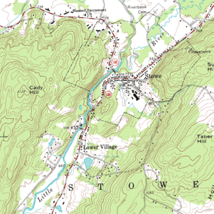
A small portion of a USGS DRG
See also
External links
- Libre Map Project
- USGS Sites
- Kentucky Raster Graphics Image Download Center
- Montana State Library Digital Raster Graphics download page
- Pennsylvania Spatial Data Access sites
- FTP site, DRGs for West Virginia (free)
- FTP site, DRGs for New York (free)
- FTP site, DRGs for Virginia (free)
- FTP site, DRGs for Maryland (free)
- FTP site, DRGs for Washington DC (free)
- FTP site, DRGs for Delaware (free)
- FTP site, DRGs for North Carolina (free)
- Texas Natural Resources Information System
This article is issued from Wikipedia. The text is licensed under Creative Commons - Attribution - Sharealike. Additional terms may apply for the media files.